Imagine needing to understand what lies beneath a centuries-old site, but without turning over a single spade of soil.
That’s exactly what Ground Penetrating Radar (GPR) makes possible.
Whether you’re a developer trying to meet planning requirements or a heritage consultant working on protected ground, GPR is a powerful, non-invasive solution that helps reveal what’s hidden underground. And it does so with speed, accuracy, and minimal disruption.
In this guide, we’ll break down exactly how GPR works, where it’s used, how it stacks up against other geophysical methods, and of course, what it typically costs.
Let’s dig in.
What is Ground Penetrating Radar (GPR)?
The Basics of GPR Technology
Ground Penetrating Radar is a geophysical method that uses radar pulses to image the subsurface. In plain English? It sends high-frequency radio waves into the ground and then records the echoes that bounce back from objects, structures, or changes in material. It’s kind of like an ultrasound, but for the ground.
Here’s what you need to know:
- Radar pulses are emitted by an antenna and penetrate the ground.
- Reflections are created when those pulses hit something different underground—say a buried wall, a pipe, or even a grave.
- Signals are received by the antenna and recorded by a control unit, which transforms them into visual data—what’s known as a radargram.
Equipment Involved
A typical GPR survey uses:
- Antenna units (low frequency for deep, less detailed scans or high frequency for shallow, high-resolution scans)
- Control and recording systems (usually connected to a laptop or handheld unit)
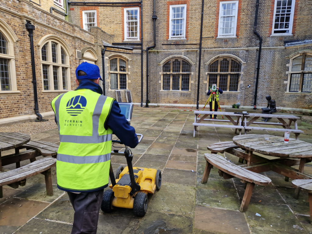
- Survey platforms (hand-pushed carts for small sites or vehicle-mounted for larger, open areas)
Soil Suitability
Here’s the honest truth: GPR isn’t a one-size-fits-all solution.
- Best performance: Dry, sandy, or gravelly soils. Chalky ground’s a win, too.
- Tricky conditions: Clay-heavy or waterlogged soils tend to absorb signals. That means less depth and fuzzy images.
How GPR is Used in Archaeology
GPR is especially handy for identifying and mapping archaeological features without disturbing them.
What GPR Can Detect
- Stone foundations
- Ancient walls or ditches
- Voids, cavities, and tombs
- Graves (yes, even in churchyards)
- Buried artefacts, pits, or hearths
You’ll often find GPR being used to plan excavations more precisely—or to avoid them altogether.
Preserving the Past Without Digging
Here’s why archaeologists and conservationists love GPR:
- Non-destructive: No need for test trenches or heavy machinery
- Efficient: You can scan large areas in a day
- Accurate: Provides good depth estimates and detailed maps
- Versatile: Works in complex urban or historic settings
What Happens During a GPR Archaeological Survey?
You might be wondering: “What exactly happens when I book a GPR survey?”
Good question. Here’s what the process typically looks like—from start to finish.
Step-by-Step Survey Process
- Desktop Study
Before anyone steps foot on-site, a thorough background check is done.
- Existing topographical surveys
- Historic maps
- Aerial imagery
- Previous archaeological reports
- Environmental and geological conditions
This helps tailor the GPR settings and coverage to suit your site’s history and subsurface.
- Grid Setup
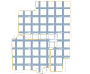
The survey area is divided into a grid—usually marked out with tape or flags. This allows for systematic scanning and ensures full, systematic area coverage.

- Data Collection
The GPR equipment is rolled (or driven) back and forth across the grid, line by line.
Depending on the size and terrain:
- Pushcart systems are used for graveyards or tight spaces
- Vehicle-mounted units cover fields and open land fast
- Post-Processing and Interpretation
Once collected, the raw data is cleaned up and visualised using specialist software. This is where the magic happens—turning blurry echoes into usable maps.
- Report Generation
A formal report is created, suitable for planning submissions, heritage bodies, or further archaeological assessment.
Pro Tip: Make sure your report is compliant with CIfA and Historic England standards if you’re submitting for planning. At Terrain Surveys, ours always are.
When Should GPR Be Used in Archaeology?
Not every site needs GPR. But when it’s the right tool, it can be a game-changer—saving time, money, and a lot of unnecessary digging.
Ideal Applications
GPR is particularly valuable on:
- Scheduled monuments and heritage sites
Where excavation is either heavily restricted or outright banned. - Churchyards and cemeteries
GPR is widely used to locate unmarked graves without disturbing remains. - Conservation areas
Where maintaining the integrity of the site is critical. - Pre-construction assessments
Especially when archaeological conditions are tied to planning permission. GPR helps demonstrate due diligence. - Urban or historic town centres
Where underground services, old foundations, and historic layers need careful mapping before any works begin.
In all these cases, GPR enables early risk identification and better-informed decision-making.
When GPR May Not Be Suitable
While it’s a powerful method, GPR does have limits. It’s not always the best choice, especially in these scenarios:
- Clay-rich or wet soils
These absorb radar energy, making results faint or unreadable. - Forested or overgrown sites
If the GPR system can’t physically pass through the terrain, scanning becomes patchy at best. - High electromagnetic interference
Urban sites packed with pipes, rebar, or old metallic debris can produce noisy data—making interpretation tricky.
Cost of a GPR Archaeological Survey in the UK
Let’s get down to brass tacks: how much is this going to cost?
As with most technical surveys, the answer depends on a few key factors. But to give you a ballpark, here’s what typical pricing looks like based on industry averages and our experience at Terrain Surveys.
Average Prices Based on Site Size and Complexity
These figures are based on standard archaeological GPR applications in 2025, drawing on data from multiple commercial providers:
| Site Size | Typical Cost Range |
| Small (0.5 – 1 acre) | £950 – £1,800 |
| Medium (1 – 5 acres) | £1,800 – £3,500 |
| Large or complex sites | £3,500+ |
Costs start to climb when you’re dealing with:
- Historic buildings or scheduled monuments
- High-resolution (multi-depth) scans
- Multi-method surveys (e.g. GPR + magnetometry)
And don’t forget—some suppliers charge extra for post-processing, travel, or fast turnaround. Always read the quote carefully.
Factors That Influence Cost
Want to understand what you’re actually paying for? Here are the biggest cost drivers:
- Terrain and accessibility: Steep gradients, thick vegetation, or hard-to-reach locations mean more setup time.
- Survey resolution and depth: Deeper scans require lower frequency antennas—and more time. Higher resolution (shallower) scans can require tighter grid intervals.
- Report complexity: A basic results map is quicker (and cheaper) than a fully interpreted, planning-grade report.
- Turnaround time: Need results in 48 hours? Expect a rush fee.
- Combination with other methods: Adding magnetometry, resistivity, or drone mapping into the mix will increase both cost and value.
So, When Should You Use GPR?
Use GPR when:
- You need depth data to distinguish between shallow modern disturbance and deeper historic features.
- You’re dealing with stone, voids, or burials that might not show on magnetometry.
- You need non-invasive results—especially where digging isn’t permitted.
Use magnetometry or resistivity when:
- You’re working with larger areas on a tight budget.
- You’re in conditions unsuitable for GPR (clay, heavy waterlogging, or lots of metal debris).
In many cases, we recommend a hybrid approach: using GPR together with magnetometry and resistivity for a fuller, multi-layered picture.
Why Use Terrain Surveys for GPR Archaeological Surveys?
You’ve seen what GPR can do. But here’s the thing:
The results are only as good as the team behind the survey.
At Terrain Surveys, we combine cutting-edge equipment with decades of experience to deliver archaeological GPR surveys that are clear, compliant, and useful.
Trusted Experts with Multidisciplinary Support
We’re not just button-pressers. Our team includes:
- GPR specialists
- CAD and BIM technicians
- Historic site professionals
And that means you’re not just getting a radar scan—you’re getting expert interpretation, clear visualisation, and practical recommendations you can actually act on.
What Makes Us Different?
- Clear, accessible reporting: No technical waffle—just what you need to know.
- Fast turnaround times: Without sacrificing accuracy.
- Multi-method capabilities: We offer magnetometry, resistivity, topographic surveys and more—so you get a one-stop solution.
- Heritage and planning know-how: We’ve worked with Historic England, local authorities, and planning consultants across the UK.
Locations We Cover
With offices in Hertfordshire, Rugby, Bristol, and Sussex, we cover projects across:
- England
- Wales
- Scotland
Whether it’s a graveyard in Gloucestershire or a suspected Roman villa in Norfolk, we’ve got you covered.
Get a Free, No Obligation Quote Today
Ground Penetrating Radar has changed the game in archaeological surveying.
You can now visualise what lies beneath the ground—walls, voids, burials, and more—without lifting a trowel. And when combined with expert interpretation, it gives you the insights you need to make informed decisions, satisfy planning requirements, or preserve the past.
Whether you’re managing a development project, preparing a heritage report, or simply want to understand the archaeological potential of your land, a GPR survey is a fast, precise, and non-destructive way to get the answers.
At Terrain Surveys, we handle the entire process—from the first desktop assessment to the final report. No jargon. No delay. Just actionable results from a team you can trust.
