Topographical Surveys
Get a clear, accurate picture of your site so you can design, plan and build with confidence.
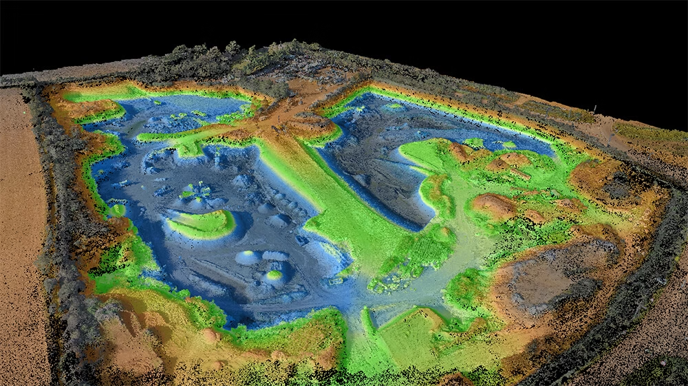
A topographical survey is a detailed measured survey that records the physical features of a site and the surrounding land. It captures elements such as levels, contours, boundaries, buildings, walls, roads, drainage features, hard and soft landscaping, utility covers and other visible structures that may affect design and construction.
For architects, developers, engineers and landowners, it provides the reliable base information needed to make informed decisions early in a project. A topographical survey helps reduce uncertainty, supports smoother planning and design, and lowers the risk of costly surprises later on.
- Provides accurate site data to support design, planning and construction decisions
- Helps identify physical constraints, access issues and level changes early
- Reduces the risk of redesign, delays and unexpected site-related costs
- Gives architects and engineers a dependable base drawing to work from
- Supports better communication between project teams, consultants and contractors
Get a free quote
Request a free, no-obligation quote for your project today.
- Existing buildings and structures
- Ground levels, spot heights and contours
- Boundaries, walls, fences and access points
- Roads, kerbs, footpaths and hardstanding
- Drainage features, covers, chambers and visible service points
- Trees, hedges and significant landscape features
- External features such as lighting columns, street furniture and signage
- Survey information is usually delivered in the format your team needs, including CAD drawings, PDF plans and other outputs to support design and planning workflows.

What’s Included in a Topographic survey?
Our topographical surveys are tailored to the needs of your site and project, but typically include:

Why Topographic Surveys Matter
A topographical survey gives your project team a dependable foundation from the outset. Whether you are preparing a planning application, designing a new development, extending an existing building or assessing a site for purchase, accurate measured data helps move the project forward with greater certainty.
Planning a construction Project?
Planning a construction project without an accurate topographical survey can lead to design errors, drainage problems, setting-out issues and expensive delays once work is under way. Terrain Surveys helps you avoid costly mistakes before they become site problems, giving your team the reliable data needed to plan with confidence, so speak to us today for a free, no-obligation quote.
Get In Touch- Planning a new build development
- Designing an extension or alteration
- Preparing drawings for a planning application
- Assessing land before purchase or development
- Designing roads, drainage or external works
- Coordinating multiple consultants on a live project
- Updating outdated site information before construction starts

When You Need a Topographic Survey

Our Approach
Our experienced and certified surveyors combine state-of-art geospatial technology with a practical, client-focused service to capture, process and quality-check data efficiently. The result is precise, usable survey deliverables, from CAD drawings to terrain models, produced with professionalism, clear communication and a commitment to helping projects move forward with confidence.
What We'll deliver
Depending on your needs, we can also provide supporting outputs such as PDF drawings, survey reports, imagery, point cloud data, GIS-compatible information and other project-specific deliverables. At Terrain Surveys, we pride ourselves on delivering reliable, high-quality survey outputs that are complete, clearly presented and flawlessly aligned with your timescales and technical requirements.
Combined Surveys
We can combine other types of surveys with your topographical survey to provide an even richer output. Whether you require underground utility mapping data, measured building surveys layered into your topographical project or the inclusion of a CCTV drainage condition and connectivity survey, we can help.
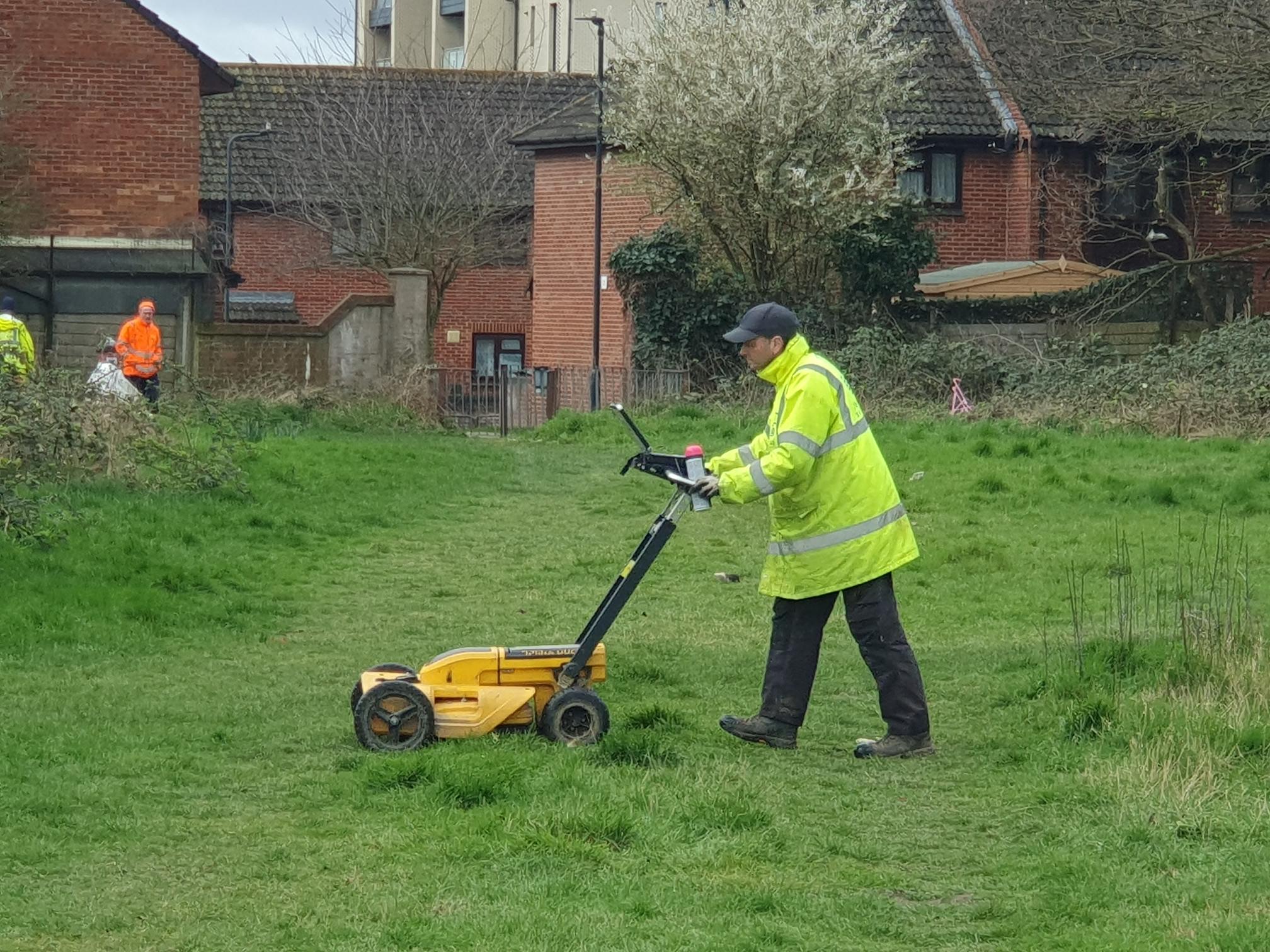
Utility Mapping Surveys
If you’re planning, designing or pricing works, a site-wide utility survey gives you a clear picture of what’s underground across the full area. This helps you avoid design clashes, plan routes for foundations and drainage, and reduce expensive last-minute changes once works are underway.

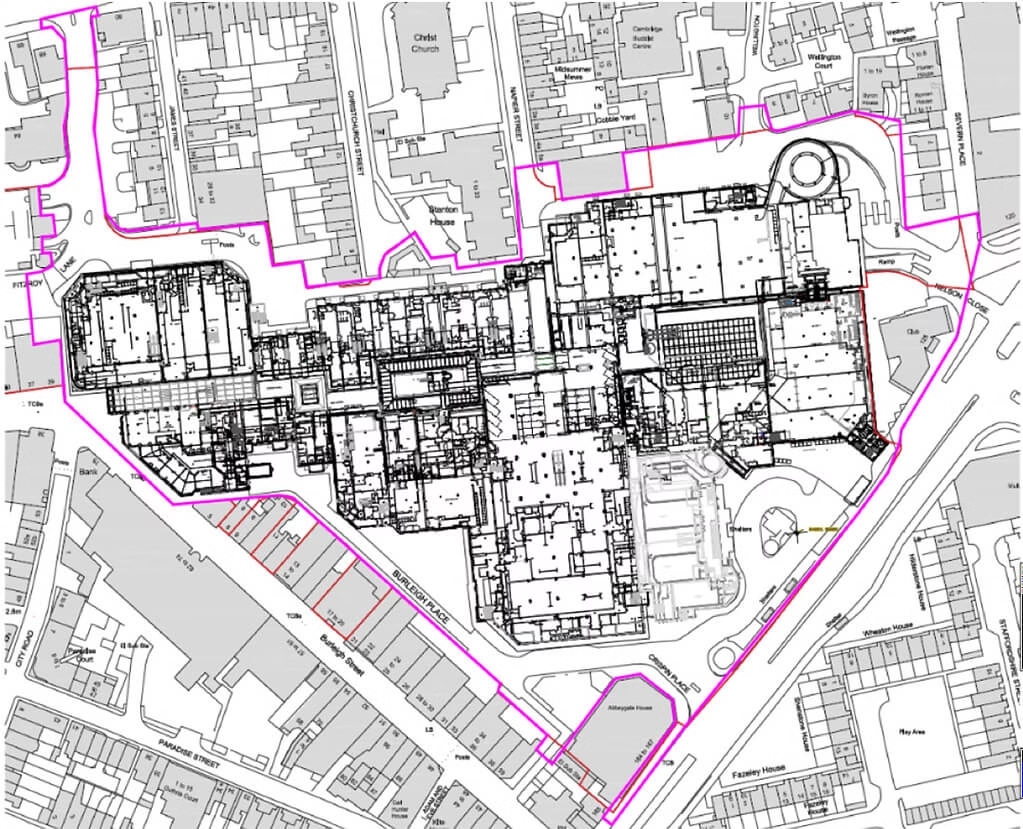
Measured building Surveys
Need a precise, professionally delivered measured building survey? At Terrain Surveys, we provide detailed floor plans, elevations, and cross-sections for buildings of every type, from historic properties and private homes to large commercial sites and public facilities.

CCTV Drainage Condition & Connectivity
Need accurate and up to date information on your drainage system? We have you covered. Using advanced camera equipment and decades of experience, we can investigate and map below ground drainage infrastructure.
Accreditations


6 key reasons to choose Terrain Surveys
Why us
Experienced
Established in 2004 by three founding directors determined to improve surveying standards, Terrain Surveys Ltd was created with a commitment to excellence.Highly rated
Terrain Surveys strives to be the survey company of choice through a wide scope of knowledge and a constant drive for excellence. We pride ourselves on the quality of service provided, including customer service, survey deliverables, training, education, and the systems we operate.Focus on sustainability
As a leading provider of measured survey services, Terrain Surveys understands the critical role our work plays in shaping the built environment. We are committed to integrating sustainable practices into every aspect of our operations.Qualified and accredited
Terrain Surveys Ltd holds the ISO 9001:2015 accreditation, reflecting our commitment to quality management systems and consistent service delivery. Additionally, our team includes professionals with various industry-specific qualifications and certifications, such as membership in the Royal Institution of Chartered Surveyors (RICS) and the Chartered Institution of Civil Engineering Surveyors (CICES).Diverse and growing team
Our strength lies in our team, whose experience and knowledge, coupled with investment in training and technology, enable efficient work and the production of high-quality, accurate measured surveys that meet clients' strict deadlines.Nationwide coverage
Terrain Surveys provides comprehensive national coverage across the UK, ensuring clients receive consistent, high-quality surveying services wherever they are. With strategically located offices, the company is well-positioned to deliver efficient and tailored solutions to meet a variety of client needs.
Our work
From our main offices in Hertfordshire and Birmingham, we've carried out thousands of topographical surveys across the UK. Browse our project case studies below or get in touch with our team to discover how we can help you.
 Read more2 min read
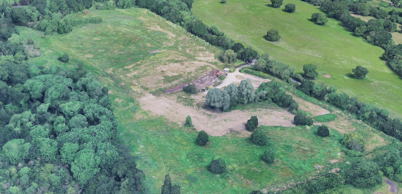
A Full Topographical Survey of a Former North London Golf Centre
Our team navigated overgrown terrain and derelict structures to deliver a full topographical survey of a former North London golf centre, helping…
 Read more2 min read
A Complete Site Picture of Neasden Recreation Ground
Integrated topographical and utility surveys of Neasden Recreation Ground.
 Read more3 min read
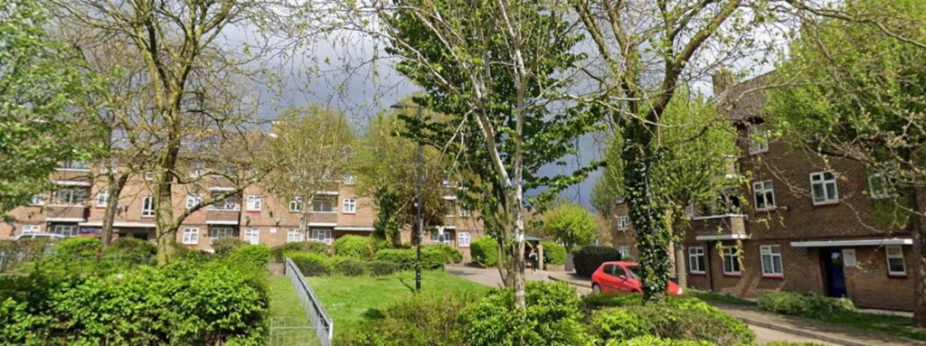
A full Topographical Survey of a Housing Estate in Bexley
Terrain Surveys carried out a full Topographical survey of an estate in Bexley. 132 flats spread over 22 separate blocks


What customers say about Terrain Surveys
Reviews


Popular Topographical Survey Locations
We'd love to hear from you
Get a free quote ONLINE OR CALL
+44(0)143 884 1300Request a free, no-obligation quote for your project today.