Introduction
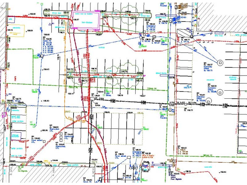
We have been working on behalf of one of our regular architectural clients who has a relationship with a house builder specialising in developing housing on regeneration sites. To support the planning process, we were requested to carry out topographical surveys, utility and measured building surveys.
The site is a large existing industrial estate with several business units, parking areas, access roads and associated services.
The Challenge
Industrial estates can be very busy places. One of the major challenges on this project was the number of parked vehicles around the site. This causes most difficulties to the utility survey team as vehicles can be parked on top of service covers which needs to be accessed/lifted and crucial survey data recorded.
Our surveyors liaised with the client and tenants to ensure formulated a programme of works that would cause minimal disruption to the site operations whilst ensuring our survey teams could work safely and unhindered. This allowed us to deliver a complete and accurate topographical survey and utility survey.
Working to the RICS specification for measured building surveys, we were also instructed to provide information on the gross internal areas of all buildings as well as recording external heights to facilitate the calculation of building volumes. This information is essential as it provides details on what is currently in place and helps support any future planning process for re-development.
As part of the project we also produced street scene elevations of the surrounding buildings overlooking the site. These elevations provide valuable contextual information which supports the design and planning stage of a project. With all developments, it is necessary to demonstrate that the designs for any site can be justified by what is currently in place.
The Results
We produced a detailed topographic survey with the addition of all underground services being accurtaely mapped. We also completed a measured building survey, which included floor plans and elevations of all units on site as well as street scene elevations of the surrounding buildings. To capture the site information effeciently, we used 3D laser scanning as one of the main forms of data capture, mimimising any disruption to the busy site and giving us a complete 3D pointcloud replica of the site. This gives us all of the critical data that we need and should the architect require further information, we are able to provide this with no need for a costly revisit.
Benefits delivered:
• Use of 3D laser scanning to quickly capture all elements of the building with minimal disruption
• 3D laser scanning is a non-contact measurement process negating potential health and safety risks
• Complete data capture of the site reducing any costly re-visits
If you would like to find out how we work with architects and developers to support your project, please contact us today.
