Ground Penetrating Radar (GPR) surveys are often described as a form of X-ray vision for the ground.
No digging. No drilling. No disruption.
Instead of excavating, GPR uses high-frequency radar waves to scan beneath the surface, detecting underground features such as plastic pipes, reinforced concrete, and even hidden voids.
How It Works
Here’s the simple version:
- A transmitter sends radar pulses into the ground.
- When those waves hit something different — say a pipe, stone, or empty space — they bounce back.
- A receiver grabs those echoes and uses the timing and strength of each reflection to map out what’s down there.
The raw data is then processed into 2D profiles or even 3D models using specialised software.
Think of it as a digital excavation — revealing what’s hidden underground without moving a single shovel of soil.
Where GPR Surveys Make the Most Impact
You’d be surprised at just how versatile this tech is. Here’s where GPR shines:
1. Utility Mapping
GPR is a go-to tool for spotting buried services — especially non-metallic ones like plastic or concrete pipes that traditional cable locators might miss.
Perfect before any digging begins. No surprises. No burst mains.
2. Void & Anomaly Detection
Got a site with subsidence risk or old culverts? GPR helps you spot underground voids, sinkholes or hidden chambers — long before they become a structural nightmare.
3. Archaeology & Heritage
Digging on historic ground? GPR helps archaeologists pinpoint structures or artefacts without disturbing the soil.
You’ve probably seen it on “Time Team” (if you’re old enough to remember that show) — it’s how they find ancient walls and graves without ever cracking open the earth.
4. Environmental & Geological Studies
Want to know where the groundwater is? Or how thick a clay layer is? GPR helps map subsurface layers, pollution zones and bedrock levels.
5. Engineering & Construction
Before pouring concrete or cutting into roads, GPR checks what’s below — from rebar grids to potential sinkholes.
Even the military use it to find landmines or buried objects.
How a GPR Survey Actually Happens
1. Planning & Prep
It begins with identifying the project goals and reviewing any existing plans or site documentation. The survey findings are then overlaid onto those maps for clearer context.
For projects requiring a PAS128-compliant utility survey, a denser scanning grid is established, and a full risk assessment is carried out.
2. On-Site Scanning
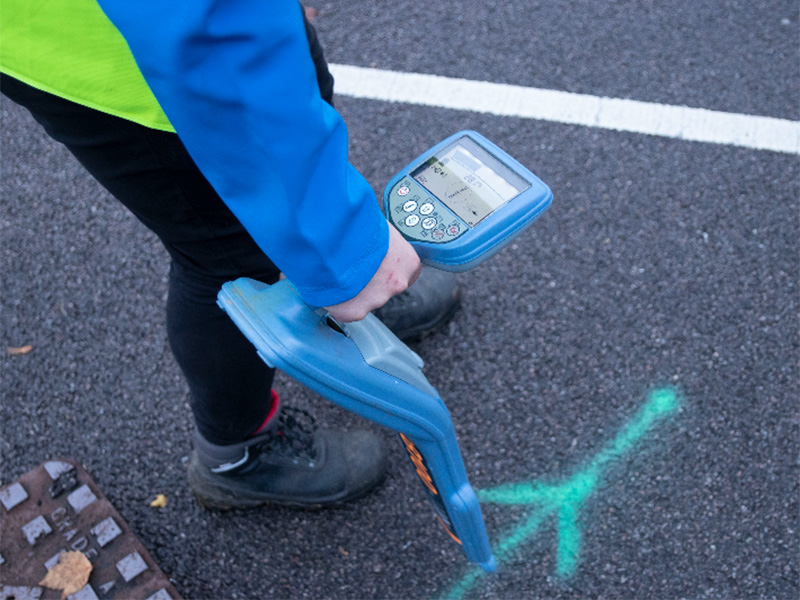
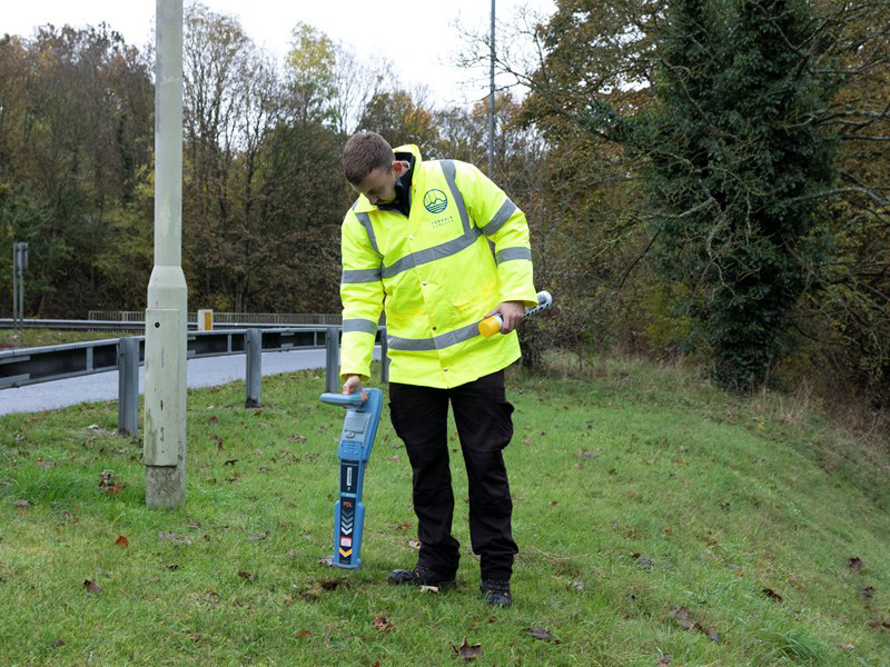
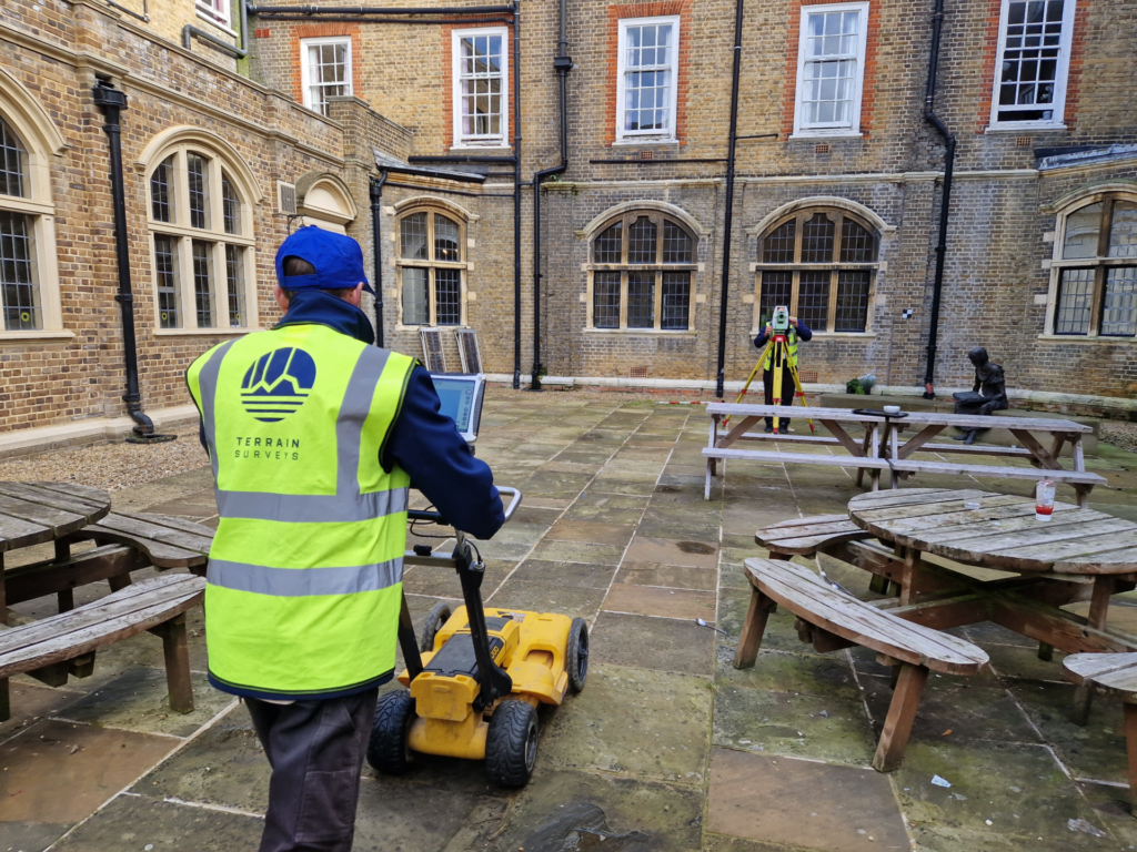
The area is systematically scanned using wheeled carts or sleds equipped with radar technology. Each radar echo is recorded, with real-time markings made on-site using spray paint or flags.
Smaller projects may be completed within a few hours, while larger sites can require a full day or more.
3. Data Crunching
Once scanning is complete, the radar data is processed and refined off-site. Analysts look for signature patterns — such as hyperbolas — that indicate the presence of buried objects.
The output can be delivered as a clean 2D map or a detailed 3D subsurface image, depending on the project’s requirements.
4. The Final Report
The final deliverables typically include annotated CAD drawings and a clear, straightforward report. Findings might be noted as: “PVC pipe at 1.2m” or “suspected void beneath car park slab.”
Additional details, such as 3D models or cross-sections, can be provided upon request, if more info is needed.
What Affects GPR Survey Performance?
Ground Penetrating Radar (GPR) is a powerful tool, but it’s not without limitations.
Several factors influence how deeply it can penetrate the ground and how clearly subsurface features are revealed.
1. Ground Type
This is one of the most critical variables.
- GPR performs best in dry, sandy soils or gravel, which have low electrical conductivity. In these optimal conditions, radar waves travel further, and depths of 2 to 3 metres (or more) may be achieved.
- In contrast, clay-rich or wet soils, and areas with high salinity, significantly reduce penetration depth. In such cases, visibility may be limited to half a metre or less.
- GPR can still operate in these conditions, but results are typically shallower and less defined.
2. Target Depth & Size
The depth and size of the object being detected influences the choice of antenna frequency:
- High-frequency antennas (e.g. 900 MHz) offer greater resolution for identifying small or shallow features like telecom cables or concrete rebar but limited depth penetration.
- Low-frequency antennas (e.g. 200–400 MHz) allow deeper penetration, making them suitable for geological surveys, but they offer lower image clarity.
The chosen antenna must balance the trade-off between resolution and depth. Very small or deeply buried objects may be difficult to detect reliably. At Terrain Surveys, we always use both to ensure we get the full picture.
3. Surface Conditions
Good surface contact between the antenna and the ground is essential for optimal data quality.
- Favourable surfaces: short grass, tarmac, flat concrete
- Challenging surfaces: loose rubble, steep slopes, uneven terrain
Poor surface conditions can reduce data clarity and increase scanning time.
4. Subsurface Clutter
Previous construction work or mixed backfill can create complex underground environments:
- Areas with reinforced mesh, utilities, or old foundation layers often produce “noisy” data, with overlapping or false reflections.
- In such cases, expert interpretation is crucial to distinguish between meaningful signals and background clutter.
5. Equipment & Survey Density
The quality and configuration of the GPR equipment also play a significant role:
- Multi-channel arrays and 3D imaging systems are used for comprehensive data collection on complex sites.
- Survey density — the spacing of scan lines and speed of scanning — is adjusted based on the accuracy requirements.
For example, a PAS 128-compliant survey demands a tighter scan grid, which increases time and complexity but produces highly detailed and standard-compliant results.
GPR Survey: Benefits vs. Limitations
Let’s be realistic. GPR’s a powerful tool — but it’s not bulletproof.
Here’s where it shines — and where it doesn’t.
What GPR Does Well
- Non-destructive: No drilling. No digging. No disruption.
- Safe: It uses radio waves — entirely harmless for people and the environment.
- Finds metal and non-metal targets: Plastic pipes, concrete ducts, old footings — all visible.
- Faster & cheaper than trial holes: Most surveys take hours, not days.
- Gives depth and shape: Outputs include not just the presence of an object, but also its depth and approximate shape through visualised data.
Limitations to Watch
- Clay & water are enemies: Signal strength drops dramatically. You might only see 0.5m into the ground.
- Depth limit: Most UK surveys hit a max of 2–3 metres. Going deeper? You may need borehole radar or seismic methods.
- Interpretation takes skill: GPR data looks like squiggly lines (not X-ray images). It takes training and experience to read properly.
- It can’t tell you exactly what an object is: GPR can say “there’s something at 1.2m”, but identifying takes context or correlation with maps.
- Tiny or close-together features may be missed: A 20mm fibre optic cable? Not likely to show. Tightly packed rebar? Might blur together.
How Much Does a GPR Survey Cost in the UK?
This is what most people want to know — and like most things, it depends.
Here’s what affects your price:
1. Site Size & Complexity
A small open garden is faster to scan than a cluttered industrial yard. Obstructions, traffic management, or multi-level access all add time and cost.
2. Required Depth & Accuracy
Want a quick utility sweep? Low cost.
Need a PAS128 grid scan with full verification? Costs more
3. Deliverables
Basic sketch plan or full DWG/PDFs with 3D subsurface imaging? The more detail, the more work, the higher the cost.
4. Travel & Logistics
Remote or hard-to-access sites may incur mobilisation charges.
Typical UK GPR Pricing (As of 2025)
| Scope | Cost Range |
| Simple site (per day) | £800 – £1,200 |
| Complex site (per day) | £1,500 – £2,500+ |
| Small garden or field (half-day) | ~£500 – £700 |
| Full utility survey (project total) | £10,000 – £35,000+ |
| 3D processing or extra reporting | May cost extra |
Pro tip: Always ask what’s included in the quote. Some firms charge extra for CAD layers, cross-sections, or fast turnaround.
Choosing a GPR Survey Company (Without Getting Burned)
GPR surveys are only as good as the people behind them.
The equipment matters, sure — but it’s the skill in planning, scanning and interpreting the data that makes the real difference.
So how do you spot a top-tier provider from one that’ll waste your time and budget?
Here’s what to look for:
1. Accreditation & Standards
The best providers follow industry standards — especially for utility surveys.
In the UK, that means PAS128 compliance. It sets out how thorough a utility survey should be, from scan spacing to verification.
Also look for:
- TSA Membership (The Survey Association)
- CICES Accreditation (Chartered Institution of Civil Engineering Surveyors)
- ISO9001 Certification for quality management
- Constructionline membership for supplier assurance
If a firm ticks all these boxes, you’re off to a solid start.
Time saving tip; Terrain Surveys ticks all these boxes, and we offer a complete range of GPR services nationwide.
2. Experienced Surveyors
GPR isn’t just “point and shoot”. It takes genuine expertise to run the kit, interpret the radargrams and avoid false positives.
Ask:
- Are your surveyors trained geophysicists or CICES-certified?
- Have they worked on similar projects (construction, heritage, civils)?
- How many GPR surveys have they completed?
The difference between a pro and a novice? Misidentified pipes. So don’t take chances.
3. Modern Equipment
Tech matters. The best providers use:
- Multi-channel GPR arrays for fast, dense coverage
- 3D radar imaging systems for volume scans
- Top-end software like RADAN or GPR-Slice for analysis
Also ask if they combine methods — cable locators, electromagnetic locators or even drone surveys — for validation. Again, something we do as standard.
4. Quality of Reports
You’re not just paying for a scan. You’re paying for insight.
Ask to see a sample report. It should include:
- Clear, labelled CAD or PDF drawings
- Depths of detected features
- Marked utilities, voids, or anomalies
- Interpretation — not just screenshots
If they’re giving you raw radar data with no explanation? Walk away.
5. Safety and Insurance
Reputable firms come fully insured and follow site safety regs to the letter.
They should handle things like:
- Traffic management
- Lone working protocols
- Working at height or confined spaces
Don’t assume — check their HSE record and ask what measures they’ll put in place.
6. Reputation and Client Feedback
Read reviews. Ask for references. Look at case studies.
And avoid lowball quotes. If a company comes in way under the competition, they’re likely cutting corners — on data quality, reporting or staff experience.
You want a relaible solution, not just a cheap technician.
Terrain Surveys: Our GPR Service Promise
At Terrain Surveys, we’ve been running underground surveys across the UK for over 18 years.
Our surveyors are PAS128 trained, CICES certified, and have tackled everything from private gardens to major infrastructure projects.
We use state-of-the-art GPR systems, including 3D and multi-channel setups, to deliver accurate and efficient results, fast.
Here’s what you get with us:
- PAS128-compliant scanning
- CAD and PDF deliverables
- 2D and 3D mapping options
- Clear, jargon-free reports
- Personal service — from planning to final report
Need topographic data too? We do that. Want an urgent utility scan before siteworks start? We’ll sort it.
Get in touch via our contact form and we’ll get back to you with a no-obligation quote.


