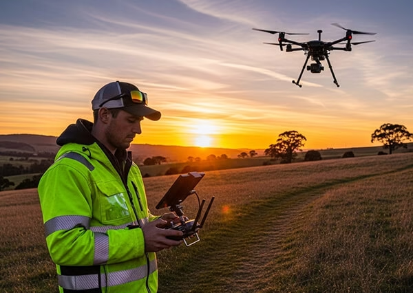
Drone Surveys & Aerial Inspections
Accurate, safe and cost-effective aerial data capture across the UK
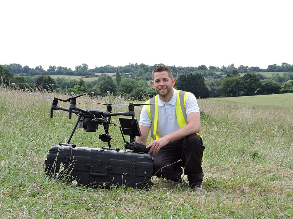
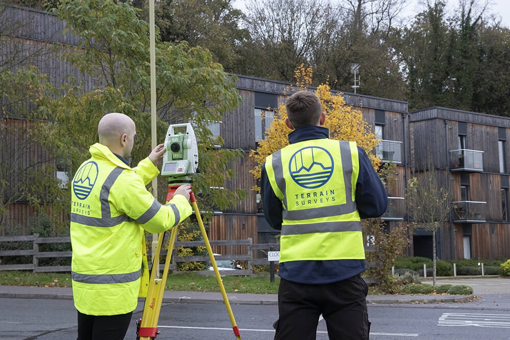
At Terrain Surveys, we use advanced drone (UAV) technology to deliver fast, detailed and highly accurate survey data, from topographic mapping to roof inspections and 3D modelling. Our CAA-approved pilots and experienced surveyors provide a complete aerial survey service that saves time, reduces risk, and integrates seamlessly with your CAD, BIM and GIS workflows.
- CAA Licensed Pilots
- Fast Response – Nationwide
- Scaled Drawings in 2D CAD or 3D BIM Formats
- Clear Fixed, & Competitive Pricing
- CICES Approved
5.0
powered by
Call us today
+44(0)143 884 1300Get a free quote
Request a free, no-obligation quote for your project today.
- Construction and infrastructure projects
- Building and roof inspections
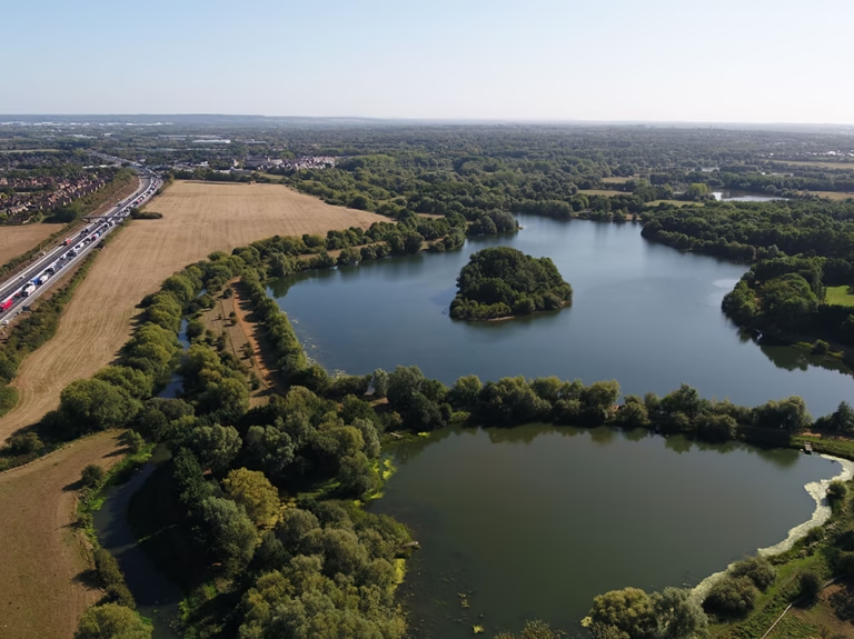
- Environmental and heritage mapping
- Land development and topographic surveys
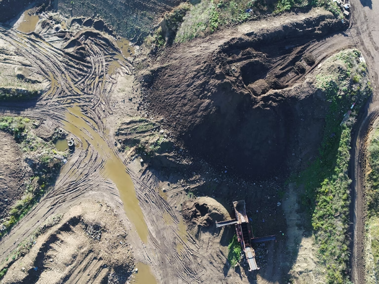
- Volumetric stockpile calculations and cut-fill analysis
- Site monitoring and progress reporting
- Powerline & pipeline corridor surveys
Why Choose Drone Surveys
Drone surveys can provide a powerful alternative to traditional ground-based surveying. They allow us to cover large or complex sites rapidly, reach hard-to-access areas, and reduce on-site disruption, while maintaining high levels of accuracy.
Typical applications include:
Typical applications include:
- Speed and efficiency: Large areas can be captured in hours, not days.
- Improved safety: No need for scaffolding or working at height.
- Reduced site disruption: Minimal ground access required.
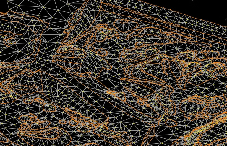
- High-resolution imagery: Generate crisp ortho-photos, 3D models, and point clouds.
- Cost savings: Lower mobilisation time and fewer return visits.

Key Benefits of Drone Surveys
Our Drone Survey Services
Below you'll see the drone survey service-types that we offer offer
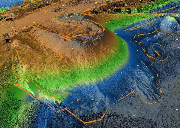
- Ortho-rectified imagery (GeoTIFF)
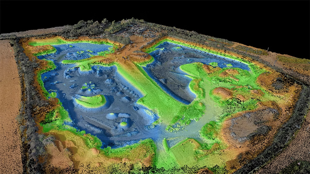
- Digital Terrain and Surface Models
- Contour mapping and breaklines
- Volumetric calculations for stockpiles and earthworks
- CAD data outputs (DWG, DXF)
- High-resolution still images and video
- Accurate 2D plans delivered in DWG & PDF formats
- 3D mesh and point cloud models for BIM integration
Land & Topographic Drone Surveys
For developers, planners and civil engineers, drone-based topographic surveys deliver accurate terrain models with rapid turnaround.
We capture high-resolution imagery and/or lidar data, processing it into 2D orthomosaics and 3D models (DSM/DTM) for mapping, design and volume analysis.
Deliverables include:
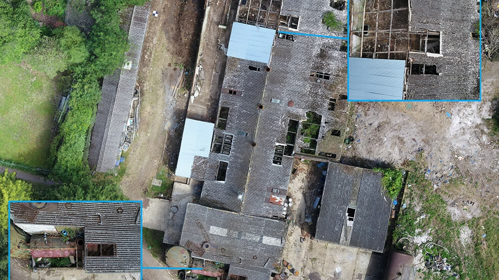
Building & Roof Inspection Surveys
Our drones eliminate the need for scaffolding, cherry pickers or rope access.
We capture high-definition imagery of roofs, façades and structures — ideal for condition surveys, maintenance planning and insurance assessments.
Deliverables include:
Accreditations


Every Terrain Surveys drone survey follows a rigorously planned workflow to ensure accuracy, safety and compliance.
Our Equipment
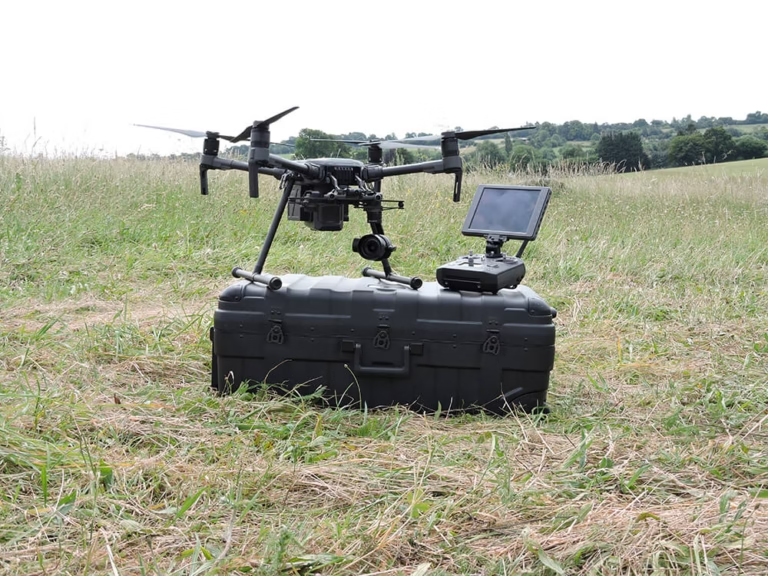
- Professional-grade multirotor and fixed-wing UAVs
- RTK/PPK GNSS positioning for improved accuracy
- RGB, LiDAR, and thermal sensors for multi-purpose data capture
- Ground control points (GCPs) to validate results
Our Process
Pre-Survey Planning:
- Feasibility assessment, risk and airspace checks
- Flight path planning and CAA notification
On-Site Capture:
- Data collection by certified pilots under Method Statement and RAMS
Processing & QA:
- Photogrammetric reconstruction and accuracy validation
- Quality control against ground data
Deliverables & Review:
- Data delivered in formats tailored to your workflow
- Optional online viewer for easy collaboration
At Terrain Surveys, precision is our promise. Every drone flight is supported by robust ground control, calibration, and verification processes to ensure reliable, survey-grade results.
How We Guarantee Accuracy
- Ground Control Points (GCPs):
We establish GCPs using GNSS equipment to provide reference data with centimetre-level accuracy. These are clearly visible and georeferenced for consistency across multiple flights.
- RTK/PPK Positioning:
Our drones use Real-Time Kinematic (RTK) or Post-Processed Kinematic (PPK) systems, allowing for real-time correction and post-flight verification of all captured data.
- Quality Control Checks:
◉ Independent accuracy validation against known control points
◉ Residual error analysis and tolerances reviewed per project
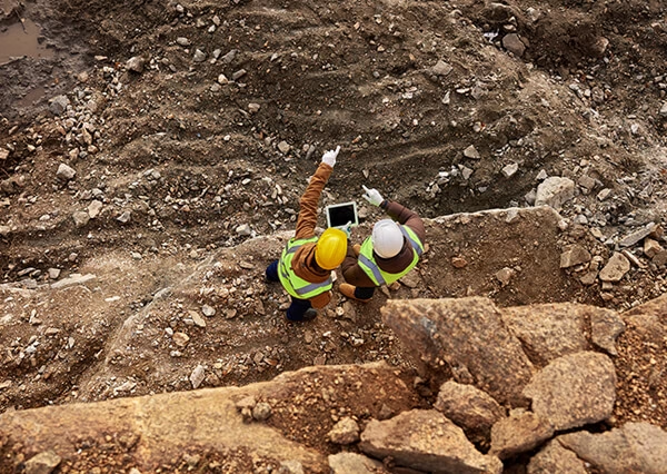
Safety, legality, and professionalism are central to every flight we undertake.
All Terrain Surveys drone operations are carried out by CAA-approved pilots, under a Civil Aviation Authority Operational Authorisation (GVC).
Our Commitments
- CAA Licensed Pilots:
Fully qualified to fly drones commercially in UK airspace. - Risk Assessment & Method Statements:
Site-specific RAMS prepared for every project. - Insurance & Liability Cover:
£10 million public liability insurance as standard. - Data Security:
Client data securely stored and transferred via encrypted servers. - Health & Safety First:
Compliance with CDM and all relevant on-site safety regulations.
We also handle all necessary flight permissions, site coordination, and airspace notifications — so your project proceeds smoothly and safely.
Each drone survey is unique, but understanding what affects cost helps you plan with confidence.
Factors That Influence Pricing
- 1. Site Size & Complexity:
Larger or more complex sites require more flight planning and processing time. - 2. Accuracy & Resolution Required:
Higher image overlap and GCP density increase data precision and post-processing effort. - 3. Deliverables & File Formats:
Basic orthophotos cost less than full 3D point clouds or BIM-ready models. - 4. Permissions & Airspace Restrictions:
Surveys near airports, railways or sensitive sites may need special authorisations. - 5. Travel & Logistics:
Costs vary slightly based on site access and geographic location.
Typical Project Range
- Small roof or structure inspection: from £650 +VAT
- Medium site topographic survey: £950 – £1,800 +VAT
- Large area or volumetric mapping: from £2,000 +VAT
(Estimates are for guidance only — each project receives a tailored quotation.)
Our Approach: How a Drone Survey Works
From planning to delivery, our process is built around accuracy, efficiency, and safety.
Every project follows a structured workflow designed to deliver high-quality, compliant data on time and within budget.
- Airspace and NOTAM checks
- Risk assessments and RAMS documentation
- Weather and operational window planning
1. Consultation & Project Scoping
We begin by understanding your objectives — whether you need volume calculations, roof inspections, or 3D site models.
Our team will assess your site constraints, accuracy requirements, and preferred data formats to propose the most efficient solution and free quote.
2. Flight Planning & Permissions
Once you approve the proposal, we handle all the logistics:
3. On-Site Data Capture
Our certified pilots and surveyors carry out the flight using RTK-enabled drones.
We mark ground control points (GCPs) and perform verification checks before, during, and after each flight.
- Orthoimagery and point clouds
- 3D surface and terrain models
- BIM ready and CAD datasets
4. Data Processing & Quality Control
Back at our office, we process the imagery using specialist photogrammetry software to generate:
We then perform detailed accuracy and consistency checks, comparing results against known ground control data.
5. Data Delivery & Client Review
We deliver your results in your preferred format — via secure download link, cloud viewer, or USB delivery.
Our surveyors are available for technical support, ensuring seamless integration with your design or asset management systems.
- Fully CAA-Certified Drone Operators: All flights are authorised and insured under current UK legislation.
- Surveyors First, Drone Pilots Second: Our team combines aerial expertise with decades of surveying experience — ensuring your deliverables are accurate and meaningful, not just photogenic.
- Integrated Solutions: Combine drone data with our topographic, building, and utility surveys for a complete picture of your site.
- Nationwide Coverage, Local Knowledge: With survey teams across the UK, we respond quickly and cost-effectively to any project location.
- Trusted by Leading Clients: We work with construction companies, local authorities, architects, and developers nationwide.
- Commitment to Safety & Compliance: Every flight is risk-assessed and logged, with digital data retention for traceability.
Why Choose Terrain Surveys
With over 20 years’ experience delivering measured surveys across the UK, Terrain Surveys is trusted by architects, engineers, developers and construction professionals for reliable, detailed and compliant results.
Our Advantages:
Our Advantages:
Other Surveys We Offer
 Explore
GPR Surveys
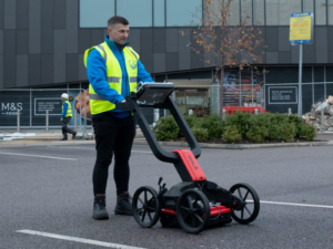
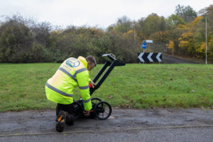
Ground Penetrating Radar (GPR) is a technique used in conjunction with Electromagnetic locators to carry out underground utility surveys
 Explore
PAS128 Surveys
A PAS128 Survey is an underground utility survey which detects, verifies, and locates all underground utilities.
 Explore
Utility Clearance Surveys
A utility clearance survey is an essential step in avoiding accidental strikes on buried service infrastructure when undertaking excavation or drilling works.


We'd love to hear from you
Get a free quote ONLINE OR CALL
+44(0)143 884 1300Request a free, no-obligation quote for your project today.