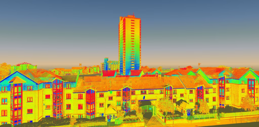
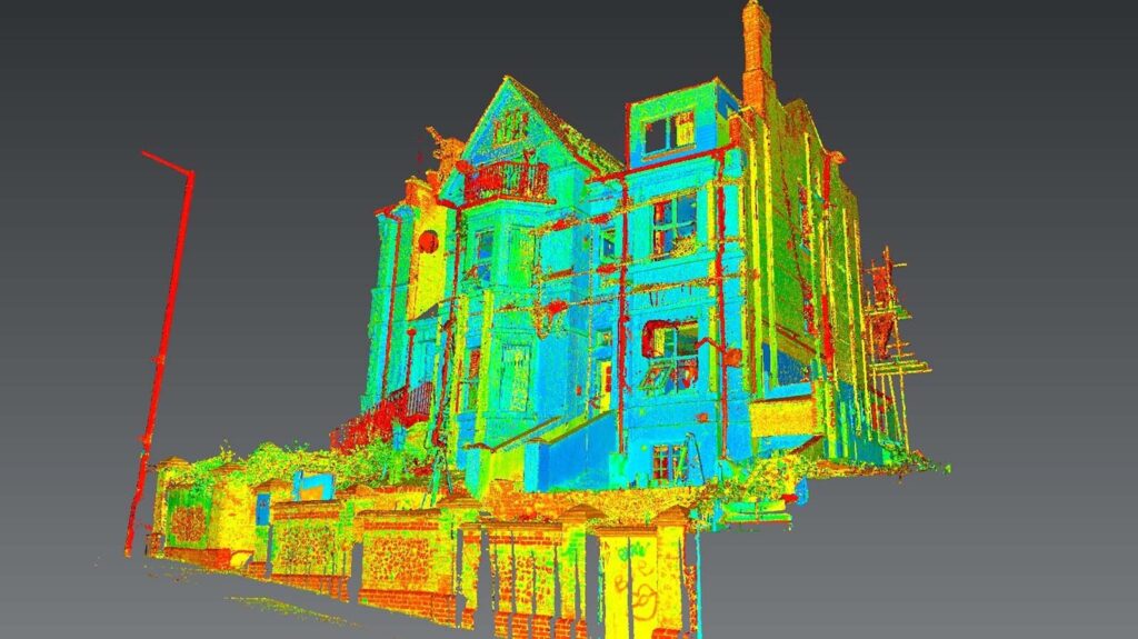
Picture this: You’re about to renovate your Victorian office building, or perhaps you’re an architect designing a new mixed-use development in Manchester. Either way, you’re dealing with complex information about buildings—measurements, materials, systems, and countless other details.
This is where BIM comes in.
Building Information Modelling (BIM) isn’t just another piece of software or a fancy 3D model. It’s a collaborative process for creating and managing all the information about a building throughout its entire lifecycle—from initial concept through to demolition.
The crucial bit? It’s the “Information” in BIM that matters most. Yes, the 3D models look impressive in client presentations. But the real value lies in the rich data attached to every beam, pipe, and wall.
Why BIM Matters to You
Gone are the days of relying solely on 2D paper drawings that inevitably led to conflicts on site. Today, it’s about creating intelligent, data-rich models that everyone can trust—improving efficiency, reducing costly errors, and transforming how teams collaborate.
As surveyors who’ve been in this industry since 2004, we’ve witnessed this evolution first-hand. And that process? It starts with accurate data from the real world.
That’s where we come in.
The BIM Levels Explained
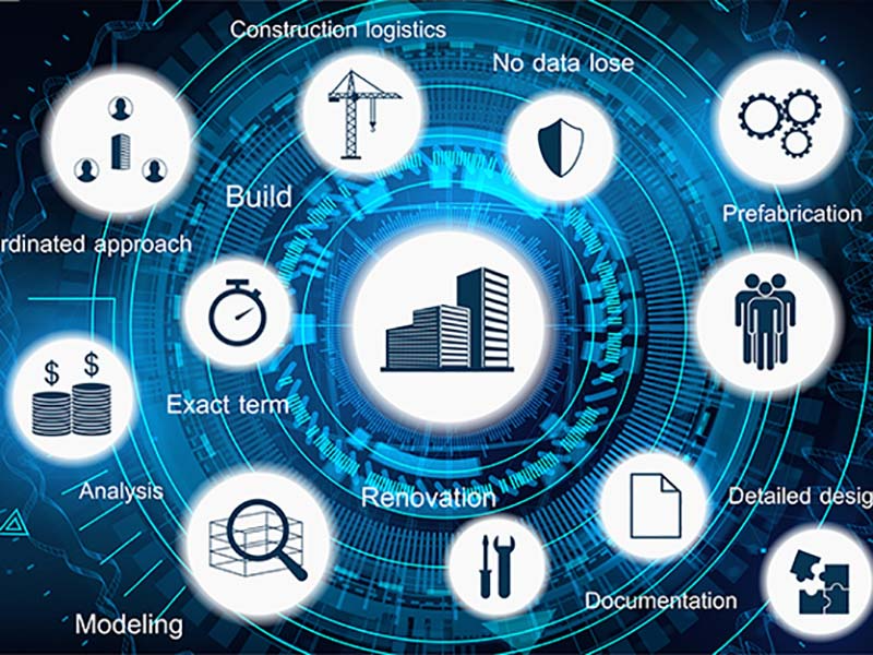
BIM levels are kind of like different depths of instruction manuals. You might start with a rough sketch on the back of an envelope, but eventually, you want a fully interactive digital guide that updates in real-time.
Each BIM level represents a step up in sophistication and collaboration.
Let’s break each BIM level down:
Level 0: The Starting Point (Unmanaged CAD)
This is where many of us started- and where some smaller projects still operate today.
Level 0 means no collaboration whatsoever.
Everyone works in their own silo with their own 2D CAD drawings. Information is shared via paper or basic digital files, often leading to that dreaded phrase: “Which version are we using?”
What you’ll find at Level 0:
- Traditional 2D CAD drafting
- Paper-based or basic digital file sharing
- High risk of conflicting information
- The classic “the left hand doesn’t know what the right hand is doing” scenario
Whilst largely superseded in professional construction, you might still encounter Level 0 on smaller domestic projects or with contractors who haven’t yet made the digital leap.
Level 1: A Glimmer of Collaboration (Managed CAD)
Level 1 represents the first tentative steps towards collaboration. It’s like moving from handwritten notes to a shared Google Doc- better, but not quite there yet.
At this level, you’ll see a mix of 2D and 3D CAD. The game-changer is the introduction of a Common Data Environment (CDE)– essentially a central repository where all drawings are stored and managed. However, models aren’t shared between disciplines.
The structural engineer has their model, the architect has theirs, and never the twain shall meet.
Key characteristics of Level 1:
- Use of a Common Data Environment
- Standardised data structures (following standards like BS 1192)
- Each team member still manages their own data independently
- Some 3D work, but not universally adopted
It’s a step forward from Level 0, certainly. But it still lacks the true collaborative benefits that make BIM transformative.
Level 2: The Collaborative Standard
Now we’re talking.
Level 2 is where BIM truly comes alive. This is the level that changed the UK construction industry when it became mandatory for all centrally-procured public sector projects in 2016.
At Level 2, all parties use their own 3D CAD models, but here’s the crucial difference: these models are shared and combined into a central “federated” model. Everyone works to the same standards, using the same formats, ensuring true interoperability.
What makes Level 2 special:
- Each discipline creates its own 3D model
- Models are combined to check for clashes before anyone picks up a hammer
- Rich data is attached to every component
- True collaboration becomes possible
Imagine the architect’s model showing a beam in one location, whilst the MEP engineer’s model shows a major duct running straight through it. At Level 2, these clashes are spotted and resolved digitally, saving thousands in rework costs.
To achieve Level 2, your project must begin with a precise digital twin of the site. This is created through expert BIM surveys that provide the data-rich 3D models of the existing environment. Without this accurate as-built information, even the best BIM workflow falls apart.
Level 3: The Future Vision (Full Integration)
Level 3 represents the holy grail of BIM- a single, shared project model that everyone can access and modify in real-time.
Imagine a construction site where the moment an engineer updates a structural detail, it instantly appears in everyone’s model. The quantity surveyor sees the cost implications immediately. The contractor adjusts the programme. All in real-time, all from one single source of truth.
What Level 3 promises:
- A fully open and integrated process (iBIM – integrated BIM)
- Based on open standards like IFC (Industry Foundation Classes)
- Real-time collaboration across all disciplines
- Complete lifecycle management in one model
We’re not quite there yet as an industry. Level 3 remains largely aspirational, though pioneering projects are pushing the boundaries. The technology exists, but the cultural shift- getting everyone to truly work as one team- that’s the real challenge.
Beyond the Levels: The UK BIM Framework
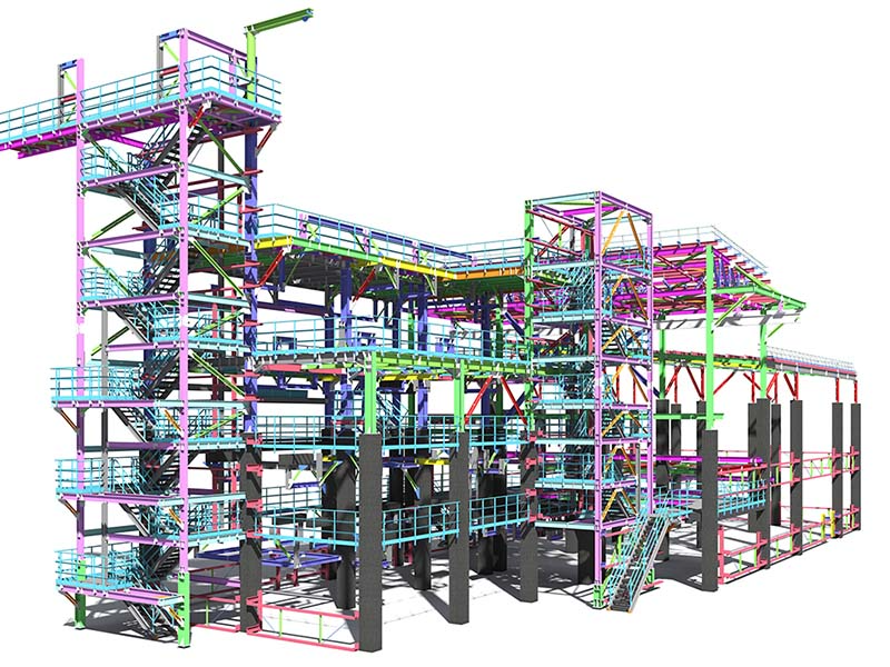
Here’s where things get interesting for anyone working in the UK construction industry today.
The conversation has moved on from simply talking about “BIM Level 2”. The UK Government’s 2016 mandate has evolved into something more comprehensive: the UK BIM Framework.
This framework incorporates and builds upon the standards for BIM Level 2, but crucially, it aligns them with new international standards- specifically the ISO 19650 series. It’s not just about using 3D models anymore; it’s about ensuring a standardised, high-quality approach to information management on projects of any size.
What this means for you:
- Consistent standards across all projects
- Better quality assurance
- International compatibility
- The new benchmark for best practice
At Terrain Surveys, our commitment to these standards is proven. We are accredited by bodies like The Survey Association, and we hold ISO 9001:2015 for quality management. This means our data and processes align perfectly with the UK BIM Framework, giving our clients confidence from day one.
What Does BIM Mean for You?
Let’s get specific. BIM isn’t just an abstract concept- it delivers real, tangible benefits. But those benefits vary depending on who you are and what you’re trying to achieve.
For Architects & Engineers
You’re the ones in the trenches, dealing with complex designs and tight deadlines.
BIM transforms your workflow. Early clash detection means you spot that conflict between the structural steel and the ventilation system long before it becomes a £50,000 problem on site. Improved coordination means fewer angry phone calls from contractors.
We undertake highly accurate surveys of the ‘as-is’ terrain and built environment. This data goes into the cloud. All subsequent work from stakeholders can plug into this.
For Property Developers
You’re juggling multiple stakeholders, tight margins, and ambitious timelines.
BIM gives you better cost certainty from day one. Reduced project risk means fewer sleepless nights. Faster delivery times mean quicker returns on investment. And a BIM-enabled building?
That’s a more marketable end product.
An accurate survey at the outset de-risks your entire investment. By understanding the existing site conditions perfectly with a detailed topographical survey and identifying any potential conflicts with a utility survey, you can budget more effectively and minimise unforeseen delays.
For Facilities Management Companies
You’re thinking beyond construction to the 50-year lifecycle of the building.
BIM provides you with the “golden thread” of information. The model becomes a digital twin- a complete user manual for the building. Need to know the specification of that air handling unit installed five years ago? It’s in the model.
The data we capture isn’t just for the construction phase. Our detailed Revit and BIM models provide the foundation for the operational lifecycle of the building, saving your clients money for years to come.
For Homeowners
You might think BIM is just for large commercial projects. Think again.
Even for a domestic project, starting with a professional survey is a necessary investment before commencing a plan for further development . Having the blueprint of every building detail in the cloud means the history of building changes and the current digital drawings are preserved forever. Ready to use whenever you need an up-to-date 2D or 3D model of the property i.e. extensions, selling, even redecorating.
Your First Step in the BIM Journey
BIM isn’t just another industry buzzword. It’s a smarter way of working that’s here to stay.
Whether you’re working on a £100 million commercial development or a £50,000 home extension, the principle remains the same: Always start with accurate, reliable data.
The quality of any BIM model is only as good as the initial data input. You can have the most sophisticated software and the most experienced team, but if your foundational data is wrong? Everything that follows is compromised.
A professional measured survey isn’t just advisable – it’s the non-negotiable first and last in any successful project.
If you want everyone working in sync from the same source of ‘truth’, the project needs to start off with a single accurate truth. And that’s exactly what we do. We provide you that truth for your BIM. We gather this accurate data using laser measured surveys for pinpoint accuracy before the architect draws his first line.
Similarly, once a project has been completed, to keep your BIM up-to-date, and to ensure nothing in the physical world has deviated from the digital plan, we recommend an “as-built” survey. This is achieved via another laser-measured building survey. If something has been built differently vs the plans, we can either update the BIM so it’s accurate, or you can use the findings to ask the builder to correct the deviation, bringing it back inline with the architect’s or engineer’s plan.
At Terrain Surveys, we’ve been committed to accuracy since 2004. We understand that our work is the foundation upon which successful projects are built. Every point cloud we capture, every measurement we take, every detail we record becomes part of your project’s DNA.
Whether you need a topographical survey for a new development, a measured building survey for a renovation, or a full Revit model for a complex BIM project, our team has the expertise and technology to deliver data you can trust.
If you’d like to discuss your project or get some free, professional advice on your survey requirements, our team is here to help. We’ll talk through your specific needs and provide a clear, competitive quote with no hidden surprises.
Don’t let inaccurate data undermine your project before it’s even begun.
Contact us today for a free, no-obligation quote and expert advice.

