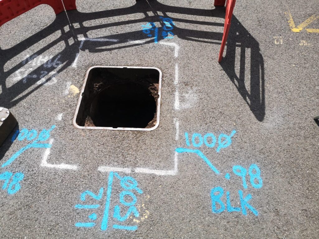
You wouldn’t build a house without checking what’s underground first, would you? Yet each year in the UK, tens of thousands of projects strike unknown pipes or cables — causing costly delays, safety incidents and major headaches. That’s where PAS128 comes in.
This guide will walk you through:
- What PAS128 is and why it was created
- The four survey types and six quality levels
- When and why PAS128 surveys are needed
- Benefits and limitations
- How to specify and commission one properly
- Expected costs and timescales
- How to choose the right surveyor
What Is PAS128?
PAS128 is the British standard for underground utility detection. Created by BSI with input from the Institution of Civil Engineers and industry experts, it was launched in 2014 and updated in 2022. It aims to introduce a structured, consistent method for mapping underground services.
It sets rigorous guidelines for:
- Detecting and verifying underground utilities
- Using both non-intrusive and intrusive techniques
- Standardising survey outputs
- Classifying data confidence through quality levels
Why it matters: Traditional methods (like old plans or assumptions) aren’t reliable. PAS128 imposes order, improving accuracy, consistency, and safety. With clear definitions of survey types and quality levels, project stakeholders can evaluate and manage underground risk more effectively.
Why PAS128 Matters
Risk Reduction
PAS128 significantly reduces the risk of hitting live utilities during excavation. This keeps people safer and avoids costly, dangerous incidents. Each year, utility strikes cost the UK construction industry an estimated £2.4 billion.
Legal & Insurance Implications
While not law, PAS128 is increasingly specified in contracts and insurance policies. It can reduce liability if something goes wrong and demonstrates due diligence and a commitment to safe practices.
Protecting Budgets and Timelines
By revealing underground risks early, PAS128 prevents expensive delays, rerouting, and redesigns. For public sector projects, using PAS128 can ensure compliance with procurement guidelines and align with CDM (Construction Design and Management) responsibilities.
PAS128 Survey Types
There are four types of survey (A-D), each offering different levels of confidence:
Type D (QL-D)
Records-only search. Involves gathering utility plans and documentation from owners. Low confidence. Good for early-stage feasibility.
Type C (QL-C)
Adds a visual site walkover to compare records with observed surface features. Medium-low confidence. Useful for identifying inconsistencies.
Type B (QL-B)
Geophysical detection using Ground Penetrating Radar (GPR) and Electromagnetic Locators (EML). Most common. Split into:
- B4: Assumed only
- B3: Detected, no depth
- B2: Detected, with depth (1 method)
- B1: Detected, with depth (2+ methods)
Type A (QL-A)
Visual verification via trial holes or manhole inspection. Highest certainty. Used on critical crossings, clash zones, or high-risk assets. Typically conducted selectively.
Most projects combine multiple types. Type D + C kick off desk-based studies, B provides detection, A verifies key locations. This integrated approach increases confidence in the final utility map.
When You Need a PAS128 Survey
Design Stage
Before finalising plans, use PAS128 to identify service clashes and inform layout. Many engineers require it at this stage.
Before Excavation
Digging without a survey risks strikes. PAS128 gives you a map to dig safely. Contractors can also use it to brief operatives.
Utility Upgrades
If modifying existing services, PAS128 clarifies what’s already there, reducing interference risk.
Complex Sites
Old or congested areas often have undocumented services. PAS128 identifies hidden risks. It is particularly valuable on brownfield sites, inner-city zones, or historically redeveloped land.
Local authorities, major contractors, and utility companies often require PAS128 by default, especially in framework agreements or pre-construction protocols.
How to Specify a PAS128 Survey
To get accurate, useful results, you need a proper brief:
Reference the Standard: Always request “PAS128:2022” compliance. The 2022 revision includes updates on reporting and new techniques.
Define Survey Type: E.g., “Type B detection, with D+C records and reconnaissance; Type A verification at 3 crossings.”
Specify Quality Levels: If high accuracy is needed, request QL-B1 for critical areas. Be explicit about confidence expectations.
State Deliverables:
These typically include the following:
- CAD (DWG)
- PDF map
- Utility report with findings and caveats
- Optional: GIS, BIM, or shapefiles
Share Site Info Early:
Provide:
- Topographic surveys
- Site boundaries
- Known hazards
- Any existing records
This helps quote accurately and tailor the methodology to the site’s specifics.
Techniques Used in PAS128 Surveys
Electromagnetic Locators (EML)
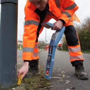
Detecting conductive services via applied signals. Includes passive and active tracing modes. Best on metal pipes, electric/telecoms cables. Limited on plastic.
Ground Penetrating Radar (GPR)
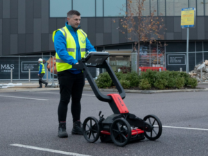
Sends radar pulses to detect both metallic and non-metallic objects. Provides depth info. Struggles in clay or near reinforced concrete. Modern systems use multi-channel arrays for wider coverage and enhanced data clarity.
Visual Inspections
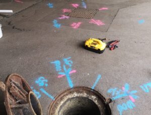
Manhole lifting and surface feature checks aid verification. Identifies pipe sizes, duct types, flow direction, and access limitations.
Trial Holes & Vacuum Excavation
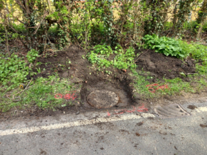
Physically exposes utilities for maximum certainty (Type A). Air excavation is safer and quicker on urban sites. Enables confirmation of utility type, material, and exact alignment.
Specialist Tools
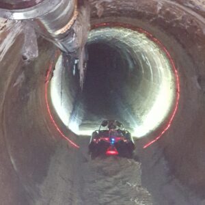
Depending on the site, surveyors might also use:
- Sondes and tracing wires
- CCTV drainage cameras
- Metal detectors for shallow assets
- Confined space equipment
Good surveys use a combination of tools for the clearest results. All methods used are documented in the final report.
How Accurate Is PAS128?
Each utility line gets a Quality Level (QL):
- QL-A: Verified visually. ±25mm accuracy.
- QL-B1: Detected via multiple methods. High confidence.
- QL-B2: Detected via one method. ±250mm typical.
- QL-B3: No depth info.
- QL-B4: Assumed only.
- QL-C/D: Based on records or site features only.
Limitations: Accuracy depends on:
- Utility type/depth
- Congestion
- Soil conditions
- Surveyor skill
Only Type A offers total certainty. If absolute precision is needed, expose the utility. For critical works like piling or directional drilling, Type A verification is often mandatory.
Deliverables to Expect
- Utility Maps: CAD and PDF files showing:
- Utility routes
- Depths and QLs
- Colour-coded services
- Symbology, metadata, and caveats
- Chamber and access locations
- Survey Report: Includes:
- Methodology
- Grid spacing
- Tools used
- Confidence breakdown
- Access constraints
- Recommendations for further work
- Optional Digital Formats: GIS, BIM, and 3D models if specified in advance. Includes georeferenced files and shapefiles suitable for integration into design systems.
- Conflict Drawings: Highlighting clashes between existing and proposed infrastructure. Useful for clash detection and rerouting.
- Post-Survey Support: Expect debriefs, clarifications, format conversions, and ongoing support. A good surveyor will help interpret findings and plan next steps.
PAS128 Survey Costs
Typical Ranges:
- Type D: £100–£500
- Type C: £200–£800
- Type B: £1,500–£10,000+
- Type A: £300–£2,000 per location
Most full projects (Type B + some A) fall between £2k–£5k. Urban or congested sites can cost more. Emergency work and weekend rates are higher.
Cost Drivers:
- Site size & access
- Quality level required
- Environmental hazards
- Deliverables (CAD only vs. GIS/BIM)
- Location (London surveyors may charge more due to higher overheads)
Timelines:
- Records search: 1–2 weeks
- Fieldwork: 1 day to 2 weeks
- Processing: 3–10 working days
Standard turnaround: 2–4 weeks. Rush jobs may be possible.
How to Choose a PAS128 Surveyor
1. Insist on Proven PAS128 Experience
Don’t settle for general “utility mapping” claims. Ask for:
- Specific examples of PAS128:2022-compliant projects like these
- Sample deliverables such as utility maps, reports, and conflict drawings
- References or testimonials from past clients such as these
2. Verify Professional Accreditations
A reputable surveyor should hold industry-recognised credentials. Look for:
- TSA membership (The Survey Association)
- ICES or RICS chartered status
- ISO 9001 certification for quality management
- CSCS-certified teams for on-site health and safety
- NVQ Level 3 in Utility Mapping or equivalent training
Note: Terrain Surveys have all of the above credentials.
3. Check Their Technology
PAS128 surveys rely heavily on cutting-edge tools. Confirm they use:
- Dual detection methods (Ground Penetrating Radar + Electromagnetic Locators)
- Modern GPR trolleys with multi-channel arrays
- Sonde and tracing equipment for non-metallic utilities
- Robust data processing software compatible with CAD, GIS, and BIM
4. Assess Communication and Support
Clear, proactive communication reduces delays and confusion. Ensure your surveyor offers:
- A named point of contact throughout the project
- Timely responses to queries and deliverables
- Willingness to provide walk-throughs, format conversions, and post-survey advice
5. Ask for Case Studies & Insurance
A confident, reliable surveyor will be happy to share:
- Relevant case studies aligned with your project scope or sector
- Details of Professional Indemnity (PI) insurance, including policy limits
Tip: Be wary of unusually low quotes — they often signal corner-cutting or lack of PAS128 compliance. A subpar survey can cost significantly more in rework, redesign, and risk exposure.
Terrain Surveys: Experts in PAS128 Utility Surveys
At Terrain Surveys, we deliver fully compliant PAS128 utility surveys across the UK — from garden plots to complex city-centre infrastructure.
Our experienced team combines cutting-edge equipment, deep technical expertise, and a proven track record to provide accurate, reliable, and cost-effective underground mapping.
We are proud to be TSA members, hold Constructionline Gold certification, and operate with CSCS-certified survey teams. Our qualified professionals use GPR, EML, duct rods, and vacuum excavation tools, delivering results that meet the highest standards in safety, clarity, and compliance.
Whether you’re specifying a PAS128 survey for the first time or need support on a high-risk or congested site, we’re here to guide you every step of the way — from consultation to final deliverables.
Our Proven PAS128 Survey Workflow
1. Free Consultation
We help you define the right survey type for your site, explain PAS128 quality levels, and clarify what’s needed — whether you’re a contractor, developer, or private landowner.
2. Fast, Transparent Quotes
You’ll receive a fully detailed quote within 48 hours. We break down deliverables, grid density, survey methods, access constraints, and timescales — so you know exactly what you’re getting and why.
3. Certified Teams & Advanced Equipment
Our surveyors are highly trained and operate UK-wide using GPR, EML, sonde tracing, and PPE-compliant field practices. We work from multiple regional hubs for maximum responsiveness.
4. Combined Topo & Utility Mapping
Need both topographical and PAS128 utility data? We integrate them seamlessly, ensuring alignment and helping reduce planning errors and additional site visits.
5. In-House Quality Checks
Every drawing, report, and annotation goes through internal verification to ensure consistency, accuracy, and compliance with PAS128:2022 standards.
6. Ongoing Post-Delivery Support
We don’t just hand over the files — we provide walk-throughs, format changes (e.g. CAD, PDF, GIS), and expert advice if further clarification or adjustments are needed.
7. Trusted Experience Across Sectors
From local authorities to national infrastructure providers, we’ve mapped it all. Our portfolio includes city centres, industrial estates, brownfield sites, and more.
Get in Touch for a PAS128 Survey
Need a PAS128 utility survey for your site? Let’s make sure you get it right — the first time.
Contact us today for a free, no-obligation consultation. We’ll help you understand:
- What survey type and quality level you need
- What deliverables to expect
- How to scope the work efficiently
