Understanding what lies beneath the surface is critical before any excavation begins. PAS128—the British standard for underground utility detection—was created to bring consistency and reliability to this essential process.
In this article, we’ll break down the four PAS128 Quality Levels, explain what each involves, when they should be used, and how they impact project risk, cost, and safety.
Why PAS128 Matters
Before PAS128, utility surveys were largely unregulated, with survey quality and methods varying widely from one contractor to another. The introduction of this standard has changed that, offering a structured approach that enables everyone involved in a project to speak the same technical language.
PAS128 provides a framework that:
- Reduces the risk of service strikes
- Improves health and safety on site
- Saves time and money during both design and construction phases
It’s not just about meeting standards—it’s about generating consistent, dependable data that project stakeholders can trust.
Applications of PAS128 Surveys
PAS128 isn’t just for major motorways or massive new builds.
It’s used across a wide variety of project types, including:
- Urban redevelopment and infrastructure upgrades
- Road and rail schemes
- Utilities planning and coordination
- Pre-construction surveys
- Asset management programmes
Wherever utilities are buried—and accuracy is important—PAS128 is relevant.
And with utility congestion increasing in towns and cities, knowing where things are is more critical than ever.
Pro Tip: If your project involves excavation or design near existing infrastructure, ask for a PAS128-compliant survey from day one. It could prevent massive headaches down the line.
Overview of the PAS128 Quality Levels

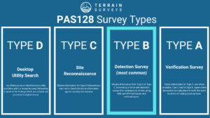
PAS128 sets out four distinct Quality Levels (QLs), and each one represents a different stage of investigation—with varying degrees of confidence and data reliability.
Here’s a quick side-by-side snapshot to help you get your bearings:
| Quality Level | Description | Methodology | Data Confidence |
| QL-D | Basic records search | No site work | Lowest confidence |
| QL-C | Visual site reconnaissance | Inspection of visible features | Low to medium confidence |
| QL-B | Detection survey using technology | GPR, EML and other geophysical methods | Medium to high confidence |
| QL-A | Verification through excavation | Direct physical exposure (e.g. trial pits) | Highest confidence |
Each level builds upon the one before it. In other words:
- QL-C includes everything in QL-D, plus some basic validation on site.
- QL-B includes QL-C data, plus active detection techniques.
- QL-A tops it all off by physically verifying what’s underground.
In the next few sections, we’ll take a deeper look at each level—starting with QL-D.
PAS128 Quality Level D (QL-D): Desktop Records Search
What It Involves
QL-D is the starting point for any PAS128 utility survey.
At this stage, there’s no fieldwork. Everything is desk-based. It involves collecting and reviewing existing statutory utility records from network operators, local authorities, and any historic data available.
You’re essentially building a picture of the underground landscape using paper trails rather than physical evidence.
Typical sources include:
- Statutory undertakers’ plans (e.g. gas, electric, telecoms, water)
- Previous survey reports (if available)
- Historic OS data
- Site plans and records from asset owners
It’s quick, cost-effective, and provides an initial overview of what might be lurking underground.
But the big caveat is it’s not verified. You’re relying on third-party records, which may be:
- Out of date
- Incomplete
- Mismatched to current site conditions
That’s why QL-D has the lowest confidence rating of all four levels.
When to Use QL-D
Despite its limitations, QL-D is ideal for:
- Early design stages, when you need general awareness of utility presence
- Feasibility studies or site appraisals
- Budget forecasting and preliminary risk assessments
- Supporting pre-application planning submissions
You wouldn’t rely on QL-D alone to start digging or planning major works, but it’s a solid, low-cost way to scope out potential utility risk zones.
Limitations
Let’s be clear: QL-D should never be used as the sole basis for excavation or construction.
Its main limitations are:
- No on-site validation i.e. there’s no confirmation that utilities exist where records say they do
- No depth information
- No insight into undocumented or private services
- High potential for omissions or positional errors
In other words: treat QL-D as a first glance, not gospel.
PAS128 Quality Level C (QL-C): Site Reconnaissance
What It Involves
QL-C builds on QL-D by adding a physical site visit.
The goal here? To visually inspect and correlate what’s shown on the utility records (QL-D) with what’s visible on the ground.
Our surveyors will walk the site looking for:
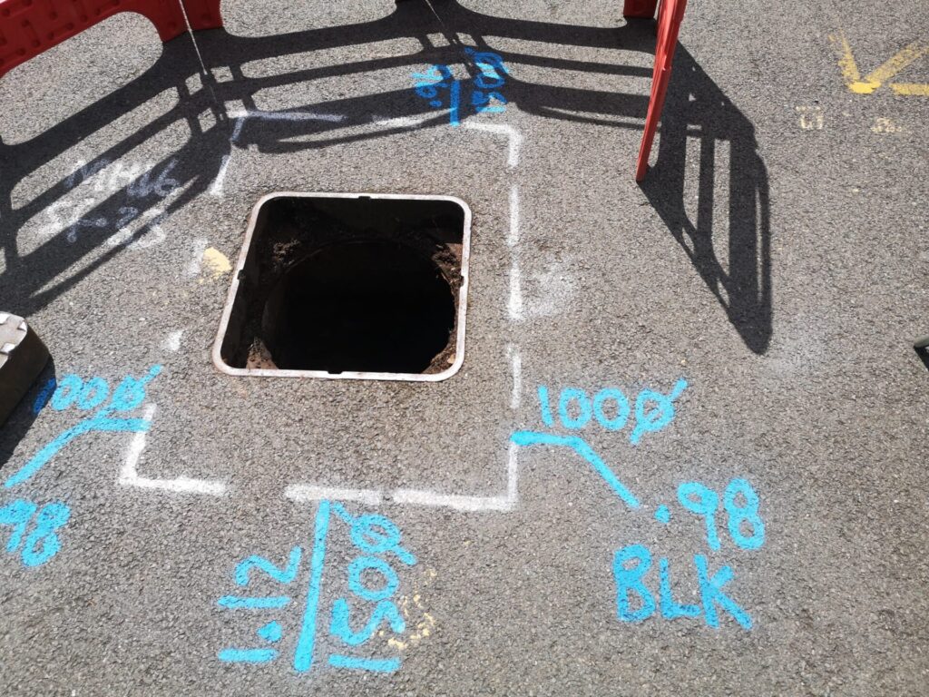
- Inspection chambers and manhole covers
- Valve covers and hydrants
- Service markers and utility poles
- Surface evidence of ducting or cabling
- Changes in kerbs, paving, or road surfaces that hint at underlying infrastructure
It’s a simple but valuable layer of reality check, making sure what’s on the drawings is at least partly reflected in the field.
We often take photographs, annotate findings on plans, and record areas of uncertainty for deeper investigation.
When to Use QL-C
QL-C is commonly used during:
- Early planning and design when you need some degree of confirmation on the underground infrastructure.
- Due diligence for development feasibility
- Preliminary works where visual validation is helpful
It’s particularly handy on open or less cluttered sites, where surface features are easily accessible.
In many cases, clients pair QL-C with QL-D to refine the utility picture before moving to full detection (QL-B).
Limitations
QL-C still doesn’t scratch beneath the surface, so the confidence level remains limited.
Main limitations include:
- No subsurface confirmation (no depth or material info)
- Heavily built-up or urban areas may obscure features
- Some utilities (like fibre optics or plastic gas pipes) might have zero surface evidence
It’s also worth noting: if the QL-D records are poor, QL-C won’t offer much improvement on its own.
So while QL-C adds value, it’s not a substitute for detection or verification. Think of it as a low-cost upgrade. Useful, but with clear constraints.
PAS128 Quality Level B (QL-B): Detection Survey

Now we’re getting into the real meat of a PAS128 survey.
What It Involves
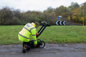
QL-B is where active detection comes in. This is the first level that uses technology to actually locate buried services on site.
Our surveyors use a mix of geophysical techniques to detect underground utilities without digging. The main tools?
- Electromagnetic Locators (EML): Ideal for locating metallic services like electric, telecoms, and water pipes.
- Ground Penetrating Radar (GPR): Used to detect non-metallic utilities, like plastic gas pipes or fibre optics.
- Radio frequency (RF) signal induction and tracing sondes for non-conductive materials.
Depending on the survey strategy, the detection is done using either a grid or linear approach—defined by the PAS128 methodologies M1 to M4:
- M1: Reconnaissance grid
- M2: Full grid (25cm to 1m spacing)
- M3: Line trace of known services
- M4: Combination of line and grid as required
Every detection survey also includes a clear method statement outlining equipment, methodology, environmental limitations, and levels of detection confidence.
When to Use QL-B
QL-B is the most widely used quality level for:
- Detailed design and construction planning
- Pre-excavation assessments
- Drainage design and foundation positioning
- Infrastructure maintenance and upgrades
- Health and safety risk mitigation
It’s the go-to level when you need reasonably accurate, project-ready data but want to avoid intrusive work.
Data Confidence & Influencing Factors
The confidence in QL-B results can be very high, but it depends on a few critical factors:
- Survey environment: Congested urban settings or reinforced concrete may limit GPR effectiveness.
- Surface conditions: Overgrown vegetation, cobbles, or wet tarmac can affect detection accuracy.
- Utility type: Plastic pipes or defunct services are harder to pick up without traceable components.
PAS128 also introduces classification codes within QL-B:
- B1 = Highest confidence
- B2 = High
- B3 = Medium
- B4 = Low
These are based on positional accuracy, depth estimation, and survey coverage. They help clients understand the reliability of each individual utility trace.
Importance of a Method Statement
PAS128 mandates that every QL-B survey is accompanied by a detailed method statement.
It should cover:
- Equipment used
- Detection techniques employed
- Grid spacing and survey approach (M1–M4)
- Environmental limitations
- Any inaccessible areas
- Confidence ratings applied to each service
Without this, a QL-B survey isn’t compliant, and frankly, it won’t give you the assurance you need to build safely.
PAS128 Quality Level A (QL-A): Verification Survey

QL-A is the gold standard in underground utility data.
Why? Because it doesn’t just detect, it confirms.
What It Involves
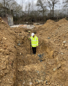
Quality Level A involves physically exposing utilities to verify:
- Horizontal position
- Vertical depth
- Size, type, and material
- Service condition (where visible)
This is done via excavation, either:
- Hand-dug trial pits
- Vacuum excavation (non-destructive and often preferred in urban areas)
Once the service is exposed, it’s measured, photographed, logged, and marked up directly onto the survey plan.
A competent utility survey provider should follow strict protocols for QL-A works, including:
- Safe digging practices (HSG47 compliance)
- Traffic management plans if near highways
- CSCS-qualified utility surveyors on site
- Coordination with utility owners for sensitive networks
When to Use QL-A
QL-A is used when you need absolute certainty, either to protect critical infrastructure or to verify what QL-B couldn’t confirm.
Examples include:
- High-risk digs (e.g. near high-pressure gas mains or fibre-optics)
- S75 agreements with utility companies
- Major infrastructure foundation works
- Dispute resolution over utility placement
It’s also used as a validation tool, double-checking the accuracy of QL-B results before construction begins.
Highest Confidence Level
By definition, QL-A offers the highest confidence level available in a PAS128 survey.
But that confidence comes at a cost.
It’s:
- Time-intensive
- More expensive than detection-only surveys
- Requires permits and H&S documentation
- Can disrupt traffic or access
That’s why QL-A is typically targeted, not blanket. You only verify what truly matters.
Often, a project will start at QL-D and progressively build confidence—moving to QL-C, then QL-B, and finally using QL-A in critical zones.
This tiered approach gives you the best balance of risk management vs cost.
How to Choose the Right PAS128 Quality Level for Your Project
Let’s be honest—most projects aren’t going to commission a full QL-A survey across the entire site. Nor should they.
So, how do you know which PAS128 quality level is appropriate?
Key Considerations
Here are the main factors to weigh up:
Project Phase
- Feasibility or concept design? QL-D or QL-C may suffice.
- Detailed design or pre-construction? You’ll need QL-B or QL-A.
Site Complexity
- Sites in dense city centres, near hospitals, or with ageing infrastructure require a more robust level—QL-B minimum, QL-A in some zones.
Known Risks
- Historical service strikes, congested utility corridors, or unknown records? Prioritise QL-B and verification in key zones.
Legal or Contractual Obligations
- Certain clients (e.g. Network Rail, HS2) mandate PAS128-compliant surveys at specific levels.
Budget and Time Constraints
- QL-D is cheapest, QL-A is costliest. The sweet spot for most projects is a mix of QL-B with selective QL-A where risk demands it.
Think of the PAS128 levels like a toolbox—not every job needs every tool. But knowing which one to reach for (and when) is where the value lies.
Best Practice Approach
The smart way to apply PAS128? Take a layered approach.
Here’s a common workflow we recommend at Terrain Surveys:
- Start with QL-D: Desktop records search to get your bearings.
- Upgrade to QL-C: Add a site reconnaissance to correlate records with visible features.
- Commission QL-B: Conduct a detection survey in areas where subsurface confidence is needed for design or excavation.
- Use QL-A selectively: Where risk, value, or uncertainty is high, carry out trial holes or vacuum excavation.
And always—always—work with surveyors who understand the nuances of each level, and who are PAS128-compliant in both method and deliverables.
How Terrain Surveys Ensures PAS128 Compliance
At Terrain Surveys, we don’t just tick PAS128 boxes—we live and breathe it.
Every underground utility survey we carry out is approached with one goal: to deliver accurate, actionable, and compliant data that supports safer, smarter decisions on site.
Here’s how we do it.
Our Capabilities
We’ve built our utility survey division around the PAS128 framework. That means:
- End-to-end compliance – from QL-D desktop studies through to full QL-A verification.
- Multidisciplinary teams – trained in electromagnetic detection, Ground Penetrating Radar (GPR), and vacuum excavation.
- In-house delivery – no outsourcing; everything is handled by our trained team, ensuring quality and consistency.
- Detailed deliverables – including annotated CAD drawings, confidence codes, method statements, and photo logs.
We follow all four PAS128 methodologies (M1–M4), and adapt our grid spacing, equipment, and strategy based on:
- Site constraints
- Utility type
- Ground conditions
- Client requirements
Benefits of Working with Us
What makes us stand out?
- Transparent pricing – We quote based on the PAS128 level required. No hidden costs.
- Rapid mobilisation – Multiple regional offices mean we can be on-site fast, anywhere in the UK.
- Flexible delivery – We work around live sites, client teams, and programme constraints.
- Expert advice – You won’t just get a drawing. You’ll get a consultative service, highlighting risks, limitations, and next steps.
We’re trusted by developers, architects, and engineers across the country because we don’t just comply—we help our clients understand what the data means and how to act on it.
Trust the Experts for Your Utility Survey
PAS128 isn’t just another industry acronym—it’s a powerful framework for reducing risk, protecting lives, and improving project outcomes.
But the real value lies in how you apply it.
Whether you’re planning a residential development, highway upgrade, or commercial build, choosing the right PAS128 Quality Level will make the difference between a confident, efficient dig… or a costly, chaotic one.
At Terrain Surveys, we’ve got the tools, the team, and the track record to deliver utility surveys that are accurate, reliable, and 100% PAS128-compliant.
So if you’re looking for a partner that understands the challenges underfoot—and how to overcome them—get in touch.
Let’s take the guesswork out of your groundworks.
