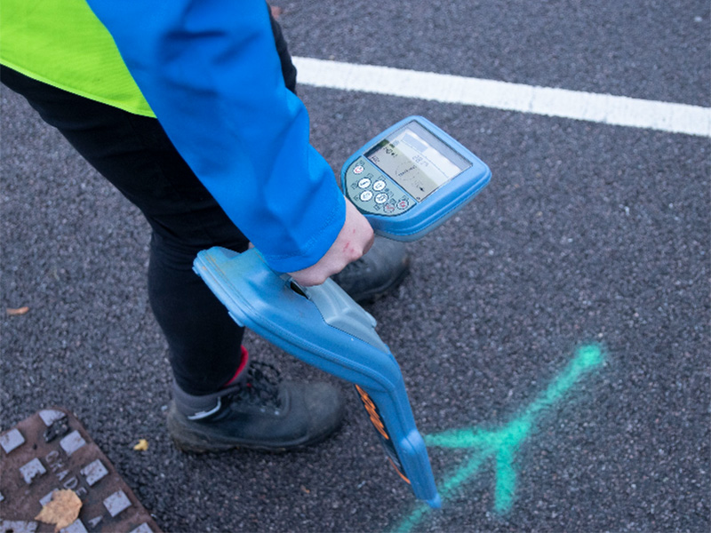
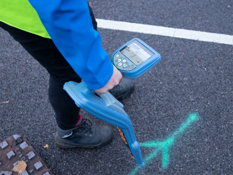
Underground utility surveys play a role of crucial importance when it comes to development and construction projects by providing accurate location details of all buried services such as sewers, water pipes, gas pipes, electricity cables and communication cables. Utility surveys can prevent project delays by having all existing site information necessary to progress your project and help to reduce costs by avoiding damaging and dangerous strikes on third party assets.
What Are Utility Surveys for?
The purpose of the survey is to identify and locate the various buried utility services and subsurface infrastructure for the planning, design, construction phases of your project. The collection of this data is crucial to anyone that wants to excavate, keeping site personnel safe and avoids costly incidents and repairs caused by damaging buried infrastructure.
A utility survey should ideally be carried out at or before the planning stage of a project as the results of the survey will help to identify any hazards on the site. If a survey is carried out at this time and costs can be saved by having all relevant vital information which could cause delays further into the project.
How does GPR and EML Work?
Utility surveys are carried out using Ground Penetrating Radar(GPR) and Electromagnetic Location(EML).
GPR is a piece of geophysical equipment that works by transmitting high-frequency radio waves through the ground as a series of pulses, and upon coming across any change in the subsurface material the pulses are reflected back to the surface where they are recorded. Together with the time taken for the signal to travel to the subsurface object and return also allows the depth of the service to be recorded.
EML is used to detect and locate buried metallic services. EML works by generating a magnetic field from the transmitter which induces an electric current in any metallic object within range. From the current a second magnetic field is generated, which is detected by the receiver on the surface. The detected signal is then processed to locate the size and depth of the buried object.
Benefits of and Limitations of Utility Survey Equipment
GPR and EML are both quick and efficient survey methods and are non-intrusive, negating the requirement to excavate and potentially cause damage or injury.
In some instances these survey methods may struggle to penetrate certain ground conditions. This can affect the reliability of results, either by failing to identify subsurface objects or by providing inaccurate results.
Due to the individual limitations that GPR and EML each have, it is necessary for EML to be used alongside GPR in order to provide a full comprehensive survey showing as much information about the subsurface conditions as possible.
Utility Surveys and Topographical Surveys
It is important to have an up-to-date topographical survey in CAD format as it helps utility survey teams to identify and record their survey findings accurately and digitally. An accurate site plan is required to present the utility survey results onto, to produce a comprehensive site plan showing all surface and subsurface features and services.
If an existing topographical survey does not for your site, it is recommended that one is carried out before commissioning a utility survey.
Our Team
At Terrain Surveys, we are dedicated to delivering services that aid our clients in making well-informed and safe decisions to do with their project. We take pride in always operating with integrity and honesty, which means keeping communication at the heart of everything that we do. By remaining transparent, our clients are assured that their trust is in reliable hands. Our team of experts are always at hand if you are considering having a utility survey carried out to make your development site as safe as possible for your dedicated team of workers and yourself.
To get in touch you can find our contact details on our contact page. Alternatively, fill out a contact form and a member of team will get back to you on your enquiry shortly.

