PAS128 Surveys
A PAS 128 survey gives you a reliable, standardised map of all buried utilities — helping you avoid costly strikes, delays, and redesigns. It's the gold standard for underground utility detection.
A PAS 128 survey is the British Standard for mapping underground utilities. It sets out a clear, consistent methodology for detecting, verifying, and locating buried services like water pipes, gas mains, electric cables, and telecom ducts.
Every year, utility strikes cause thousands of injuries, site shutdowns, and legal disputes across the UK. A PAS 128 survey helps prevent all that by making sure you’ve got accurate information before excavation begins.
Whether you’re planning a new development, extending a building, or digging for infrastructure, PAS 128 ensures your designs avoid hidden hazards and stay compliant with health and safety regulations.
- Avoid utility strikes – Prevent accidental damage to gas, electric, water and telecoms that could injure workers or shut down your site.
- Stay compliant – Meet legal duties under HSG47 and satisfy planning or build-over requirements with a recognised industry standard.
- Reduce delays and costs – Spot potential conflicts early and avoid costly design changes, emergency repairs or service outages.
- Demonstrate due diligence – Show clients, insurers and regulators that you’ve taken every reasonable step to locate buried services.
Get a free quote
Request a free, no-obligation quote for your project today.
- Desktop review of existing utility records
- On-site detection using EML and GPR
- Manhole lifting, sondes, and verification where needed
- Confidence ratings (Quality Levels A–D) clearly shown
- Accurate CAD drawings with utility positions and depths
- Clear report highlighting risks and unknowns

What’s Included in a PAS 128 Survey?
What’s included in your PAS128 Survey depends on the survey type you choose:
TYPE OF PAS128 SURVEY
Below you'll see the four levels of Pas128 that you can choose from.
Type D - Desktop utility record search
Type D is the starting point. It involves gathering and reviewing existing utility plans and records to give a rough idea of what services might be underground. It’s useful for early planning but comes with low confidence.
Best for feasibility studies and early-stage concept design.
Type C - Site Reconnaissance
Type C adds a visual check on site to compare the records from Level D against physical features like manholes, inspection covers, or street furniture. It improves confidence slightly but doesn’t involve any service detection.
Typically used before more detailed surveys to identify visible service clues.
Type B - Detection
Type B uses on-site survey techniques like electromagnetic location (EML) and ground penetrating radar (GPR) to locate and map underground utilities. It’s non-intrusive and delivers accurate results — this is the most commonly requested level.
Essential for design, coordination, and pre-construction planning.
Type A - Verification
Type A provides the highest confidence by physically exposing the utility (e.g. trial pits or vacuum excavation) to confirm its exact position and depth. It’s usually only needed for critical or high-risk areas.
Required where absolute accuracy is needed — for example, before piling or deep excavation near key services.
Planning a building project?
A PAS 128 survey isn’t just best practice — it’s often essential. UK health & safety guidance (HSG47) makes it clear: you must locate buried services before digging. And if you’re building near public sewers, most water companies require a PAS 128-compliant survey as part of their build-over approval.
Get In Touch- Before digging, trenching, or piling — to avoid striking buried services
- When planning new developments, extensions, or infrastructure upgrades
- For build-over agreements or sewer connection approvals
- During design stages — to coordinate with existing utilities
- On brownfield or undocumented sites with unknown underground risks
- To meet health and safety obligations (e.g. HSG47 compliance)
- For accurate tendering, risk assessment, and cost planning

When Do You Need a PAS 128 Survey?
- Detailed CAD drawings showing utility locations, depths, and types
- Confidence levels (Quality Levels A–D) clearly marked for every service
- Top-down views to help visualise positions relative to your design
- Colour-coded plans following industry-standard symbology
- Concise utility report outlining key findings, risks, and recommendations
- Optional 3D or BIM models to integrate with your project workflow
- Follow-up advice from a senior surveyor if you need help interpreting results.

What we'll Deliver
Our Technology
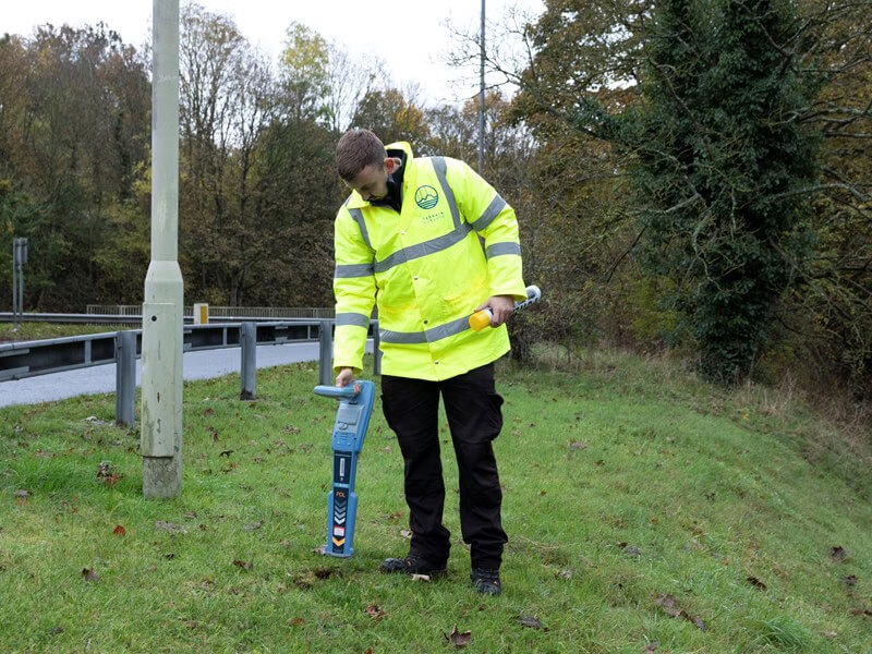
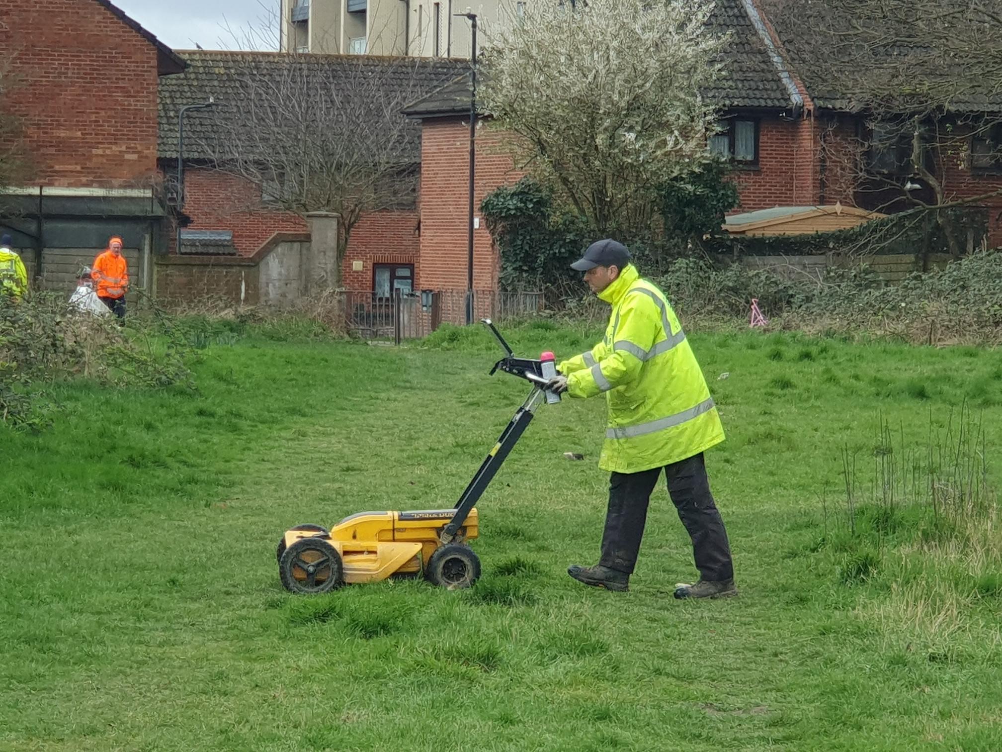
To get a clear idea of what's beneath the surface, we deploy cutting-edge technologies such as EML and GPR to do a type of ultrasound of the ground. Used together, they give a fuller picture of what’s underground and increase the reliability of the survey.

EML (Electromagnetic Location)
EML is excellent for tracing metallic pipes and live cables. We also use sondes to trace non-metallic drains when access is available.

GPR (Ground Penetrating Radar)
GPR detects both metallic and non-metallic utilities — including plastic pipes and ducts, and it helps estimate depth.
Accreditations


6 key reasons to choose Terrain Surveys
Why us
Experienced
Established in 2004 by three founding directors determined to improve surveying standards, Terrain Surveys Ltd was created with a commitment to excellence.Highly rated
Terrain Surveys strives to be the survey company of choice through a wide scope of knowledge and a constant drive for excellence. We pride ourselves on the quality of service provided, including customer service, survey deliverables, training, education, and the systems we operate.Focus on sustainability
As a leading provider of measured survey services, Terrain Surveys understands the critical role our work plays in shaping the built environment. We are committed to integrating sustainable practices into every aspect of our operations.Qualified and accredited
Terrain Surveys Ltd holds the ISO 9001:2015 accreditation, reflecting our commitment to quality management systems and consistent service delivery. Additionally, our team includes professionals with various industry-specific qualifications and certifications, such as membership in the Royal Institution of Chartered Surveyors (RICS) and the Chartered Institution of Civil Engineering Surveyors (CICES).Diverse and growing team
Our strength lies in our team, whose experience and knowledge, coupled with investment in training and technology, enable efficient work and the production of high-quality, accurate measured surveys that meet clients' strict deadlines.Nationwide coverage
Terrain Surveys provides comprehensive national coverage across the UK, ensuring clients receive consistent, high-quality surveying services wherever they are. With strategically located offices, the company is well-positioned to deliver efficient and tailored solutions to meet a variety of client needs.
Our work
From our main offices in Hertfordshire and Birmingham, we've carried out thousands of PAS128 surveys across the UK, including in popular areas such as London, Manchester, Yorkshire, and many others. Browse our project case studies below or get in touch with our team to discover how we can help you.
 Read more3 min read
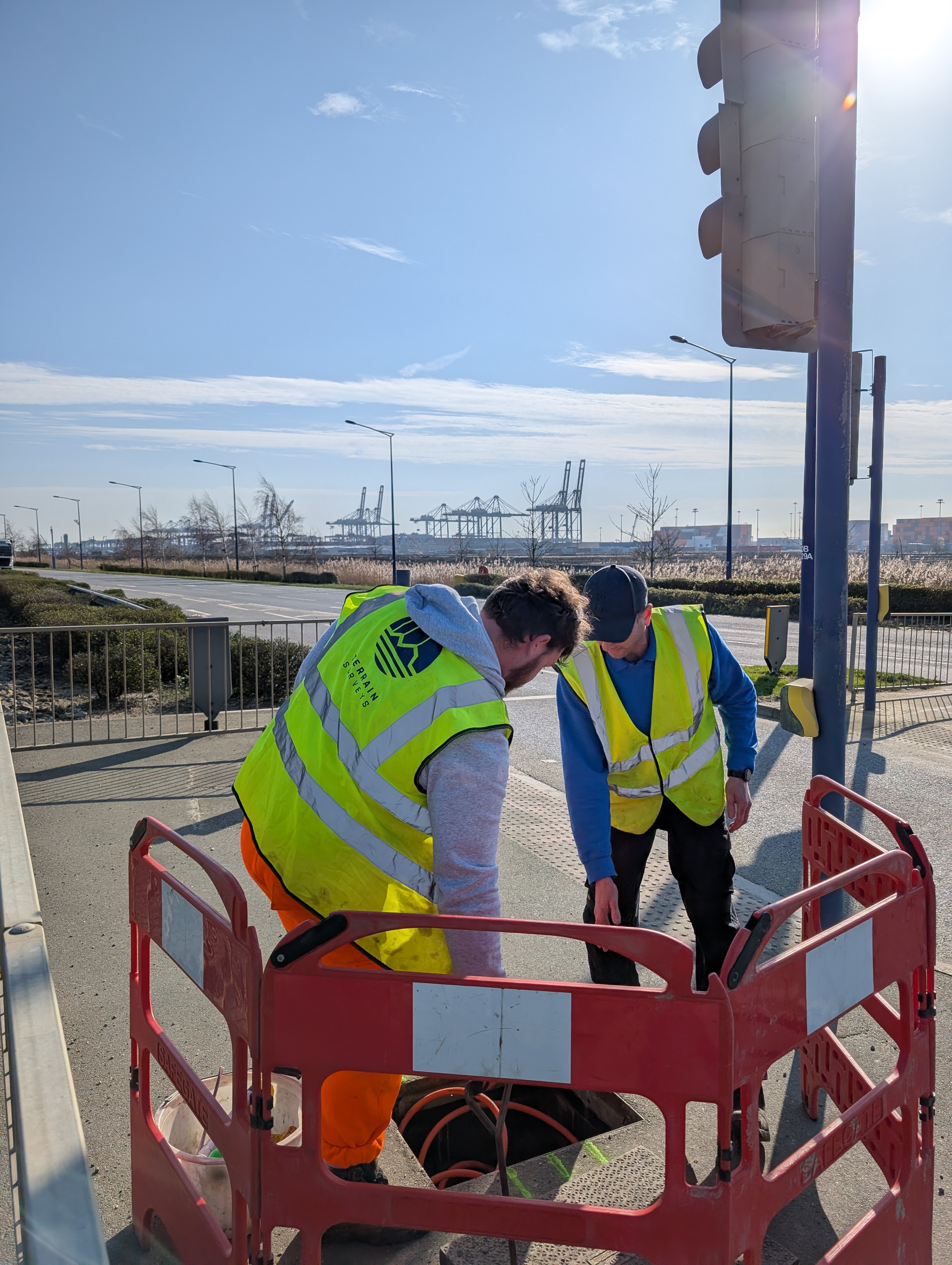
A PAS128 Survey at – London Gateway Port
Terrain Surveys carried out a PAS128 utility survey across a 50,000m² junction, using EML and GPR to support the design of a…
 Read more2 min read
A Complete Site Picture of Neasden Recreation Ground
Integrated topographical and utility surveys of Neasden Recreation Ground.
 Read more2 min read
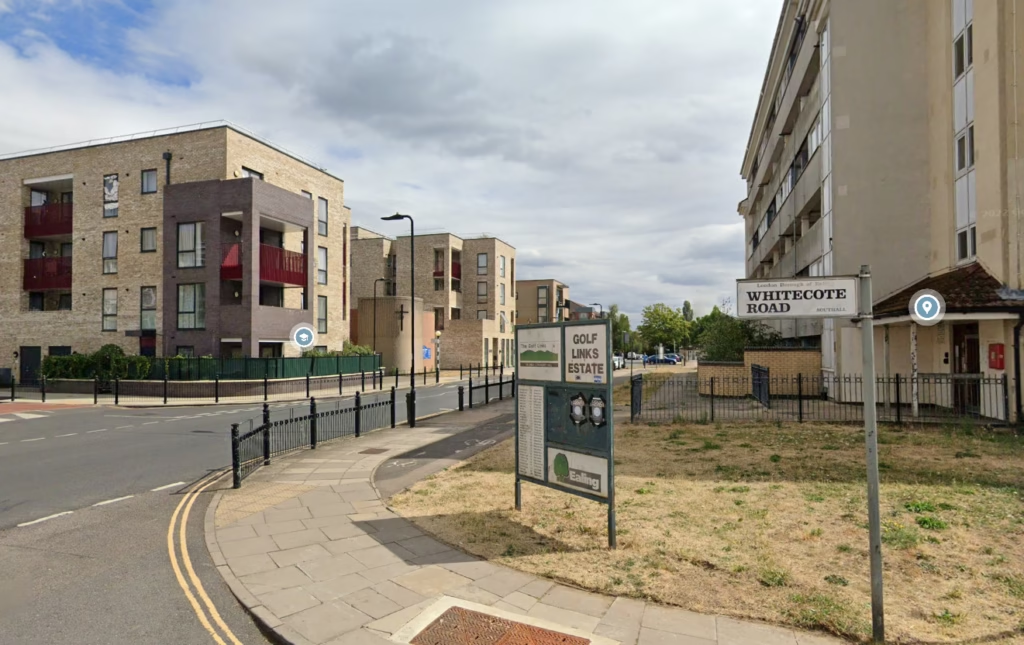
PAS 128 at Golf Links Estate
We carried out a comprehensive PAS128 utility survey, mapping existing infrastructure across the entire estate


What customers say about Terrain Surveys
Reviews


We'd love to hear from you
Get a free quote ONLINE OR CALL
+44(0)143 884 1300Request a free, no-obligation quote for your project today.