Overview
Located in North West London, Neasden Recreation Ground is a well-used public green space within the London Borough of Brent, positioned alongside the scenic Welsh Harp Reservoir (Brent Reservoir). The reservoir is one of London’s most significant open water spaces and a designated Site of Special Scientific Interest (SSSI), valued for both its ecological importance and recreational use.
The recreation ground itself forms an important part of the local community, providing open parkland, walking routes, and access to the reservoir’s wider landscape. As part of ongoing public realm improvements in the area, plans were developed to enhance accessibility, infrastructure, and the overall usability of the space—creating a more pedestrian-friendly and inclusive environment for residents and visitors.
To support the design and planning of these works, Terrain Surveys were commissioned to provide a comprehensive understanding of the site, both above and below ground.
Survey
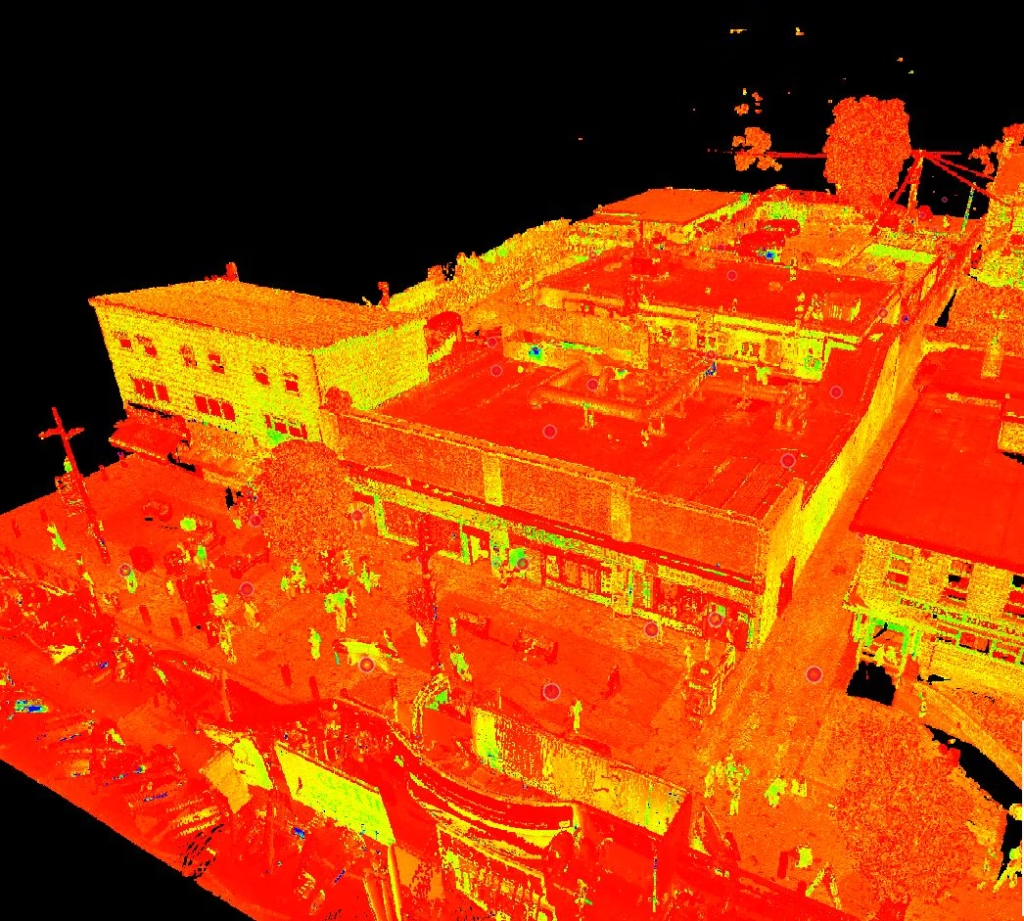
Terrain Surveys carried out a full Topographical Survey of the recreation ground, capturing the key features of the open green space, pathways, boundaries, and surrounding infrastructure.
Given the scale and open nature of the site, our survey team utilised a combination of Total Station and GNSS technology, allowing for efficient and accurate data capture across the parkland while reducing time required on site.
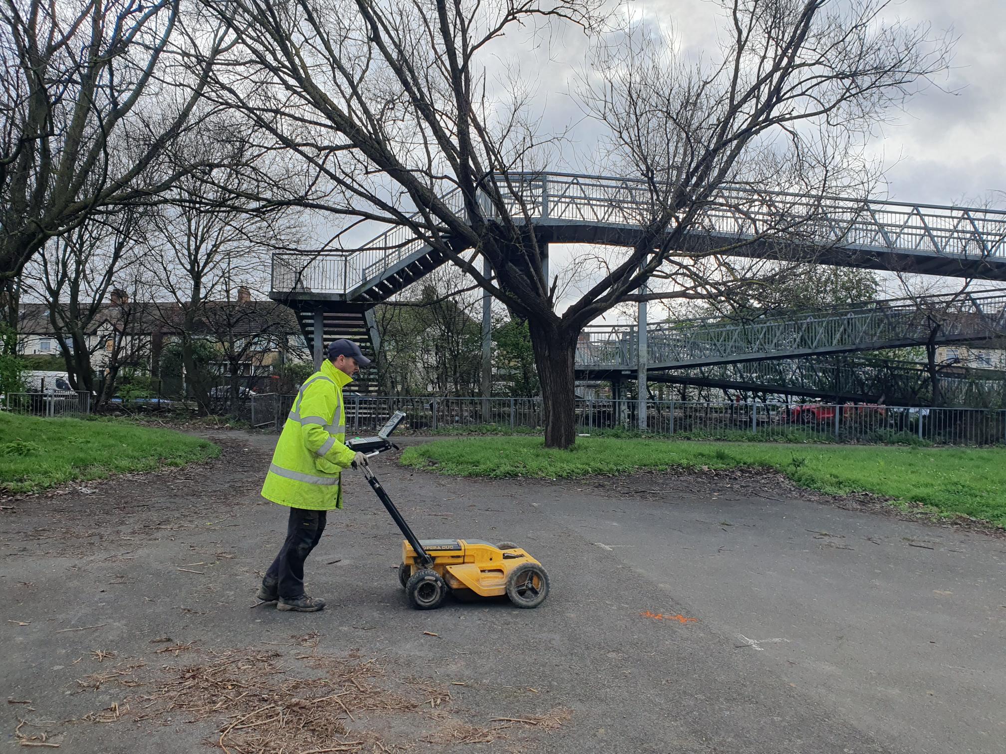
In addition to the topographical works, we undertook a PAS128 M2 Utility Survey, providing a detailed mapping of underground services to complement the above-ground data. This ensured the client received a complete and coordinated dataset, critical for design development and risk mitigation.
Working to a tight programme, Terrain Surveys were able to mobilise quickly and attend site at short notice, completing all survey works across a 6-day period.
Results
The combined topographical and utility surveys provided the client with a fully integrated view of the site, enabling informed decision-making for the planned public realm improvements.
Our deliverables included accurate, design-ready drawings that:
• Supported the enhancement of pedestrian routes and accessibility
• Identified and mapped underground utilities to reduce project risk
• Provided a reliable foundation for design and planning works
By delivering both surveys in a coordinated manner, Terrain Surveys helped streamline the project, reducing the need for multiple contractors and ensuring consistency across all datasets.
Despite the short lead-in time and programme constraints, we successfully completed the project within the required timeframe and budget, helping to keep the wider scheme on track.