Let’s get this straight:
If you’ve had a CCTV drainage survey done (or you’re planning one), the report you get at the end isn’t just a formality. It’s the whole point. No matter how fancy the camera system or how thorough the inspection, if the report’s vague, missing key details, or hard to understand, it’s basically useless.
So, in this article, I’ll walk you through exactly what a proper CCTV drainage survey report should include, and how to use it to save money, avoid risk, and make smart decisions.
Let’s dive in.
What Is a CCTV Drainage Survey Report?
Definition and Purpose
A CCTV drainage survey report is a structured technical document. It’s created after inspecting your underground drainage system using a remote-controlled camera mounted on either a push-rod, or a robotic crawler.
Think of it as a health check for your pipes. It tells you:
- What condition your drainage system is in
- Where faults exist (if any)
- What needs doing to fix them
It’s typically used for:
- Property purchases (to spot hidden drainage issues)
- Insurance claims (evidence of insured defects)
- Construction works (like build-over approvals or quality assurance)
- Ongoing maintenance planning
Here’s who typically commissions these reports:
- Homebuyers and home owners: to check drains before buying or to identify the location of a blockage
- Developers and builders: for pre/post-construction condition surveys
- Letting agents and landlords: to avoid costly tenant complaints
- Commercial property managers: for planned maintenance, asset records or troubleshooting problems
- Insurance claimants: to back up drainage-related claims where the insurer should cover the costs
Even if you’re not required to get one, if you’re buying property or dealing with recurring drainage issues, a CCTV drainage survey is a good idea.
Pro tip: A quality report can reveal issues you can’t see, but that could cost you thousands later if left unchecked to get even worse.
What’s Included in a CCTV Drainage Survey Report?
Core Components of the Report
Here’s what a proper, professional drain survey report should contain:
- Drainage layout: A clear map of the underground system – sometimes in CAD, sometimes a schematic.
- Condition grading: Each pipe section gets a rating based on what’s seen.
- Defect codes: Standardised WRC MSCC5 coding, identifying cracks, joint displacements, root ingress, and more.
- Photos and video: Still images and HD video clips of issues, complete with exact location tags.
- Recommendations: Expert advice on next steps, including severity and urgency of repairs.
- Pipe specs: Material types, depth, diameters, and direction of flow.
- Manhole data: References and how sections connect across your site.
All this gives you a full picture of the entire pipe network, and where there’s any problems, you also learn where, why, and what to do about it.
What you can expect your report to include:
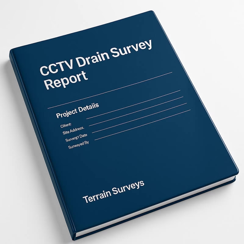
- Cover Page – Project name, site address, purpose of survey.
- Executive Summary – A plain-English digest of key findings.
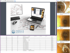
- Inspection Breakdown – Pipe-by-pipe results.
- Risk Grading – Often using a traffic light system for clarity.
- Photo Appendix – Defects shown in high-res stills, annotated.
- Video Footage – Supplied via download link or USB (DVDs are less common these days).
- Mapping – CAD or schematic showing pipe routes, flow direction, and manholes.
Pro tip: Ask your provider to include a ‘walkthrough’ session – a quick call or site meeting to explain the report in plain terms.
Drainage Defect Classification Explained
Not all pipe problems are equal. That’s why CCTV drain reports use defect grading systems, so you know whether something’s a mild irritation or a full-blown emergency.
Grading Systems Used
Most reputable survey providers use the WRC MSCC5 standard. It’s the industry benchmark, outlined in the Manual of Sewer Condition Classification, 5th Edition by the Water Research Centre (WRC). You can learn more about it here.
Here’s how it works:
- Grade 1 – Minor defect. Cosmetic or light wear, no action needed.
- Grade 2 – Slight deterioration. Monitor over time, but not urgent.
- Grade 3 – Moderate defect. May need maintenance or minor repair within 6–12 months.
- Grade 4 – Serious defect. Needs fixing soon to avoid escalation, typically within 3–6 months.
- Grade 5 – Severe damage, or collapse imminent. Urgent action required immediately.
And the types of defects? Expect to see terms like:
- Fractures and cracks – Splits in the pipe material.
- Displaced joints – Misaligned connections between pipe sections.
- Root ingress – Tree roots invading and blocking or damaging the line.
- Deformation – Pipe misshapen or bulging, often due to pressure or age.
- Obstruction or blockage – Debris or build-up preventing flow.
- Silt accumulation – Build-up of fine particles, restricting flow.
- Collapsed section – Complete structural failure of part of the pipe.
Every defect is assigned a code and a grade, so engineers can prioritise issues and recommend next steps.
Interpretation Tips
Here’s how to make sense of your grading table:
- A Grade 2 crack might be fine for now – but if it’s in a high-load area or near other issues, it could worsen quickly.
- A Grade 4 displaced joint? That’s bad news. Water could be leaking, or silt infiltrating, leading to further damage.
- Multiple Grade 3s in a row? That often signals a pipe section needing closer attention.
Why this matters: Insurers, water authorities, local authorities and mortgage lenders expect WRC MSCC5-compliant grading. If your report just says “crack noted, suggest monitoring,” it’s not up to scratch.
Deliverables: Footage, Mapping, and Documentation
The best CCTV drainage survey reports don’t just throw jargon at you. They give you everything you need to see, understand, and to act on what’s happening underground.
Here’s what you should receive (and what to look out for).
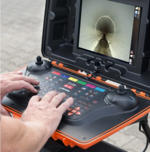
Video Footage
This is the raw, unfiltered evidence. You should get:
- HD video files, supplied via download link or USB (DVDs are rarely used in 2025).
- Time-stamped footage, so you can track when and where issues occur.
- Narrated inspections (if included) – surveyors explaining what they see as the camera moves through the pipe.
- Defect references – video cross-referenced with the report using chainage markers (e.g., “Crack at 14.6m”).
Pro tip: A good surveyor always pauses at a defect and zooms in with the camera, to get a proper look, so you can get a full picture of the issue and understand the extent of what needs doing to fix it. Bad reports just rush through.
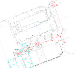
Drainage Maps and Schematics
Mapping is where everything clicks.
Expect to receive:
- A schematic diagram or CAD plan of the entire drainage system.
- Details like:
- Flow direction
- Pipe diameters
- Manhole positions
- Chainage markers
- Depth
- Location of joints
- When possible, survey traces plotted against your site plan, so you can see how the drains relate to buildings, boundaries, and identifiable fixed features. This helps you better locate areas of pipework later on.
At Terrain Surveys, our surveys integrate into wider topographical plans and measured building surveys when needed. This is invaluable for architects, contractors, and planners who need accurate geospatial data of both the above and below ground environments.
Documentation Formats
You’ll usually get a PDF report, but that’s just the start.
Professional reports should also include:
- Hyperlinked visuals, so you can jump from summary tables to video/photos.
- Digital CAD or GIS files (e.g., DWG or DXF) for architects, engineers, or asset managers to use in planning software like AutoCAD or Revit.
- Annotated photo packs – particularly useful for submitting evidence to insurers, local authorities, or utility providers.
Pro tip: Request editable formats like DWG or DXF for seamless integration with BIM or CAD workflows.
How the Report Is Used
A CCTV drainage survey report isn’t just a tick-box exercise. It’s an actionable document used to make decisions, plan construction works, fix critical problems, and protect your property.
Here’s how different people use it:
For Property Buyers
When you’re buying or selling a property, your standard survey won’t cover what’s below ground.
A CCTV drainage report:
- Reveals hidden liabilities, like collapsed pipes, root ingress, or long-term blockages.
- Strengthens your negotiating position: If faults are found, you can request a price reduction or demand the seller fixes them.
- Avoids nasty surprises post-completion: Imagine moving in and discovering the toilet backs up every two weeks because of an unseen defect.
Some solicitors now recommend a drain survey before exchange of contracts, especially for historic buildings, commercial properties, or any property with signs of drainage problems
For Insurers and Claims
Insurers need evidence before they pay out. A high-quality CCTV report gives them just that.
It’s often used to:
- Validate claims for flooding, subsidence, or water damage.
- Demonstrate pre-condition by proving a pipe was damaged or undamaged before your policy started.
- Support mitigation works: You can use a CCTV drainage survey to prove both the presence of an issue, and to prove you’ve taken the required remedial action.
Insurers are far more likely to process claims quickly if you provide a professional, WRC MSCC5-coded report with clear defect coding and video proof.
For Remedial Works
This is where the report really pays off.
Drainage contractors and civil engineers use the CCTV survey report to:
- Prioritise repairs based on severity.
- Choose the best method; patch lining, full re-lining, excavation, or replacement.
- Pinpoint locations so repairs are as non-invasive and cost-efficient as possible.
Rather than guessing where a problem is, they can go straight to 13.8 metres downstream from Manhole A4, where the displaced joint is causing the issue.
Pro tip: A report with precise chainage, manhole references, and accurate CAD mapping can shave days off a job, and save thousands in labour.
Combining your CCTV drainage report with an underground utility survey, using ground penetrating radar (GPR) and Electromagnetic Locators (EML), is a great way to discover what other services are buried underground near your damaged pipes.
If excavation is needed to fix damaged pipes, you’ll need to know if there’s any risk of striking any other buried assets. This can be a big cost saver vs accidentally striking a water mains, gas pipe or fiber optic cable. Better to be safe than sorry.
Cost Considerations and Value
A CCTV drainage survey isn’t free, but it’s an investment that can save you a fortune.
Costs typically range from £500 to £1000 for smaller domestic properties, more complex drainage systems associated with larger commercial properties, complex historic buildings etc can run into 10’s of thousands of £’s. Its all dependent on the size of the property, complexity & condition of the drainage system, desired deliverable and site location.
Complexity is what Terrain Surveys specialises in. We offer very competitive prices on larger or more complex CCTV drainage condition & connectivity surveys our experts love a challenge!
For small domestic jobs like clearing a simple blockage located between the kitchen sink and the access junction on the back patio, you can use a local plumber. This type of drainage survey should only set your back about £150 – £300.
The Value of CCTV Drainage Surveys
Consider this:
- A hidden collapsed pipe could cost £5,000–£10,000 to repair post-purchase. Identifying it before the purchase means you can the cost discounted off the asking price
- A contractor tells you they have done a great job laying the pipes and they want to be paid. You have no way to check their work without a pipe survey. It might find that they allowed rubble into the pipes, or heavy machinery caused pipe collapse
- You have a drainage or sewer system on your property that’s flooding. If it’s strom water, it could cause water damage to nearby buildings or infrastructure – which you might be responsible for. If it’s sewage it presents a serious health risk if foul water surfaces, potentially leading to sickness or lawsuits.
Pro tip: Get quotes from multiple providers, but don’t just go for the cheapest—check they’re WRC MSCC5-compliant and include full deliverables.
Why Report Quality Matters
Here’s something most people don’t realise until it’s too late: not all CCTV drainage survey reports are created equal.
The difference between a poor report and a professional one? Night and day. One gives you clarity and confidence. The other just leaves you with questions.
Common Issues with Low-Quality Reports
Some providers cut corners, especially at the cheaper end of the market. Watch out for:
- No defect grading: “There’s a crack” is meaningless without a WRC MSCC5 grade.
- Low-resolution, shaky, or non-comprehensive footage: making it impossible for a tradesman to fully assess damage and provide an accurate quote for repair
- Missing mapping: no schematic or CAD drawing of the system layout making it difficult to locate the damage or the access junctions
- Inconsistent or vague defect locations: no reference to manholes, no chainage, no context.
- No recommendations; just a list of problems with no solutions.
If your report can’t be used to plan repairs or support a claim, it’s not worth the paper it’s printed on.
Pro tip: If your contractor struggles to use the report to quote for remedial works, it’s probably not a good report.
What to Look for in a Professional Survey Provider
If you’re sourcing a CCTV drainage survey, here’s what separates the best from the rest:
- WRC Accreditation (MSCC5) – Ensures defects are coded to industry-recognised standards.
- High-Resolution Camera Equipment – Look for providers using HD crawler cameras with pan-and-tilt functionality.
- Trained Surveyors – WRC-certified personnel who know how to interpret and code defects properly.
- Comprehensive Deliverables – Not just video, but CAD drainage maps, PDF reports, photo packs, and digital data files.
- Digital Traceability – Time-stamped footage linked directly to the report.
At Terrain Surveys, we tick every one of those boxes, and more. Because we know a report is only useful if it’s clear, coded, and complete.
Why Choose Terrain Surveys for Your CCTV Drainage Survey?
Let’s be honest.
Anyone can buy a CCTV drainage camera and call themselves a surveyor. But if you want accurate data, actionable insights, and a report you can actually use, you need a provider that takes this seriously.
That’s us.
Here’s why Terrain Surveys is trusted by homeowners, developers, engineers, and commercial property managers across the UK.
1. We’re WRC-Compliant, MSCC5-Coded
Every CCTV drain survey report we produce is fully coded to the latest WRC MSCC5 standard, which means:
- Clear, consistent grading of every defect
- Easy compatibility with contractors and utility companies
- Acceptance by insurers, water authorities, and local councils
We don’t guess. We code everything properly, and you get a structured report you can rely on.
2. High-Res Video + Clear Mapping
We use high-definition crawler cameras to capture crisp internal footage, and we can pair that with accurate drainage mapping, produced by our CAD technicians.
That means you don’t just get a blurry video clip. You get:
- Pinpoint locations of faults
- Clear direction of flow
- Drain sizes, depths, and materials
- A fully mapped system that slots into your building design drawings if needed
Whether it’s a domestic job or a large commercial site, we scale our deliverables to suit.
3. Experienced, Accredited, UK-Wide
With teams based in Hertfordshire, the Midlands, Bristol, and Sussex, we cover the whole of England, Scotland, and Wales.
Our staff are:
- CSCS-certified for on-site work
- Trained in confined space entry
- Constructionline Gold and ISO 9001 accredited
- Members of The Survey Association and ICES (Chartered Institution of Civil Engineering Surveyors)
You’re not just hiring a drainage company. You’re hiring a team of survey professionals that won’t let you down.
So, if you want a drainage survey report that’s actually worth something?
Get in touch today for a free, no-obligation quote at Terrain Surveys.
We’re here to make sure you know exactly what’s going on underground and precisely what needs to be done about it.
