GNSS stands for Global Navigation Satellite System. It is the collective term for all the satellite constellations that provide global positioning, navigation and timing services, including GPS (USA), GLONASS (Russia), Galileo (EU) and BeiDou (China).
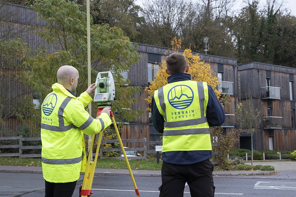
A GNSS survey uses a survey grade receiver to listen to signals from many of these satellites at once and calculate the precise position of points on the earth’s surface in three dimensions: east, north and height.
In plain English:
A GNSS survey is like dropping pins on a map, but with accuracy measured in centimetres rather than metres, and in a format your designers, engineers and contractors can actually build from.
That might be the corners of a site, existing buildings, roads, drain covers, trees, proposed foundation locations or anything else that matters to your project.
Because modern receivers use multiple constellations rather than GPS alone, they see more satellites in more of the sky. That means faster fixes, stronger signals and more reliable positioning, especially in the real world where you have trees, buildings and cranes to contend with.
Note: If you’re more interested in getting a GNSS survey than learning about them, then get in touch with us. We offer GNSS surveys nationwide Contact us today for a free quote
GNSS vs GPS: Clearing Up the Confusion
People often say “GPS survey” when they really mean GNSS. There is a simple difference:
- GPS is the American satellite navigation system, one constellation among several.
- GNSS is the umbrella term for all such systems working together.
For serious surveying you want a multi constellation GNSS receiver, not a basic GPS gadget.
That is what allows us at Terrain Surveys to pick up more satellites, get robust fixes more quickly, and keep working confidently in marginal conditions.
How a GNSS Survey Works (The technical stuff)

Every GNSS satellite continuously broadcasts a signal that includes its precise orbit and the exact time that signal left the satellite. A receiver on the ground measures how long the signal took to arrive, turns that into a distance, and combines distances from several satellites to work out its own position.
This process, called trilateration, gives you X, Y and Z for the receiver. Move the receiver around the site, and you build up a cloud of accurate points that can be joined into a topographic survey, used for design, or converted into setting out data.
Where it gets really powerful is in the techniques we use on top of that basic idea:
- With static GNSS, a receiver sits over a point for a long period, and we process that data later to establish extremely precise control points and geodetic networks.
- With RTK (Real Time Kinematic), a base station at a known location sends corrections to a moving rover receiver, giving live positions with roughly 1–2 cm accuracy in real time.
- With Network RTK / CORS, instead of your own base, you use a permanent network like Ordnance Survey’s OS Net in Great Britain, which streams correction data from over a hundred GNSS reference stations and lets you get centimetre accurate coordinates tied directly to ETRS89 and the British National Grid.
- With PPK (Post Processed Kinematic), you log raw GNSS data during the job and process it afterwards, which is ideal for drone surveys or remote sites with patchy communications.
On site we will normally use RTK or Network RTK to work quickly, and then back that up with static or PPK where higher confidence is needed. You get speed on the ground and rigour in the office.
What Does a GNSS Survey Actually Give You?
From your point of view, a GNSS survey is mainly about three things:
Accurate plan position
Every point you care about gets a precise easting and northing in a chosen coordinate system, for example the Ordnance Survey National Grid (OSGB36) or a well defined local grid.
Reliable levels
You get heights tied to a recognised datum, such as Ordnance Datum Newlyn, rather than “some arbitrary level that happens to match an old drawing”. We often cross check GNSS heights against benchmarks or levelling runs so that your drainage and slab levels work as intended.
Usable outputs
The raw positions are formatted into coordinate schedules, CAD drawings and control point reports that plug straight into your design and BIM workflows. For construction, we can supply setting out files tailored to your engineer’s instruments.
In short: you receive coordinates that are accurate, traceable and ready to use, not a mystery spreadsheet that someone has to decipher.
Why GNSS Surveys Are So Valuable
The big win is speed. GNSS allows a single surveyor to cover large areas far more quickly than traditional total station methods, because there is no need for line of sight between instrument and target and no need for a second person holding a prism. That is exactly why national agencies and professional bodies highlight GNSS as a much faster way to collect mapping data than purely conventional techniques.
The second win is accuracy where it matters. Standard, uncorrected GNSS (the sort your phone uses) is usually only accurate to a few metres. With RTK or Network RTK, survey grade receivers achieve centimetre level positioning that is suitable for land surveying, construction set out and precision engineering.
That combination of speed and precision makes GNSS highly cost effective for:
- large open development sites
- road and rail corridors
- utility and pipeline routes
- floodplain and earthworks surveys
You get more ground covered per day, with data you can trust, and fewer repeat visits.
Just as important, GNSS integrates beautifully with total stations, laser scanning and drone surveys. We use GNSS to establish control that everything else hangs from, so your underground utilities, building models, topo survey and drone surveys all live in one coherent coordinate framework.
The Limitations: Where GNSS Struggles
GNSS is not a magic solution for every situation, and a good surveyor will be open about that.
The receiver needs a reasonably clear view of the sky. Deep in urban streets, under dense tree cover, in tunnels, under bridges or indoors, you may not have enough clean satellite signal for reliable fixes, or multipath reflections can introduce error.
The signals also pass through the ionosphere and troposphere, which can bend them slightly. Modern RTK and network correction services model these effects, but over long distances or during unusual conditions they can still affect very high precision work.
Finally, not all GNSS is created equal. The few metre accuracy quoted for consumer GPS in general navigation contexts is nowhere near adequate for setting out a building or verifying drainage falls.
This is why we constantly check quality indicators, cross reference with control, and fall back to total stations or laser scanning whenever the environment suggests that GNSS alone is not enough.
Where GNSS Shines: Typical Applications

If you are involved in land development, infrastructure or environmental work, GNSS touches more of your world than you might realise.
For topographic land surveys, especially greenfield or lightly developed brownfield sites, GNSS is often the backbone. It allows us to rapidly capture ground levels, boundaries, access roads, watercourses and features over large areas, ready for masterplanning and detailed design.
On transport and utility schemes, GNSS is ideal for establishing and maintaining control along routes, checking alignments, and setting out structures and services. RTK and CORS networks were designed with exactly this sort of use in mind.
In construction, GNSS lets us set out gridlines, foundations, kerbs and infrastructure directly from the digital model. It also underpins machine control systems that guide excavators and pavers in real time.
For monitoring and deformation, static GNSS can track small movements of embankments, bridges or structures over time, especially where long term stability matters.
And in agriculture and environmental work, GNSS is integral to precision farming, habitat mapping and flood risk assessment, where large areas and repeatability are critical.
How GNSS Fits Into the Design and Construction Journey
Think of GNSS as the thread that runs through your project from first sketch to final handover.
At the start, we use it to establish a robust control network tied to national coordinate systems like ETRS89 and OSGB36, or to a carefully defined local grid where that suits the project better.
That control then feeds into:
- topographic surveys for design
- measured building surveys for refurbishments or extensions
- utility surveys for clash avoidance and service planning
- construction set out for getting things built in the right place
Because the coordinates are consistent, your architects, engineers, contractors and asset managers are all literally working from the same map. You reduce risk, avoid costly misalignment and minimise “measure twice, rebuild once” moments on site.
Commissioning a GNSS Survey: What Working With Us Looks Like
When you ask us at Terrain Surveys to undertake a GNSS based survey, the process is straightforward.
We start with a conversation about what you are trying to achieve, the level of detail you need, your preferred coordinate system and any site constraints. Then we plan a GNSS strategy that fits: perhaps Network RTK tied into OS Net for a housing scheme, static GNSS plus a dense control network for a complex urban redevelopment, or RTK plus drone mapping for a large rural estate.
On site, our surveyors collect the data, monitor quality in real time and supplement GNSS with total station and other techniques wherever that will improve the end result. Back in the office we process and check everything, transform it into the right grid and datum, and produce clean CAD drawings and coordinate schedules that your team can drop straight into their models.
Because GNSS is so efficient, we are often able to cover sites in one or two visits, which keeps both programmes and budgets under control.
Choosing the Right GNSS Survey Partner

The technology matters, but the team behind it matters more.
You want surveyors who are experienced with GNSS, who understand coordinate systems, who use proper correction services, and who are open about limitations as well as strengths. You also want a company that is accredited, insured and takes quality management seriously.
Terrain Surveys has been delivering measured surveys across the UK since 2004, investing heavily in the latest geospatial technology and staff training so we can work efficiently and accurately for our clients. We are ISO 9001 certified, hold Constructionline Gold membership, are members of The Survey Association and the Chartered Institution of Civil Engineering Surveyors, and our site staff carry appropriate CSCS cards.
Most importantly, we combine GNSS with topographic, measured building, utility and GPR surveys, so you get a joined up picture of your site, above and below ground, all on one reliable grid.
If you are planning a development, checking design levels, or simply want to be sure your site data is accurate, a professionally executed GNSS survey is one of the smartest early investments you can make.
You bring the ideas and the questions. We bring the satellites, the instruments and the expertise.
If you would like help scoping a GNSS survey for your site, send us your drawings or a red line boundary and we will talk you through the options, no obligation.
Contact us today for a free quote or expert advice.
