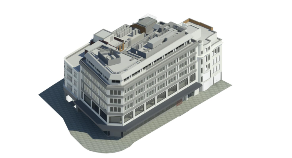
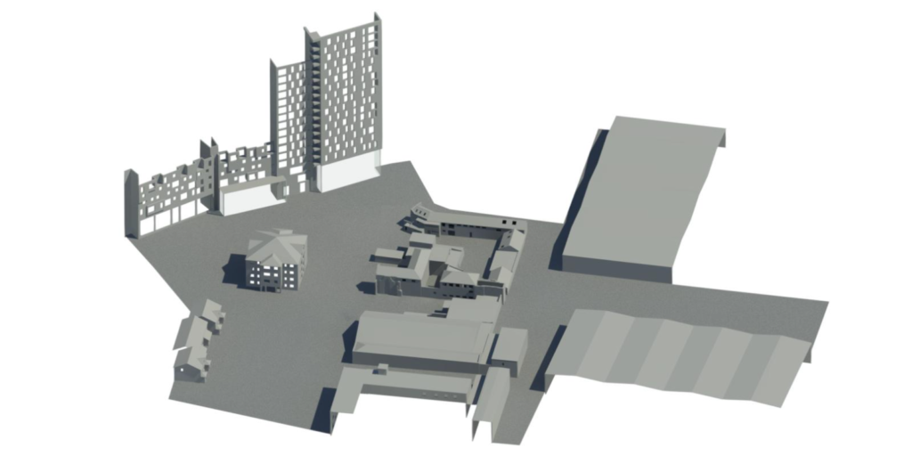
At Terrain Surveys, when we’re asked about what we do, the way we like to think about it is that when we work on a project, be it a topographical survey at a local wildlife park or a measured building survey of a historical building, we translate what initially looks like a mass of site or building features into a formula for opportunity. But these formulas are not a one-size-fits-all situation, your project demands its own unique techniques and requirements, you might say its own level of detail and, as it were, there’s a solution for just that. The Level of Detail, or LOD, definition is used to define the information content of the Revit Model; it depicts what will be included in the model at each level of the LOD definition, spanning 0 to 3, thus giving the opportunity to decide what to what degree of detail your project requires and eliminating the inconvenience of having details which are unnecessary.
Understanding 3D Revit Modelling
When it comes to project management, 3D Revit Models plays an essential role in successfully translating the projects goals and projected outcomes into a detailed visual medium, which can be used externally in marketing, to show lessors, and internally to elicit understanding of changes that might need to be made and so the 3D model can be easily adapted. Revit is a software that supports BIM (Building Information Modelling). It is the Revit software that is used to create the 3D model and which allows us to construct intelligent survey models, alongside the expertise of our dedicated team.
Pointcloud data is captured of your building using 3D laser scanning techniques, providing us with a complete replica of the building, which is then used in Revit by our CAD technicians, to produce the 3D Revit survey model. Having sufficient pointcloud data allows any part of the building or, if necessary, the entire building, to be effectively modelled, transforming even the most complex structural and architectural features into highly accurate, detailed, 3D models which enhances understanding of the existing spaces and project’s design outcomes.
Level of Detail Definition: Explained
For a number of projects, it is necessary to use different Levels of Detail for the survey model. This is not an issue at all as the Level of Detail can differentiate between the walls, floors and ceilings, structural elements, and many other areas of the model – as mentioned, we know that your project has its own individual requirements and our models are catered to those very needs!
The following descriptions explain the essential information represented by each Level of Detail when used for a Revit model but, additionally, our Revit Specification document offers a comprehensive explanation of the Levels of Detail for each specific area and highlights additional information regarding visibility and access, materials, approximation and much more.
LOD 1
LOD1 is the conceptual basis where it shows an accurate representation in overall size and shape, but has little detail.
An LOD1 model the building or structure will be accurate in overall size and shape, but the model has little in terms of detail. For buildings, the model will be shown as a mass object or with wall and roof elements using generic system families. If requested structural openings of doors and windows can be included.
Basic LOD1 survey models are used either for early conceptual stages of a construction project or are used as context models surrounding the building of interest which is modelled to a higher level of detail.
LOD 2
LOD 2 includes more of the general geometry of the site objects, where it combines the conceptual basis in LOD 1 but is now more detailed in terms of design development.
All elements included in the model will not be shown in detail, but overall size and shape will be correct. Modelled elements are simplified, with the purpose of the model used for preliminary designs, analytical processes and project planning.
LOD 3
LOD3 represents a more accurate and visually clear representation of the existing site features, which is essential when coordinating the sizes and the location of the objects being installed with the ones that are already there (such as pipes, to avoid pipe collisions and breakages, etc). Finishing details, such as surface types, brick or rendered walls or the addition of grass or paving in the case of topographical models, and more, play an essential role in truly elevating the model into something that can be envisioned more clearly as a real, tangible final product.
Why Is This Important?
The LOD definition exists to allow those overseeing the project to ensure that no critical details are overlooked and minimise time wasted on overcomplicating areas which do not require as much detail. It allows you to recognise and decide which areas are of particular interest and to what degree they need to be examined and modelled. In this way, the existence of our LOD specification allows you to categorise and prioritise the areas of the site, and reduces time lost to over- or under-developed areas which might occur were the entire site modelled to the same Level of Detail. The detail of a model directly impacts the way it is perceived, the degree to which it accurately represents the final product and the likelihood that, where necessary, changes can be made based upon the model, and so familiarity with the LOD scale can truly help elevate your project, and we are here to help.
At Terrain Surveys, we strive to exemplify excellence in all that we do, and guarantee a client-centred approach to all projects, and so we do not expect you to come to us with all of the answers, that is part of our job! Our expert team are dedicated to outstanding customer service and are ready and available to discuss any questions or queries you may have, so don’t hesitate to get in touch by calling us on 01438 841300 or emailing enquiries@terrainsurveys.co.uk. Alternatively, enquire today by completing the Contact Form to get a quotation and a member of our team will be in contact with you.

