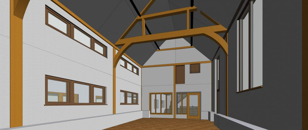
Imagine you’re planning to renovate an old house or redesign an office space. Before any construction begins, you need precise plans of what’s already there. This is where a measured building survey comes in. It’s the process professionals use to create an accurate representation of a building’s layout, structure, and features, either as detailed floor plans or even a 3D model. In this blog, we’ll explain what a measured building survey is, why it matters, how it’s done, and provide real-world examples of its use.
What Is a Measured Building Survey?
A measured building survey is essentially a comprehensive mapping of a building. Surveyors meticulously measure every part of the structure to produce precise drawings or digital models. In technical terms, it results in a detailed depiction of the building’s structure, layout, and features, presented as 2D plans or a 3D model. This means every wall, door, window, and architectural detail is captured with accurate dimensions and spatial relationships. The output gives architects, engineers, and property owners a clear picture of the building’s current form. It’s commonly used for planning renovations, creating architectural designs, supporting heritage conservation, or preparing legal documentation of a property.
Why Is It Important?
Conducting a measured building survey might sound like extra work, but it’s extremely important whenever changes to a building are planned. Here are a few key reasons why these surveys are so valuable:
- Accurate Design and Planning: Architects and engineers rely on precise measurements to design new elements (like an extension or a remodeled interior) that fit perfectly. A measured survey provides a reliable basis so that design plans match the real-world building. This reduces errors and surprises during construction.
- Legal and Documentation Needs: Property transactions, leases, and building permits often require exact floor areas and layouts. Measured building surveys produce official floor plans and area calculations (such as Net Internal Area (NIA) or Gross Internal Area (GIA)) that support legal documents and property records.
- Historical Conservation: For historic structures (churches, monuments, old estates), preservationists need detailed records of the building’s features. A measured survey records ornate details and the current condition of heritage buildings, which is vital for preservation. This information helps architects plan restoration work with confidence, ensuring that changes respect the original structure.
- Structural Assessment: Engineers planning structural alterations or safety assessments need accurate data about the building. The survey provides essential information (like exact wall positions, ceiling heights, and beam placements) that engineers use to evaluate structural integrity and plan reinforcements. In many cases, a measured survey is essential for engineers before they undertake significant refurbishments.
In essence, having a measured building survey ensures everyone – from architects to lawyers to conservationists – is working from the same accurate information about a building.
How Is a Measured Building Survey Conducted?
Measured building surveys today use high-tech tools to gather data quickly and accurately. Surveyors will typically visit the site with specialised equipment to capture every dimension:
- 3D Laser Scanners: These devices fire laser beams around rooms and facades to collect millions of points of data (called a “point cloud”). This forms a complete 3D snapshot of the building’s geometry. In fact, many modern survey companies (like Terrain Surveys) use 3D laser scanners as the primary tool for data capture. The result is an extremely detailed digital record of the property. An advantage of this method is that if later on more measurements are needed, they can be extracted from the saved point cloud without another site visit, saving time and cost.
- Total Stations and GPS: Total stations are precise electronic instruments (like advanced theodolites) that measure distances and angles, often used in conjunction with GPS for locating points. They help ensure that all parts of the building are measured in the correct position relative to each other and to the earth. This is important for aligning the survey to real-world coordinates (for example, tying into a site grid or ordnance survey grid).
- Drones: For large or hard-to-reach areas (like roofs or tall structures), drones can be used to capture aerial imagery and measurements. They are especially useful for mapping exteriors and roof details safely, without the need for ladders or scaffolding. High-resolution photos from drones can also be combined with laser scan data for complete coverage.
- Measuring by Hand: In some cases, surveyors still use tape measures or handheld laser distance meters for small details or to double-check certain dimensions. Experienced surveyors know which tool suits each aspect of the job – while high-tech scanners do the heavy lifting, a hand measurement can sometimes clarify a tricky corner or hard-to-scan spot.
After the on-site data collection, the real magic happens back in the office. The raw data (measurements, laser scans, photos) is processed using specialised software. Surveyors convert the point cloud and measurements into organised drawings and models. They often produce CAD (Computer-Aided Design) drawings – basically detailed digital blueprints – or create BIM (Building Information Modeling) files, which are intelligent 3D models of the building. The final product might be a set of floor plan drawings, external elevation views, cross-section drawings, or a full 3D model of the structure that you can navigate on a computer. This digital output is then delivered to the client (architect, engineer, or property owner), who can use it for whatever project is at hand.
What Does a Measured Building Survey Include?
A measured building survey usually results in a collection of documents and files that comprehensively describe the building. Here are the common elements typically included:
- Floor Plans: These are overhead (bird’s-eye view) drawings of each floor of the building. They show wall layouts, door and window positions, staircases, and other internal features in their exact locations. If the building has multiple levels (including a roof attic or loft space), each level gets its own floor plan.
- Elevations: Elevation drawings are like looking at the building from the outside. Each side of the building (north, south, east, west facade) is drawn to show all the details of that exterior wall, including windows, doors, and architectural styling. This helps visualise what the building looks like from each direction.
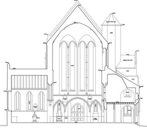
- Sections: Think of a section as a slice through the building. If you cut vertically through a house and looked at the cut face, you’d see a cross-section showing how the floors, walls, and roof relate to each other. Section drawings reveal the interior structure – floor heights, ceiling heights, thickness of floors/ceilings, and how rooms stack above each other. They are very useful for understanding vertical relationships and clearances inside the building.
- 3D Models: Sometimes, instead of (or in addition to) flat drawings, the survey deliverable is a full 3D model of the building. This could be a digital model you can rotate and examine on a computer. A 3D model usually encompasses all the details from the floor plans, elevations, and sections, but in an interactive form. Architects and engineers can use this for advanced visualisation, clash detection (seeing if new components would conflict with existing ones), or feeding into BIM workflows.
- Reflected Ceiling Plans: These are like floor plans, but for ceilings. They show details on the ceiling of each room – for instance, the height of the ceiling, the shape of any soffits or beams, and the placement of lights or other fixtures. They’re called “reflected” because it’s like looking down at a mirror on the floor that reflects the ceiling above. Such plans are important for interior designers and engineers (for things like lighting layouts or HVAC planning).
- Site Plan: A site plan outlines the building’s position within its plot or surroundings. It shows the footprint of the building on the site and includes external features like property boundaries, adjacent structures, driveways, gardens, and pathways around it. This gives context to the building – for example, how far it is from the street, or the relationship between multiple buildings on the same property.
All these pieces together form a complete package of information about the building. Depending on the project’s needs, a survey might include some or all of these deliverables. For instance, a simple house extension might only require floor plans and one section, whereas a complex historic building survey might include every detail plus a 3D model. Survey companies will tailor the deliverables to what the client needs. The end result is typically provided as digital files (like PDF or DWG for CAD drawings, or RVT for BIM models) and sometimes as printed drawings.
Examples of Measured Building Surveys
A measured building survey is useful for all kinds of properties – from modern homes to ancient churches. Even a typical family house like the one pictured may require a measured survey before renovation, to ensure new additions integrate smoothly with the old structure. Measured building surveys are used in many scenarios. Here are some real-world examples of when and why they are conducted:
- Heritage Building Restoration: Imagine a beautiful historic church that’s centuries old. Before restoration work begins, surveyors conduct a detailed measured survey of the entire church. This includes mapping every pillar, arch, and even the intricate carvings on the doors and ceilings. The resulting plans, elevations, and sections capture ornate features that are crucial to preserve. Architects can then plan the restoration with confidence, knowing they have a blueprint of the church as it stands. The survey ensures that any restoration or repairs stay true to the original structure – an absolute must when conserving history.
- Office Space Planning: A tech company wants to redesign its office floor to create an open-plan workspace. They commission a measured building survey of their current office layout. The survey delivers accurate floor plans locating all existing walls, columns, doors, and even electrical outlets. With this precise map of the space, interior designers can experiment with the new layout (like where to add glass partitions or collaborative areas) without guessing where things are. The measured survey ensures the redesign uses the space efficiently and avoids any costly surprises (like discovering a structural column was hidden inside a wall after you already planned a desk there!).
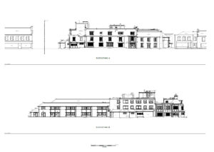
- Residential Property Renovation: A family planning a home extension needs to tie the new addition seamlessly into their existing house. To do this, they first get a measured survey of the house to obtain precise dimensions of the current structure. The architects use these measurements to design the extension so that, for example, the new roof meets the old roof at the right height and the new walls align perfectly with the old walls. This minimises construction issues. Essentially, the survey acts as a reality check, ensuring the renovation plans will fit the existing home like a glove.
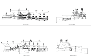
Here is another full example of the array of drawing from a measured survey on a house.
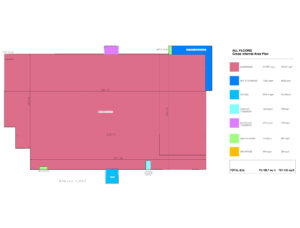
- Area Measurement for Legal Documentation (NIA/GIA): When selling or leasing a commercial building, it’s important to know the exact floor area according to industry standards. A measured building survey will produce detailed floor plans and calculate the Net Internal Area (NIA) and Gross Internal Area (GIA) of the building. For example, a landlord of an office block might use this to officially document that they have, say, 10,000 square feet of rentable space across all floors. This becomes a legal reference in contracts and can be crucial for compliance with property regulations or valuations. Having an accurate area measurement ensures transparency and trust in real estate transactions.
- Construction Verification (As-Built Survey): After a building is constructed, owners or project managers might want to verify that what was actually built matches the original design plans. In this case, a measured building survey is done on the newly constructed building to produce “as-built” drawings. These drawings and 3D models represent the building as it truly is, post-construction, and can be compared to the architect’s plans. For instance, if a steel beam ended up being installed 5 cm lower than planned, the as-built survey will reveal that discrepancy. This process is great for quality control – any deviations from the design can be spotted and addressed. It provides peace of mind that the construction meets the specifications, or highlights where adjustments are needed for safety and compliance.
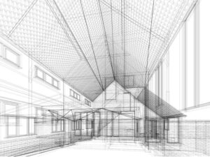
These examples show how versatile measured building surveys are – from preserving history to aiding modern office makeovers, and from helping with home improvements to ensuring construction accuracy.
Terrain Surveys: Accuracy and Expertise in Measured Surveys
When undertaking a measured building survey, it helps to have experts who use the latest technology and have a keen eye for detail. Terrain Surveys, for example, specialises in delivering high-quality measured building surveys for a wide range of clients in the property and construction sectors. Their survey process involves the use of advanced 3D laser scanning equipment operated by experienced surveyors to capture precise measurements of a building’s structural and architectural elements. The wealth of data collected on site is then processed to create detailed 2D CAD drawings or 3D BIM models, tailored exactly to the needs of each project.
Terrain Surveys’ expertise encompasses everything from simple residential houses to complex, historically significant buildings. In every case, their commitment to accuracy and quality ensures that clients receive reliable data to inform their design and construction decisions. By using cutting-edge tools (like the 3D laser scanners mentioned earlier) and following best practices, they are able to provide survey results that architects and engineers can trust. This level of professionalism is crucial because whether it’s a home renovation or a heritage site restoration, successful outcomes depend on having correct, precise information from the start.
Need a Measured Survey?
If you’re planning renovations, redesigning an office, or conserving a heritage building, choosing the right team for your measured building survey is crucial. Terrain Surveys combines expert surveyors with cutting-edge technology to deliver accurate, detailed, and reliable surveys tailored specifically to your project’s needs. From precise floor plans and elevations to interactive 3D models, Terrain Surveys ensures that architects, engineers, and property owners have all the necessary information to make informed decisions. For exceptionally accurate surveys anywhere in the UK, from a company over a decade of experience, reach out to Terrain Surveys for a free no obligation quote.
