Overview
An existing customer contacted us to discuss a topographical survey of a client’s active quarry site to accurately map the site extents and locate and calculate volumes of materials across the quarry.
Sanctus (https://www.sanctusltd.co.uk/) is one of the country’s leading environmental consultants and contractors working on some of the most challenging brownfield and blue/green infrastructure programs and projects across the UK. Sanctus has won, been highly commended and shortlisted in no less than eight industry awards this year (2021).
The Survey Brief
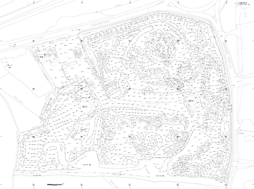
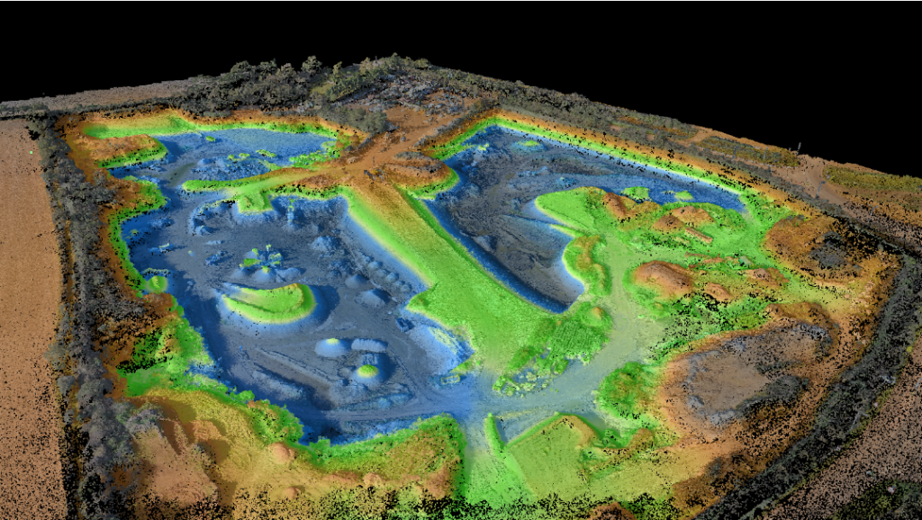
They required a Digital Terrain Model (DTM) of Dansand Quarry, an open pit quarry covering 125,000m² (30 acres) in the Southeast of England. The quarry needed to understand the volume of materials which had been excavated and stockpiled across the site.
The site had several significant health and safety challenges (large machinery constantly moving around carrying large loads of materials, lack of accessibility to certain sections and steep banking), plus the survey process could not stop day to day operations.
The Solution
Sanctus wanted to find a way to produce the survey results safely, efficiently, and within budget. Through our discussions, we gained an in-depth understanding of their specific situation. It became clear that using an Unmanned Aerial Vehicle (UAV), more commonly known as a Drone, would be the ideal choice for data capture, addressing all their concerns and producing the required results.
Sanctus were unaware that drone technology could be used in this way. Using a Drone coupled with our survey experience meant we could produce survey-grade results efficiently and cost-effectively whilst, most importantly, reducing the health and safety risk to our surveyors and quarry operatives.Using a UAV would give maximum coverage of the site whilst significantly reducing site time and preventing any disruption to the daily workings of the site.
Taking high resoltion images with the drone and using established survey control points, a photo-realistic 3D point cloud of the entire site area was created. This accurately presented the site in its current state to a higher level of detail than traditional survey methods would have been able to. This 3D point cloud was then imported directly into LSS 3D Vision, allowing a Digital Terrain Model to be created from the UAV survey data. LSS is a powerful Digital Terrain Modelling software that enables you to undertake highly comprehensive volume calculations for the quarrying industry.
The survey gave them accurate answers to several questions, enabling them to make appropriate operational decisions
The Results
Using conventional survey methods would have required a team of two surveyors on the ground, and the survey would have taken eight days onsite. The use of the drone meant this data was captured in only one day with one surveyor and the drone.
Benefits delivered:
- Significantly reduced time scales and costs associated with a conventional survey
- Negated various health and safety challenges
- Allowed for greater and more in-depth coverage than traditional methods
- Significantly reduced onsite time and business impact
- Complete data capture reduced site re-visits
- Provided historical photographic document of current site conditions
- Provided instant volume calculations from the Digital Terrain Model

