
Architecture
Essential for design, restoration, and redevelopment. Architects can import point clouds directly into their software to visualise, measure, and design within the real geometry of a building.
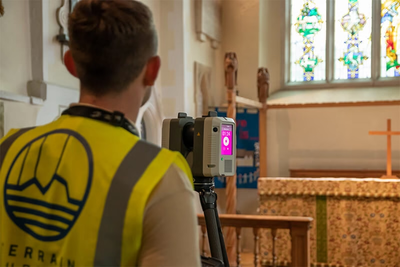
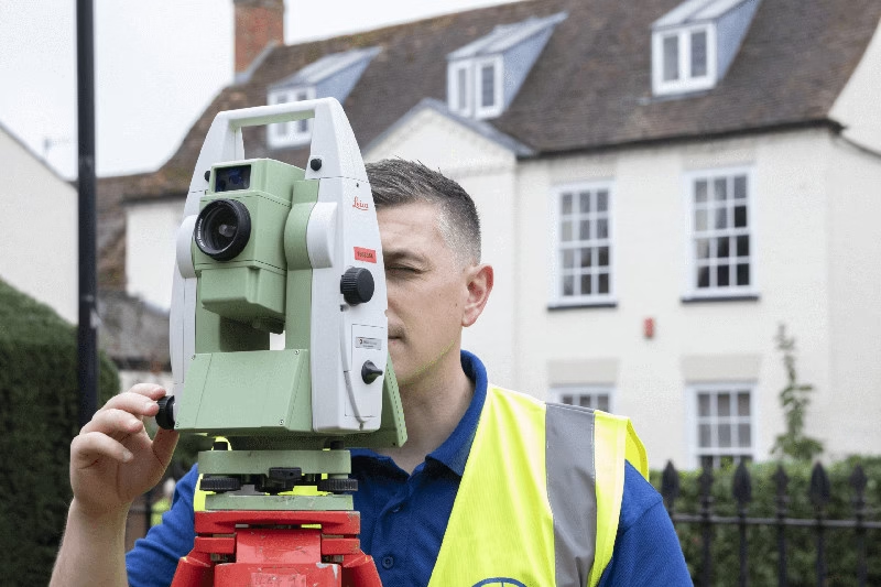
A point cloud survey is a highly accurate digital survey created using 3D laser scanning technology. Millions of laser points are captured across every visible surface of a site, structure, or object. These points combine to form a detailed 3D dataset known as a point cloud, representing the exact geometry of the real environment.
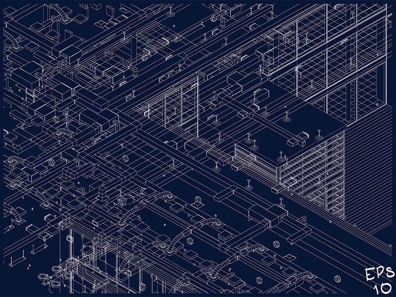
Point clouds can be viewed, measured, and modelled within CAD or BIM software, providing a permanent digital record of existing conditions.
They are ideal for projects involving refurbishment, heritage preservation, complex structures, or sites requiring precise dimensional accuracy.
Request a free, no-obligation quote for your project today.
Essential for design, restoration, and redevelopment. Architects can import point clouds directly into their software to visualise, measure, and design within the real geometry of a building.

Reliable as-built data for planning, verification, progress monitoring, and clash detection — ensuring every design decision is based on accurate site information.

Supports precise modelling for structural, civil, and MEP design. Engineers can extract detailed dimensional data for analysis, modelling, and coordination with other disciplines.


Every Terrain Surveys deliverable follows a rigorously planned workflow to ensure exceptional accuracy and customer satisfaction.

Project cost varies depending on:
Terrain Surveys provides free, transparent, tailored quotations with clear deliverables, ensuring maximum value for your investment. Get in touch for a no-obligation quote.

From our main offices in Hertfordshire and Birmingham, we've carried out thousands of 3D laser scanning surveys across the UK, including in popular areas such as London, Manchester, Yorkshire, and many others. Browse our project case studies below or get in touch with our team to discover how we can help you.

Terrain Surveys used high-definition laser scanning to capture two Grade II listed buildings in intricate detail, supporting future regeneration plans with accurate…

Terrain Surveys used laser scanning and colour contour mapping to assess structural condition and support redevelopment plans in central Mansfield.

With limited roof access at a prominent Market Hill property, Terrain Surveys deployed drone technology and laser scanning to deliver a complete…

The biggest change I've seen in 20-plus years of surveying isn't the instruments. It's what clients expect us to deliver. A decade…
Here's something that surprises a lot of clients: almost every project we run clash detection on throws up a clash of some…

Building Information Modelling (BIM) has become the industry standard across the UK. Whether you are an architect designing a sleek new commercial…
Get a free quote ONLINE OR CALL
+44(0)143 884 1300Request a free, no-obligation quote for your project today.