

Boundary Surveys
The data you need to be able to agree where your boundary lies, see it marked out on site, and have it registered officially.
If you and your neighbour want certainty about where the boundary between your properties sits, a boundary survey provides it. We carry out a detailed measured survey of both plots, set out the boundary position you’ve agreed, verify it on site, and produce a Land Registry compliant plan, ready for a determined boundary application that records the line with coordinates accurate to ±10mm.
This service is designed for neighbours in agreement. Where both owners simply want the boundary position confirmed and formally recorded (before replacing a fence, building close to the line, or selling), our boundary surveyors provide the accurate measured data that makes it possible.
- Certainty for both owners, on site and on paper
- Boundary coordinates accurate to ±10mm
- The agreed line staked out on site, then re-surveyed to verify every set-out point
- A HM Land Registry compliant plan
- A permanent, registered record that protects owners
5.0
powered by
Call us today
+44(0)143 884 1300Get a free quote
Request a free, no-obligation quote for your project today.
- Replacing a fence, wall or hedge and want the line agreed before work starts
- Planning an extension, driveway or garden building close to the boundary
- Buying or selling a property and want the boundary position recorded precisely
- Unsure exactly where the boundary sits because the title plan is vague or out of date
- Ready to make a determined boundary application to HM Land Registry
- Keen to prevent misunderstandings with a neighbour before they ever arise
When You Need a Boundary Survey
You may benefit from a boundary survey if you are:
If both owners are happy to agree the position between themselves based on an accurate expert survey, we can take care of everything else: the measurement, the setting out, the verification and the final plan.
Why Your Title Plan Isn’t Enough
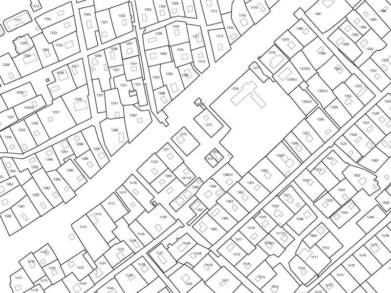
Most Land Registry title plans show “general boundaries”. They are based on Ordnance Survey mapping, typically at 1:1250 scale, and the red line on the plan is indicative only; on the ground, the width of that line can represent a metre or more. That is rarely a problem, until a fence needs replacing or an extension is planned tight to the line.
A determined boundary is different. It records the exact line of the boundary using precise survey coordinates, in our case accurate to ±10mm. Once HM Land Registry accepts a determined boundary application, the exact position is on the register for good, and future owners of both properties inherit that certainty too.
A determined boundary is different. It records the exact line of the boundary using precise survey coordinates, in our case accurate to ±10mm. Once HM Land Registry accepts a determined boundary application, the exact position is on the register for good, and future owners of both properties inherit that certainty too.
Our Boundary Survey Process
A boundary survey is a staged process, with review points along the way, so both owners stay in control of the decision at every step.

1. You agree the boundary in principle
Before any survey work starts, both owners review the information they hold, such as title plans, deeds and any older documents, and reach an agreement in principle on roughly where the boundary should be positioned.

2. We survey both plots
Our surveyors carry out a detailed measured survey of both properties, capturing every physical feature that exists on site: fences, walls, hedges, buildings, paths and anything else relevant to the boundary.

3. You confirm the position on the drawing
We issue the survey drawing to both owners for review. This shows you where the boundary line is. At this stage we expect agreement from the neighbours based on the hard evidence from the survey.

4. We set out the agreed boundary on site
With the position confirmed, we return to site and set out the boundary, staking the agreed points so both owners can see exactly where the line runs on the ground.

5. We verify the set-out positions
We then survey the newly staked points and check them against the agreed positions, confirming the set-out is correct. The final drawing, showing the agreed, set-out boundary, is issued to both owners.

6. We produce your Land Registry compliant plan
Once everything is agreed, we prepare a Land Registry compliant plan for your determined boundary application. You, or your solicitor, then submit the application to HM Land Registry to have the boundary formally recorded.
- A detailed measured survey drawing covering both plots and all physical features on site
- The agreed boundary set out and staked on site
- A verification survey confirming every set-out position
- A Land Registry compliant plan for your determined boundary application, with boundary coordinates accurate to ±10mm on the Ordnance Survey National Grid
What We’ll Deliver
Drawings are issued in the formats you and your advisers need, typically CAD (DWG) and PDF. As with all of our surveys, deliverables are clearly presented, quality-checked and issued in line with the timescales we agree with you.
Accreditations



The Legal Position
A determined boundary application is the formal route to recording the exact line of a boundary with HM Land Registry. The application is made by the property owner, who must identify and evidence the exact line being claimed, normally with the agreement of the neighbouring owner. HM Land Registry then considers the application and, if accepted, records the boundary as determined.
A determined boundary application does not mean that we have confirmed the legal boundary. As measured surveyors, we cannot confirm legal boundaries or ownership; those are matters of title and law. What we provide is the accurate, up-to-date measurement of the existing site condition, and the precise plan, that allow the owners and HM Land Registry to determine and record the boundary with confidence.
A determined boundary application does not mean that we have confirmed the legal boundary. As measured surveyors, we cannot confirm legal boundaries or ownership; those are matters of title and law. What we provide is the accurate, up-to-date measurement of the existing site condition, and the precise plan, that allow the owners and HM Land Registry to determine and record the boundary with confidence.
- Precise measured surveys of both plots and all existing site features
- Setting out and independent verification of the agreed boundary line
- Land Registry compliant plans to support determined boundary applications
- Take sides in boundary disputes or contentious matters
- Offer expert witness services
- Confirm legal boundaries, ownership or offer legal advice.

What We Do (and What We Don’t)
So expectations are clear from the start:
We do:
We don’t:
If you and your neighbour are not in agreement, a solicitor or a boundary dispute mediator is the right first call. Once agreement is reached, we’d be glad to help with everything that follows.
Need help establishing a boundary line?
We’ll provide you the survey so you can agree on the boundary position, and record it for good. Get in touch for a free, no-obligation quote for your boundary survey.
Contact UsBoundary Survey FAQ
Cost depends on the size and complexity of the plots, site access and location. Because the process can include two site visits (the initial survey of both properties, then the setting out and verification), every boundary survey is quoted individually. Contact us for a free, no-obligation quote.
This service is for neighbours who want to reach an agreement: the decision on where the boundary sits is yours to make together, based on the information you receive and the recommendation from the surveyor. If agreement isn’t possible, the matter becomes a dispute. Our survey can be used as evidence in your dispute, but we don’t offer an expert witness service.
It’s an application to HM Land Registry to record the exact line of a boundary on the register, submitted with a compliant plan and supporting evidence. If HM Land Registry accepts the application, the boundary is recorded as determined, replacing the indicative general boundary shown on the title plan with a precisely defined line.
No, and no measured surveyor can. The legal boundary is defined by the title deeds and the law, not by measurement alone. What we do is provide accurate, up-to-date measurements of the existing site condition to support you, your neighbour and your advisers in reaching and recording that decision.
The set-out boundary points are surveyed to an accuracy of ±10mm and supplied as coordinates on the Ordnance Survey National Grid. By comparison, the general boundary line on a historic title plan can represent a metre or more on the ground.
The process is staged, with review points for both owners after the initial survey and again after the setting out. Site work is typically completed across two visits; the overall timescale depends mostly on how quickly both parties can review and agree at each stage. We’ll give you clear timescales when we quote.
We'd love to hear from you
Get a free quote ONLINE OR CALL
+44(0)143 884 1300Request a free, no-obligation quote for your project today.
