Britain’s Ocean City Demands Precision
Plymouth stands where history meets ambition. From the Mayflower Steps to Millbay’s regeneration, from Royal William Yard’s transformation to Devonport’s naval heritage, every successful project starts with accurate data.
Terrain Surveys delivers measured building surveys that match Plymouth’s maritime precision – whether you’re extending your Peverell Victorian, converting Barbican warehouses, or documenting Sutton Harbour’s commercial spaces.
What is a Measured Building Survey?
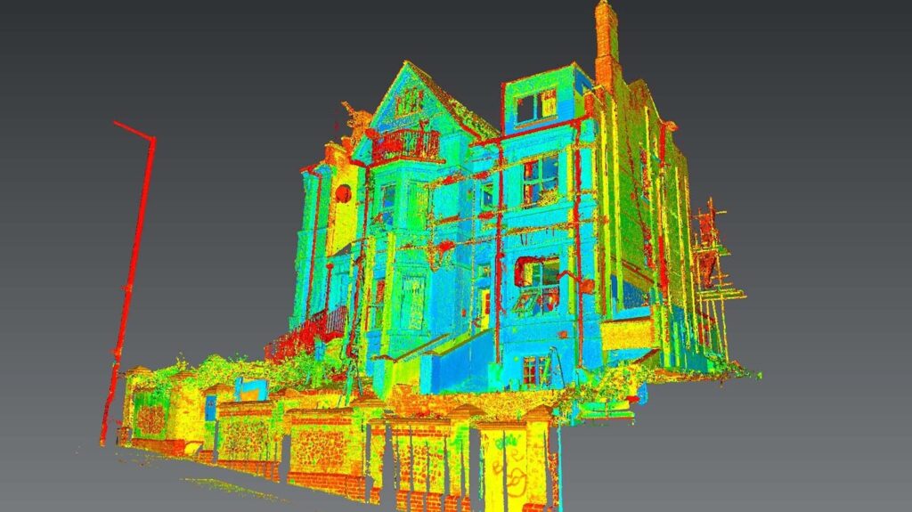
A measured building survey captures the precise dimensional data of any structure, creating a definitive record of the building as it stands today. Using advanced 3D laser scanning technology combined with traditional surveying methods, we produce highly accurate drawings and models that form the essential foundation for all design, planning, and construction work. This isn’t a condition survey – it’s pure spatial intelligence.
Plymouth Projects: Your Deliverables Defined
We provide exactly what your project needs:
- 2D CAD Drawings – floor plans, elevations, sections in DWG/PDF formats
- 3D Revit Models – intelligent BIM models at your required Level of Detail (LOD)
- Point Cloud Data – raw scan data in E57, RCP, or LAS formats
- Integrated Topography – buildings tied to Ordnance Survey grid and site levels
- Specialist Outputs – reflected ceiling plans, façade studies, structural grids
Every survey achieves ±5mm accuracy. RICS-compliant methodology. TSA-approved processes. No exceptions.
Supporting Plymouth’s Development Landscape
City Centre Evolution
The City Centre and Waterfront Plan transforms Plymouth’s core. From the Civic Centre site redevelopment to Drake Circus expansion, accurate existing building data drives successful regeneration. We can provide the foundational surveys that enable master planning, rights of light analysis, and seamless integration of new structures within Plymouth’s evolving urban fabric.
Domestic Surveys for Plymouth Homeowners
Your Mutley Plain terrace needs extending? Planning a loft conversion in Mannamead? Require Party Wall documentation for your Plymstock semi? We deliver the accurate drawings that Plymouth City Council planning officers expect.
Home improvements in areas like Stoke, Plympton, and Hartley require precision. That kitchen extension in Derriford, the garage conversion in Compton, the renovation in St Judes – each needs professional measured surveys if you don’t already have a complete and accurate set of drawings. Architects insist on it. Builders depend on it. Planning applications fail without it.

Technical Excellence Meets Practical Delivery
State-of-the-Art Equipment
- Leica RTC360 scanners – 2 million points per second capture rate
- Leica & Trimble total stations – independent verification of critical dimensions
- Digital levels – precise level data
- UAV platforms – safe roof access without scaffolding costs
BIM Capabilities for Modern Projects
Creating digital twins isn’t trendy – it’s essential. Our Revit models range from LOD0 massing studies to LOD3 construction-ready models. Clash-detection enabled, immediately usable in your workflows. We create intelligent models that support collaborative design and long-term asset management.
Why Choose Terrain Surveys?
- Established Excellence – Founded in 2004, we’ve built our reputation on professional integrity and reliable data delivery.
- Certified Quality – ISO 9001:2015 certified operations ensure consistent excellence. CICES membership guarantees adherence to the highest professional standards.
- Fast & Flexible – Standard 3-10 day turnaround with 24-hour emergency options available. We structure our operations to respond quickly to urgent survey requests.
- Clear Communication – Direct access to surveyors, not call centres. Our collaborative approach means expert advice throughout your project.
Industries We Serve
- Residential developers
- Commercial property owners
- Architects and designers
- Construction contractors
- Plymouth City Council
- Educational institutions
- Healthcare providers
- Marine and defence sectors
- Heritage organisations
- Property managers
The Legal and Planning Framework
Measured building surveys carry significant weight in legal and planning contexts:
- Planning Applications – Plymouth City Council requires accurate existing drawings
- Building Regulations – Compliance verification starts with precise measurements
- Party Wall Agreements – Definitive boundary positions prevent legal disputes
- Lease Plans – Land Registry compliant documentation
- Conservation Areas – Heritage-sensitive projects require preservation
All our surveys are conducted to the latest RICS professional standard: “Measured Surveys of Land, Buildings and Utilities.”
Plymouth’s Unique Survey Requirements
Maritime Heritage
The Historic Dockyard, National Marine Aquarium, and countless maritime structures may require specialised survey approaches. Our experience with complex industrial and heritage buildings is how developers ensure accurate documentation of Plymouth’s naval architecture before making changes.
University Development
Academic buildings require surveys that minimise disruption while capturing comprehensive data for estate management and refurbishment projects.
Transparent Pricing starting from under £800
Fixed quotes based on:
- Building size and complexity
- Required deliverables and formats
- Site access conditions
- Turnaround requirements
Quality Assurance Without Compromise
Our validated process ensures reliability:
- Planning Phase – site reconnaissance, control strategy, access coordination
- Data Capture – systematic scanning with built-in redundancy
- Registration – point clouds aligned to millimetre accuracy
- Production – experienced technicians creating your deliverables
- Verification – independent checks before release
- Delivery – clear data, clear communication, clear value
Digital Innovation, Traditional Values
We offer a range of innovations in every project we undertake:
- Cloud processing accelerates delivery.
- Mobile platforms enable real-time updates.
- Collaborative portals streamline communication.
- But technology serves accuracy – it doesn’t replace thoroughness. Our surveyors still double-check all measurements.
- QA processes remain manual, meticulous, mandatory.
Two decades of building our reputation. Thousands of successful projects. One consistent approach: deliver what we promise, when we promise it.
Begin Your Plymouth Project with Confidence
Whether you’re transforming Millbay’s waterfront, preserving Barbican heritage, extending your Efford home, or managing university estates, Terrain Surveys provides the essential accuracy and professional service you need.
Your project – whether domestic extension or commercial transformation – deserves measured building surveys that deliver certainty.
Contact us using the form below if you need a measured building or land survey in or around Plymouth