From its remarkable post-war reconstruction to its celebrated status as a UK City of Culture, Coventry is a city defined by resilience, innovation, and forward-looking ambition.
This unique identity is reflected in its architecture, a compelling mix of Grade-listed modernist buildings, cutting-edge university campuses, and thriving residential communities. For any construction, renovation, or development project in this dynamic city, success begins with a foundation of absolute precision.
Terrain Surveys delivers expert measured building surveys across Coventry and the West Midlands from our local office in Rugby.
We also provide architects, developers, project managers, and homeowners with the detailed, accurate as-built data required to navigate the complexities of any property project, ensuring your vision is realised efficiently and cost-effectively.
What is a Measured Building Survey?
A measured building survey is the definitive process of capturing the precise dimensional data of a property. The result is a highly accurate set of drawings or a 3D model that represents the building exactly as it stands today. It is a factual record of the structure’s layout, dimensions, and architectural features. This survey forms the essential blueprint upon which all successful design, planning, and construction work is based. It is distinct from a condition survey, as its focus is purely on measurement and spatial data, not the state of repair.
Applications of Measured Building Surveys in Coventry
Our services are tailored to support the full scope of Coventry’s architectural landscape, from large-scale commercial developments to private home improvements.
Fuelling Coventry’s Regeneration
As Coventry continues to evolve with major schemes like the Friargate business district and the transformation of the city centre, accurate existing plans are non-negotiable. We work with developers and construction firms to provide the foundational data needed for master planning, rights of light analysis, and the seamless integration of new structures within the existing urban fabric.
Supporting Academic and Industrial Excellence
With world-class institutions like the University of Warwick and Coventry University, the city is a hub of education and innovation. We can provide ongoing survey support for campus estate management, faculty building refurbishments, and new research facility developments. Our surveys also support the conversion and modernisation of industrial units, honouring the city’s rich engineering heritage.

Preserving Coventry’s Unique Heritage
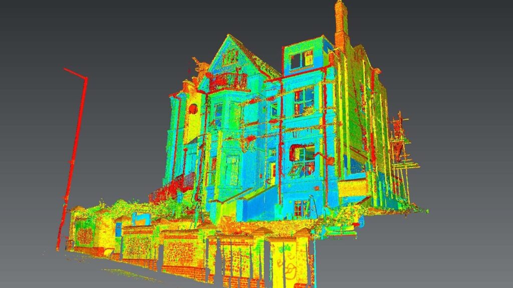
Coventry’s architectural portfolio includes significant post-war listed buildings and medieval survivors. Projects involving these sensitive assets require a meticulous approach. Our non-intrusive 3D laser scanning technology captures the intricate details of heritage buildings, providing the data needed for conservation-compliant designs and planning applications submitted to Coventry City Council.
Empowering Homeowners in Coventry
For homeowners across Coventry, a measured building survey is the first step towards transforming a property.
We provide the essential accurate drawings that architects and builders need for:
- Home extensions in residential areas like Earlsdon and Styvechale.
- Loft conversions to create new bedrooms or office spaces in properties in Coundon or Cheylesmore.
- Full internal reconfigurations and renovations.
The Terrain Surveys Deliverables: Data You Can Build On
We understand that every project has unique requirements. That’s why we offer a flexible range of deliverables, ensuring you get the exact information you need in the format that works for you.
- 2D CAD Drawings: The industry standard for planning applications and design work. We provide fully scaled floor plans, elevations, sections, and site plans in DWG and PDF formats.
- 3D Revit Models: For projects embracing Building Information Modelling (BIM), our intelligent Revit models provide a rich data source. We can produce models to various Levels of Detail (LOD), creating a “digital twin” that supports collaborative design and asset management. Formats include RVT.
- Point Cloud Data: The raw 3D data captured by our laser scanners. This incredibly detailed dataset can be supplied in formats like E57 or RCP for specialist analysis.
Why Choose Terrain Surveys? Our Core Strengths
Beyond our technical capabilities, our service is built on a commitment to our clients’ success.
- Fast Turnaround & Flexibility: We recognise that project timelines are often tight. We are structured to respond quickly to enquiries and can often accommodate urgent survey requests.
- Clear Communication: We believe in a collaborative approach. Our team is always on hand to discuss your project’s specific requirements and provide expert advice.
- A Foundation of Integrity: Established in 2004, Terrain Surveys was built on a foundation of professional integrity. We are dedicated to providing reliable data and building long-term partnerships with our clients.
The Legal and Industry Context
A professionally executed measured building survey carries significant weight in legal and planning contexts. All our surveys are conducted in accordance with the latest edition of the RICS professional standard: “Measured Surveys of Land, Buildings and Utilities.”
This ensures the data we provide is robust, defensible, and fit for purpose, meeting the stringent requirements of planning authorities and legal processes. Adherence to these standards, alongside guidance from The Survey Association (TSA), provides you with complete peace of mind.
Our Credentials: Your Guarantee of Quality
When you partner with Terrain Surveys, you are choosing a company accredited to the highest industry benchmarks.
- ISO 9001:2015 Certified: Our Quality Management System is independently audited and certified, ensuring consistent excellence in every project we undertake.
- CICES Members: As proud members of the Chartered Institution of Civil Engineering Surveyors (CICES), we are bound by the highest codes of professional conduct.
- Nationwide Experience: With a portfolio spanning the entire UK, we bring a wealth of experience to every job, delivering a nationally recognised standard of quality with a focused, local service in Coventry.
Begin Your Coventry Project on a Solid Foundation
Whether you are redeveloping a commercial property in the city centre, managing a university estate, or planning a dream extension for your home in Earlsdon, Terrain Surveys provides the essential accuracy and professional service you need to move forward with confidence.
Contact us today to discuss your requirements and receive a free, no-obligation quotation for your Coventry project.