Whether you’re planning a home extension, breaking ground on a new development, or trying to resolve a boundary question, every successful land-based project starts with one crucial element: understanding the land itself.
Yet countless projects hit costly snags because this fundamental step gets overlooked. Designs need expensive revisions based on rejected planning applications. Construction grinds to a halt when unexpected ground conditions emerge. All because the project started without proper groundwork—quite literally.
The solution? A professional land survey. It’s the foundation that gives you certainty, prevents problems, and ensures your project runs smoothly from day one.
If you’re reading this, and just want a quick answer for “how to get a land survey” then, in short, you just need to contact us. We offer all types of land surveys across the UK.
With over 20 years of experience since our founding in 2004, we at Terrain Surveys have guided thousands of clients through this process.
If however, you’d like to understand what’s involved and what the main types of land surveys are, then continue reading this article. We’ll demystify how to get a land survey, step by step.
What is a Land Survey and Who Needs One?
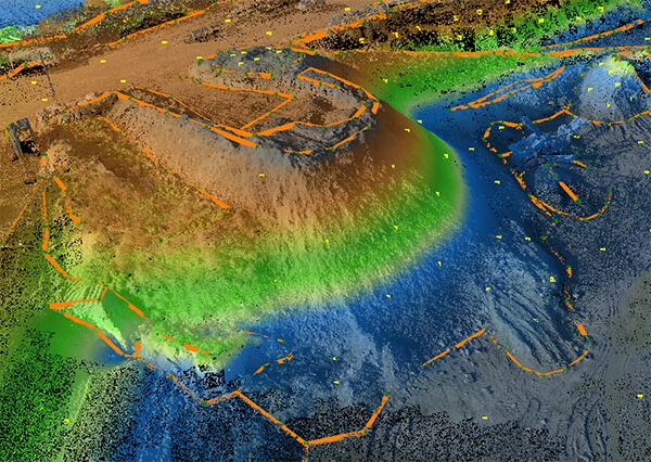
At its core, a land survey is a detailed, accurate map of a piece of land. It shows every physical and man-made feature, their precise levels (heights), and boundaries. Think of it as the definitive blueprint of your site—capturing reality as it exists today, not as someone imagined it decades ago.
But here’s the thing: different projects need surveys for different reasons.
For Homeowners
If you’re planning an extension, redesigning your garden, or settling a boundary dispute with neighbours, a survey is essential. It’s literally the first document your architect will ask for.
Why? Because they need to know exactly what they’re working with. Where that protected oak tree sits. How your land slopes. Where the drains run. Without this information, they’re designing blind.
For Architects & Developers

For you, the survey is your canvas. It’s critical for feasibility studies, site-layout planning, and ensuring your designs work with the reality of the site—not just a flat, idealised map.
A proper topographical survey forms a cornerstone of the RIBA Plan of Work. It tells you what’s possible, what’s challenging, and what’s going to cost more than expected. Better to know now than halfway through construction.
For Engineers
You need hard data. Topographical surveys provide the precise information required for designing drainage systems, calculating cut-and-fill volumes, and planning infrastructure placement. Every contour line, every spot height matters when you’re working out water flow or foundation depths.
For Facilities Managers
Keeping accurate, up-to-date site records isn’t just good practice—it’s essential for effective management. Whether you’re planning new installations like EV charging points, maintaining underground services, or simply ensuring compliance, a current survey gives you the control you need.
The Step-by-Step Guide to Commissioning Your Survey
Getting a land survey isn’t complicated. In fact, when you break it down, it’s remarkably straightforward.

Step 1: Define Your Requirements
First, think about what you need the survey for.
Is it for a simple boundary check? A residential extension? Or perhaps a complex multi-plot development?
Here’s what to consider:
- The exact area to be surveyed. We call this the “red line boundary”. Be specific—surveying more than you need wastes money, but missing a crucial corner could mean calling us back.
- The level of detail required. Do you need every tree marked and measured? All manholes and inspection covers? Street furniture? The more detail, the more time on site, but also the more complete your picture.
- Underground utilities. If you need to know what’s beneath the surface—pipes, cables, drains—that’s a separate service called a Utility or GPR Survey. We offer this too, but it’s worth knowing it’s an additional requirement.
Don’t worry if you’re unsure about any of this. A brief chat with an experienced surveyor in out team can quickly clarify your needs. We offer this professional advice for free to ensure you only pay for what you actually need.
Step 2: Find a Reputable Surveying Company
Not all surveyors are equal. Here’s what separates the professionals from the rest:
Industry Accreditations
Look for membership of The Survey Association (TSA)—the main UK body for surveying companies. Also check for the Chartered Institution of Civil Engineering Surveyors (CICES). These aren’t just badges; they’re proof of high professional standards and ongoing training and compliance.
Health & Safety Certification
For site work, this is non-negotiable. Every surveyor on site must carry CSCS cards. The company should ideally hold accreditations like Constructionline Gold, demonstrating they take safety seriously. At Terrain Surveys, we hold all of these. Safety isn’t an afterthought—it’s built into everything we do.
Quality Management
An ISO 9001 accreditation shows a company has proper quality systems in place. It means consistent service, proper procedures, and a genuine commitment to customer satisfaction. This is the standard we operate to every single day.
Investment in Technology
Modern surveying has moved far beyond chains and theodolites. Today’s professionals use robotic Total Stations, GPS systems, and Laser Scanners. This technology delivers accuracy and efficiency that simply wasn’t possible even a decade ago.
Step 3: Request a Quote
Ready to get a price?
Here’s what you’ll need to provide:
- Site address or postcode
- A plan showing the survey area (even a screenshot from Google Maps with the boundary marked works)
- A brief description of your project
- Your required final format (2D DWG for AutoCAD? 3D Revit Model? Simple PDF?)
Once you have this information, you’re ready to get a quote. At Terrain Surveys, we make this easy. You can upload your files directly via our contact page, and our team will provide a free, no-obligation quote, usually within 24 hours.
Step 4: The Survey Itself
What actually happens on survey day?
Our professional surveyors arrive on site with their equipment. They’ll establish a control network—essentially creating a framework of known points that everything else references to. Then they systematically capture thousands of data points across your site.
The process is designed to cause minimal disruption. We work around your schedule, your operations, your needs.
Step 5: Receiving Your Drawings
The magic happens back in our office.
Our drafting team takes the raw data and transforms it into clear, accurate drawings. Every point is processed, checked, and placed. The result is a clean, professional drawing or digital 3D model that’s ready for immediate use.
You’ll receive your files in exactly the format you requested. Ready to import into your software. Ready to hand to your architect. Ready to form the foundation of your project.
Your Project’s Foundation
Getting a land survey isn’t just a box to tick. It’s an investment in the success and security of your entire project.
An accurate survey isn’t a cost—it’s a tool that saves money, time, and headaches. It prevents planning rejections. It stops costly design revisions. It eliminates those stomach-dropping moments when you discover something unexpected halfway through construction.
The truth is, commissioning a land survey is straightforward when you know the process. Define what you need. Find a reputable company. Get a quote. Let the professionals handle the survey. Receive your drawings.
That’s it. Five simple steps between you and the certainty your project deserves.
Ready to Take the Next Step?
If you’re ready to lay the right foundation for your project, our friendly, expert team is here to help.
Contact us today for free professional advice and a detailed, no-obligation quote. We’ll talk through your requirements, explain your options, and provide a clear price with no hidden surprises.