Overview
Following an initial enquiry by engineering firm Elliotwood, our CCTV Drainage Survey team were instructed to undertake an investigation of an inverted syphon running under the River Stort in Bishop’s Stortford, Hertfordshire. As part of a proposed redevelopment project, Elliotwood required details of the inverted syphon’s current capacity, including the location of the inlet and outlet and the diameter of the syphon.
The Challenge
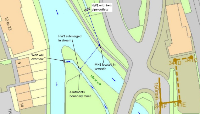
Owing to the lack of utility records available, Terrain Surveys undertook an initial site scoping assessment to obtain any relevant information enable a better understanding of what the full survey would require. Upon arrival, we located the open watercourse section and headwall outfall taking the proposed sites drainage outfall. Various water/dye testing was undertaken and a confirmed connection to a flooded manhole on the river towpath. Prior to lifting this manhole cover to trace/confirm dye test, it was noted to be fractured. The Environment Agency & Local District Council were contacted to confirm ownership and responsibility for the asset, and later remedied by installing a new cover and frame. Further investigation found that the inlet running into the manhole from the watercourse was partially visible under the standing water surface, despite being obscured by debris.
The outfall was found to be running in the direction of nearby council-owned allotments, located on a small island where the river has been split to form a main channel and a shallower overflow section to a weir wall. Further site investigations noted a separate ‘cut’ (a small, ditched stream) which traverses in and alongside the allotments, dug lower than the river level, which presented an additional overflow point from the main river and potentially a connection outfall point from the syphon. Upon entering the ‘cut’ and through further dye testing, we confirmed a connection into the ‘cut’ and through the allotments via a potential submerged head wall.
The Result
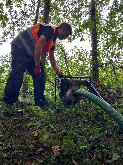
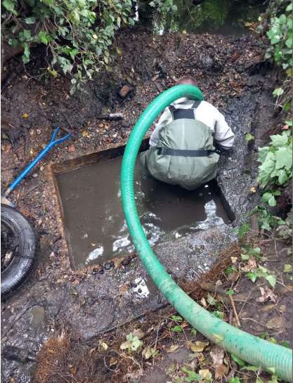
Following the initial site scoping, Terrain Surveys returned to site over the course of two days, where a four-man team undertook various works to facilitate access and survey the inverted syphon. Enabling works included temporarily damming the river weir wall to the cut, reducing flow levels, and facilitating access to the potential syphon outlet. Utilising a vacuum tanker unit to draw down water levels within the towpath manhole including over-pumping the dammed section within the cut, allowed us to remove significant standing debris from the potential syphon outfall and gain access to survey.
As a result of the over-pumping and water level reduction, what was presumed to be a head wall was in actual fact a purpose-built sump chamber filled with debris, including bottles, cans and bricks, as well as a car tyre. With continued over-pumping and water level reduction we eventually exposed the soffit of the box culvert inlet confirming connection from the manhole upstream and recorded various measurements and syphon construction as required. Upon completion of the survey, all data and measurements taken were overlaid onto a topographical survey for ease of reference and confirmation for Elliotwood’s drainage design.
Should you be an engineer or architect with a requirement for a CCTV survey, Terrain Surveys would be delighted to assist.
