Cookie Consent by Free Privacy Policy Generator

3d Laser Scanning Surveys & Services

We can record millions of data points per second to create a precise 3D model of buildings or land

3D laser scanning is a cutting-edge surveying technique that captures highly detailed and accurate spatial data about existing environments, structures and surfaces. Using high-speed laser scanners, millions of data points are recorded every second to create a precise 3D digital representation of real-world conditions known as a point cloud.

This data can then be processed to produce 2D drawings, 3D models, or full Building Information Models (BIM), making it an essential foundation for modern design, engineering and construction projects.

  • Unrivalled accuracy: High precision for complex structures.
  • Speed & efficiency: captures vast areas quickly with minimal disruption.
  • Comprehensive data capture: reduces the need for return visits.
  • Improved collaboration: supports BIM workflows.
  • Cost savings: minimises project errors, rework and delays.
  • Versatility: suitable for buildings, infrastructure and land surveys.
5.0
powered by Google
Call us today
+44(0)143 884 1300

Get a free quote

Request a free, no-obligation quote for your project today.

Max. 5MB images, .dwg, .dxf, .docx, or .pdf files only.

3D Laser Scanning Services

    Scanning to Point Cloud

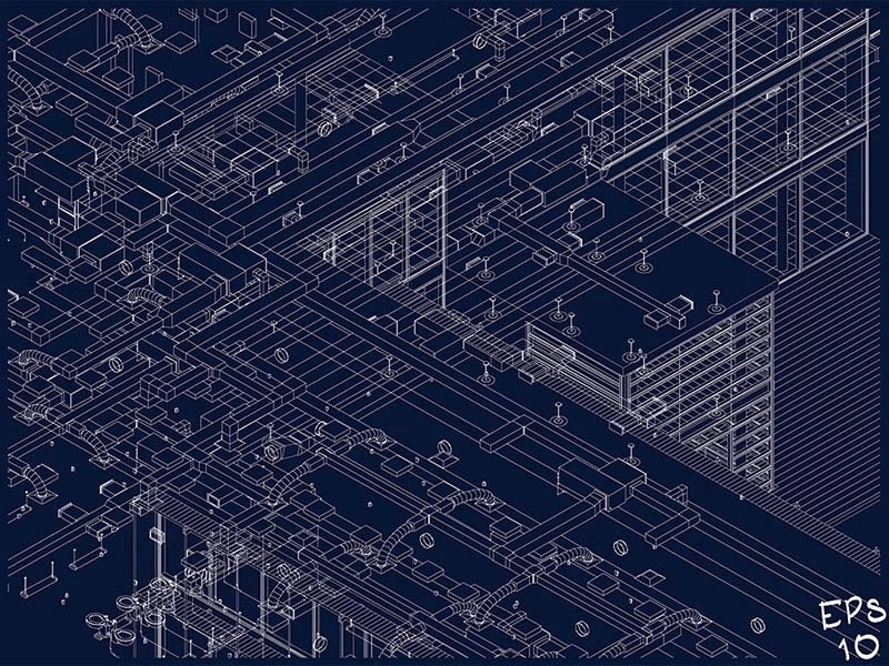
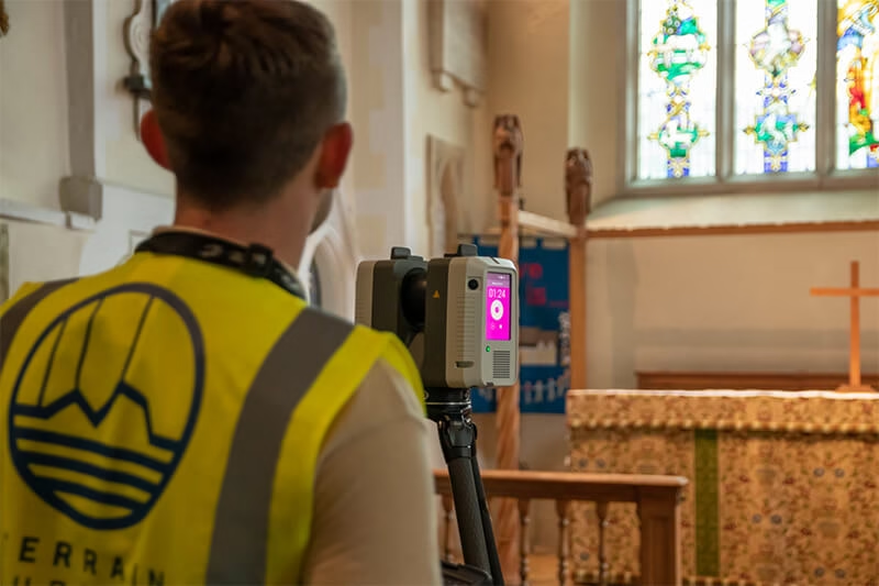
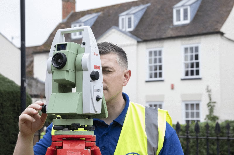
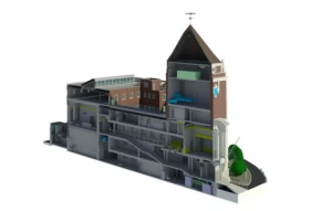
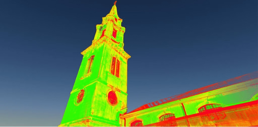
    3D Laser Scanning to Point Cloud

    Terrain Surveys provides high-resolution point cloud data that accurately captures every visible surface of your site or structure. We can capture this data from the ground or from the air via drones. The point cloud can be used for:

    • Dimensional analysis and validation
    • As-built documentation
    • Design, planning and restoration projects
    • Visualisation and clash detection
    • Discover More
    Scanning to BIM

    3D Laser Scanning to BIM

    Our Scan to BIM service converts raw point cloud data into intelligent BIM models, delivering a full digital twin of your building.

    Models are produced in Revit or IFC format and can be tailored to specific Levels of Detail (LOD 100–500).

    Discover More

Projects we Support

    3d laser Architecture

    Architecture

    Essential for heritage recording, refurbishments, extensions and conceptual design.

    3d laser construction

    Construction

    Accurate as-built data for planning, verification and progress monitoring.

    3d laser Engineering

    Engineering

    Provides detailed spatial data for structural analysis, coordination, and clash detection.

Accreditations

Every Terrain Surveys deliverable follows a rigorously planned workflow to ensure exceptional accuracy and customer satisfaction.

Our Process

  • 1. Planning: Establish survey control and coordinate reference systems.
  • 2. Scanning: Use of advanced terrestrial laser scanners to capture millions of data points.
  • 3. Registration: Combine and align multiple scans into a unified dataset.
  • 4. Quality Assurance: Check accuracy against control benchmarks.
  • 5. Output Creation: Generate point clouds, CAD drawings, or BIM models depending on project requirements.

Deliverables

  • Registered 3D point cloud files
  • Revit / IFC BIM models
  • 2D drawings (plans, elevations, and sections)
  • Digital Terrain Models (DTM)
  • Accuracy reports and metadata documentation
Img 0939 edit
 

Project cost varies depending on:

  • Site complexity and accessibility
  • Level of detail (LOD) or required model accuracy
  • Type of deliverable (point cloud vs BIM model)
  • Additional processing or visualisation needs

Terrain Surveys provides free, transparent, tailored quotations with clear deliverables, ensuring maximum value for your investment. Get in touch for a no-obligation quote.

LaserScanChurch
    Laser Scanning Surveying Service

    Choosing a 3D Laser Scanning Surveying Service

    When selecting a 3D laser scanning provider, consider:
    • Accreditation: TSA and CICES member surveyors.
    • Experience: proven record across multiple sectors and building types.
    • Insurance: Professional levels of insurance in the unlikely event of an issue.
    • Equipment: use of industry-leading Leica, FARO & NavVis scanners.
    • Deliverables: ability to provide Revit, AutoCAD, and IFC outputs.
    • Quality assurance: robust data verification and audit trail.
    Laser Scanning Company

    Why Terrain Surveys is the Best 3D Laser Scanning Company

    At Terrain Surveys, we combine over 20 years of surveying excellence with state-of-the-art scanning technology to deliver highly accurate and dependable results.
    • TSA and CICES accredited team
    • Experienced BIM, Revit and CAD technicians producing industry-standard deliverables
    • End-to-end service from site scanning to BIM model creation
    • Quality assurance at every project stage
    • Nationwide coverage, rapid turnaround times and exceptional quality.
    Request free quote

OTHER SERVICES WE OFFER

  • Scanning to Point Cloud

    Point Cloud Surveys

    A point cloud survey is a highly accurate digital survey created using 3D laser scanning technology. Millions of laser points are captured…

    Explore
  • Revit Technician

    Revit Technician

    Using the latest Autodesk Revit software and accurate laser scan data, we create BIM-ready models that support architects, engineers, and contractors at…

    Explore
  • Scanning to BIM

    Scan To Bim Service

    Scan to BIM is the process of converting precise 3D laser-scan data – known as a point cloud – into a smart…

    Explore

Our work

From our offices in Hertfordshire, Bristol, Hastings and the Midlands, we've carried out thousands of 3D laser scanning surveys across the UK, including popular areas such as London, Birmingham, Bristol, Manchester, Yorkshire, and many others. Browse our project case studies below or get in touch with our team to discover how we can help you.

We'd love to hear from you

Get a free quote ONLINE OR CALL

+44(0)143 884 1300

Request a free, no-obligation quote for your project today.

Max. 5MB images, .dwg, .dxf, .docx, or .pdf files only.

Processing...
Thank you! Your subscription has been confirmed. You'll hear from us soon.
ErrorHere