You’re planning a new extension, but how close to that old fence can you legally build? Or perhaps you’re an architect designing a new housing development, and you need to understand the precise layout of the land to plan for drainage and access.
In both cases, a ‘survey’ is the answer.
But here’s the thing: the type of survey you need is critically different.
While people often use the term “land survey” generically, two distinct types—topographic and boundary surveys—serve very different purposes. Choose the wrong one, and you could face costly delays, rejected planning applications, or even legal disputes with neighbours.
In this article, we’ll break down the differences, explain the purpose of each, and help you understand which one is essential for your project’s success.
What is a Topographic Survey? The ‘What and Where’ of Your Land

A topographic survey is essentially a detailed 3D map of your land.
Think of it as the foundational blueprint for any design work.
Its purpose? To identify and map the contours of the ground and all its features—both natural and man-made. Without this critical information, architects and engineers are essentially designing blind.
What Does a Topographic Survey Include?
When we conduct a topographical survey, we’re capturing everything that matters for your design:
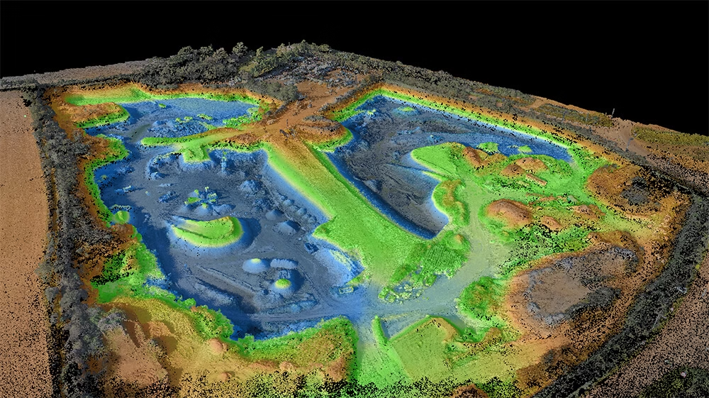
Ground levels and contours form the backbone of the survey. These are lines of equal elevation that show exactly how your land rises and falls. This data is crucial for understanding drainage patterns, calculating earthworks volumes, and ensuring your design fits into the actual landscape.
Natural features are meticulously recorded. We map trees, including their position, canopy spread, and trunk diameter. Streams, ponds, ditches, and every change in ground level are captured. This isn’t just about knowing what’s there—it’s about understanding how these features will impact your development.
Man-made features receive equal attention. Buildings, walls, fences, roads, pathways, street furniture, manholes, and visible utility covers are all precisely located. Even that old shed at the bottom of the garden that you thought wasn’t important? It could affect your planning application if it’s not properly documented.
The output you receive is a highly accurate 2D or 3D digital drawing, typically in CAD format. For more complex projects, we can provide a BIM-compliant 3D model that integrates seamlessly with your design software.
Who Needs a Topographic Survey?
Architects and developers simply cannot work without one.
It’s essential for planning applications, site design, and calculating earthworks volumes (cut and fill). Without accurate topographic data, your planning application is likely to be rejected outright. Local planning authorities need to see that you understand the site and have designed accordingly.
Engineers rely on topographic surveys for designing drainage systems, planning infrastructure, and conducting flood risk assessments. The precise elevation data allows them to calculate water flow, design sustainable drainage systems (SuDS), and ensure compliance with building regulations.
Homeowners often underestimate the importance of a topographic survey. If you’re planning a large extension, complex landscaping project, or any work that involves altering ground levels, you need one. That beautiful garden design you’ve been dreaming of? Without understanding the existing levels and features, it could turn into a drainage nightmare.
The Real-World Impact
I recently worked with a developer who tried to save money by skipping the topographic survey.
They relied on old Ordnance Survey data instead. The result? Their architect designed a beautiful home that, on paper, looked perfect. But when construction began, they discovered the site had a significant slope that wasn’t shown on the OS maps.
The redesign cost them £50,000 and delayed the project by three months.
A topographic survey would have cost a fraction of that.
What is a Boundary Survey? The ‘Whose is What’ of Your Property

Now, let’s talk about boundary surveys—a completely different beast altogether.
A boundary survey is a legal exercise to formally establish the true boundary lines of a property.
Its purpose isn’t to map what’s on your land, but to define the extent of your ownership.
Where does your property end and your neighbour’s begin?
That’s the fundamental question a boundary survey answers.
The UK Context: Why Boundary Surveys Are Complex
In the UK, boundary surveys involve interpreting legal documents such as title plans and deeds from HM Land Registry.
Here’s the challenge: HM Land Registry title plans show ‘general boundaries’. They are drawn on Ordnance Survey maps at a scale of 1:1250 or 1:2500. At these scales, the thickness of a line on the map can represent more than a metre on the ground. This means the red line showing your boundary is an indication, not a precise definition.
That’s why disputes arise.
The process often requires a site visit to locate or place physical boundary markers. A surveyor will examine historical deeds, old maps, aerial photographs, and physical evidence on site. They’re looking for clues: old fence posts, mature hedge lines, walls that have stood for decades.
The outcome is a legally robust plan and report that can be used in legal disputes or to support a formal application to clarify boundaries with the Land Registry—what’s known as a ‘Determined Boundary’ plan.
Important note: This is specialist work often undertaken by a Chartered Land Surveyor or expert witness to stand up in a court of law. It’s not something you want to get wrong.
Who Needs a Boundary Survey?
Homeowners represent our most common enquiries for boundary surveys.
You need one if you’re in a dispute with a neighbour over a fence, wall, or hedge line. Before building right up to a boundary—that new garage or extension—you absolutely must know where the legal line sits. We’ve seen too many cases where homeowners have built expensive structures only to discover they’ve encroached on their neighbour’s land.
Buying a property where the boundaries are ambiguous? Get a boundary survey. The cost is minimal compared to the potential legal headaches down the line.
Property developers need boundary surveys to confirm the exact size and extent of a parcel of land before purchase. When you’re paying millions for a development site, you need to know precisely what you’re buying. Developers also need them when subdividing a larger plot into smaller ones—each new boundary must be legally defined.
A Critical Distinction
While our topographical surveys will map the location of existing boundary features like fences and walls, a formal boundary survey legally defines where those features should be.
Understanding this distinction is vital.
That fence that’s been there for 20 years? It might not be on the actual boundary. The hedge your neighbour trimmed last summer? They might have been within their rights—or they might have trespassed. Only a boundary survey can tell you for certain.
At a Glance: Topographic vs Boundary
Let me break this down into a simple comparison:
| Topographic Survey | Boundary Survey | |
| Primary Purpose | To map the physical features and elevation of a site for design purposes | To legally define the property lines and extent of ownership |
| Answers the Question | “What is on my land and what is its shape?” | “Where does my land legally begin and end?” |
| Key Output | A detailed 2D/3D CAD drawing or digital model | A legally defensible plan and report, often for HM Land Registry |
| Common Use Case | Architectural design, engineering, and planning applications | Boundary disputes, property transactions, and land subdivision |
| Who Performs It | Land surveyors with topographic expertise | Land Surveyors for legal standing |
When You Might Need Both
Here’s something many people don’t realise: you often need both surveys.
Let me give you a real example from last month. A client came to us planning a major extension to their Victorian property in Surrey. They needed a topographic survey for their architect—standard stuff.
But during our initial site visit, I noticed their proposed extension would run right along what appeared to be the boundary line.
“Have you checked where the actual boundary is?” I asked.
They hadn’t.
We recommended a boundary survey alongside the topographic work. Good thing too—the actual boundary was 800mm closer to their house than the existing fence suggested. Their architect had to redesign, but imagine if they’d discovered this after breaking ground?
The Real Costs of Getting It Wrong
Before we wrap up, let me share some sobering statistics from our 20 years in the industry.
Planning application rejections: A significant number of planning applications fail because of inadequate survey information. The planning officer can’t assess the impact of your development if they don’t understand the site context.
Boundary disputes: The average boundary dispute in the UK can cost each party tens of thousands of pounds in legal fees. Some cases we’ve been called to provide expert witness testimony for cases exceeded £100,000 in legal costs per party. All for the sake of a few inches of land.
Construction delays: When contractors discover unexpected level changes or features not shown on their plans, work stops. We’ve seen projects delayed by months whilst revised surveys are conducted and designs amended. The cost? Daily contractor standing time, revised planning applications, and frustrated clients.
How to Choose the Right Survey for Your Project
So how do you know which survey you need?
Ask yourself these questions:
Are you designing or building something? You need a topographic survey. No architect or engineer can properly design without understanding the physical characteristics of your site.
Are you concerned about where you can legally build? You need a topographical & boundary survey. This is especially critical if you’re building close to what you believe is your boundary line.
Are you buying or selling property? Consider a boundary survey if there’s any ambiguity about the extent of the land. For development sites, you’ll likely need both—a boundary survey to confirm what you’re buying, and a topographic survey for your feasibility studies.
Is there a boundary dispute with a neighbour? You definitely need a boundary survey, conducted by a qualified surveyor who can provide expert witness testimony if needed.
Getting It Right From the Start
The first step is always a conversation.
With over 20 years of experience since our founding in 2004, our team has the expertise to assess your project’s needs and advise on the correct surveying approach. We’ve worked on everything from suburban garden extensions to major infrastructure projects.
The difference between a topographic and boundary survey is clear: one is for design, the other is for definition.
Don’t guess which survey you need. The cost of getting professional advice is nothing compared to the cost of getting it wrong.
Take the Next Step
If you’re unsure which survey you need, don’t guess. Contact our expert team for free, no-obligation professional advice. We’ll help you get it right from the start.
Get your free quote by visiting our contact page.
Whether you need to understand the physical landscape of your site or establish its legal boundaries, we have the expertise to deliver the precise, reliable data your project demands.
Because in land surveying, as in construction, a solid foundation is everything.