If you’re planning a building project in Gloucester — whether it’s restoring a historic property near the Cathedral, developing new office space in the Docks, or simply adding an extension to your family home in Abbeydale — you’ll need reliable information about the building itself. That’s where a measured survey comes in.
What Exactly Is a Measured Survey?
A measured survey is a highly accurate record of a building’s dimensions and features. Using advanced surveying equipment, every wall, floor, roofline, and opening is captured and converted into scaled drawings or digital models.
The outputs are typically:
- 2D CAD drawings (floor plans, elevations, cross-sections).
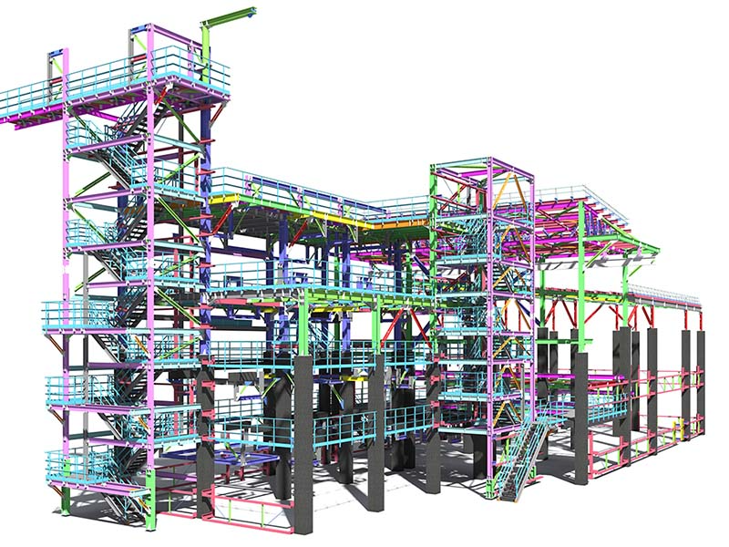
- 3D Revit/BIM models for collaborative design.
- Point cloud data (E57, RCP, LAS) for in-depth visualisation.
- PDF and DWG drawings for straightforward sharing with architects and contractors.
In simple terms: a measured survey gives you a digital “blueprint” of your property, ready to be used by architects, planners, and builders.
Why Measured Surveys Matter in Gloucester
Gloucester is a city with a unique mix of historic and modern buildings. The Cathedral Quarter features centuries-old architecture, while the Docks area has seen large-scale regeneration in recent years. Whether you’re working on a heritage building or a new commercial development, precision is vital.
Measured surveys support:
- Planning applications to Gloucester City Council.
- Heritage restoration of listed and conservation properties.
- Commercial redevelopments, from office blocks to retail units.
- Facilities management for schools, hospitals, and civic buildings.
- Domestic projects — homeowners needing accurate drawings for extensions, loft conversions, or renovations.
How Accurate Are They?
Terrain Surveys uses 3D laser scanners and total stations which can achieve accuracy within ±5 mm. For Gloucester projects, that level of accuracy & precision can make all the difference — ensuring your designs fit the building perfectly, avoiding costly mistakes later on.
The Standards Behind the Service
Our surveys comply with the RICS Measured Surveys of Land, Buildings and Utilities Standard (3rd edition). This means accuracy levels, control points, and datums are clearly defined and fully accepted by planning authorities and legal teams.

Why Choose Terrain Surveys in Gloucester?
Terrain Surveys has been providing professional measured surveys across the UK since 2004. We are:
- ISO 9001:2015 accredited, guaranteeing quality.
- Members of CICES & TSA.
- Specialists in both heritage properties and modern developments.
- Known for fast turnaround times and flexible deliverables.
From recording the detail of a historic warehouse conversion in the Docks to preparing drawings for a residential extension in Tuffley, we provide tailored solutions for every client.
Why Choose Us
- Fast response across Gloucestershire.
- Flexible outputs — from simple CAD drawings to full BIM models.
- Trusted by developers, councils, universities, and homeowners.
- Proven experience in handling both listed buildings and new developments.
Ready to Start Your Gloucester Project?
Whether you’re a homeowner planning an extension in Barnwood, a developer working on a new build at Gloucester Quays, or an architect restoring a listed property in the Cathedral Quarter, Terrain Surveys is your trusted partner.
Contact Terrain Surveys today to get a tailored quotation and ensure your Gloucester project starts with the accuracy it deserves.