
Ask most homeowners where their boundary runs and they’ll pull up the red line on their Land Registry title plan. It looks official, so it must be exact.
It isn’t. We’ve been surveying across England and Wales since 2004, and in all that time I’ve never seen a title plan that could be pegged out on the ground. (This guide covers England and Wales only.)
So how do you establish where your property boundary really is?
You measure the site, overlay the documents on that survey as a best fit, agree the line with your neighbour, set it out, check it and register it with coordinates. The title plan is your starting evidence, never the answer.
Throughout, one rule holds: the surveyor measures, and the neighbours decide.
Why your title plan can’t show the exact line
Why can’t you just read the boundary off the plan?
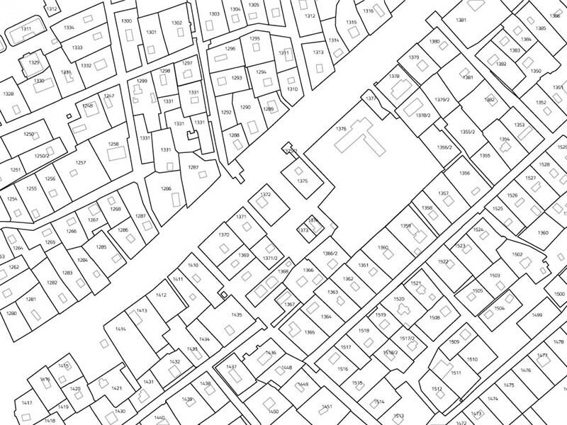
Because it was never designed for that. Under section 60 of the Land Registration Act 2002, the red edging on a title plan shows only the general position of the boundary (a “general boundary”), unless the boundary has been formally fixed as a “determined boundary”.
HM Land Registry’s Practice Guide 40 Supplement 3 puts it plainly: a general boundary leaves the exact line undetermined.
That’s the first thing I explain when a client asks us to “just peg out the Land Registry line”. Land Registry plans are only indicative, and they come with no coordinate information.
No coordinates means there is no line to read off. That’s true for you, and it’s true for a surveyor.
The red line was also drawn on old Ordnance Survey (OS) mapping. That feeds a myth I hear constantly: “the red line follows my fence, so the fence is the boundary.”
The match proves nothing. The fence shown on the plan and the red line come from the same approximate map, so of course they agree with each other. Neither tells you where the line sits on the ground.
What the red line covers on the ground
Transfer the red line from a title plan to the ground and, in practice, it’s a couple of metres thick. It’s also not always in the right place.
Two separate things add up to that. The first is the width of the printed line itself (our guide to how accurate Ordnance Survey maps are covers this in detail). The second is how far out the OS map underneath it can be.
The table below keeps them apart and sets them against a measured survey. The OS figures are the distance within which 95% of mapped points fall.
| What you’re using | Typical accuracy on the ground | Good for |
|---|---|---|
| Phone GPS (open sky) | About 5m, worse near buildings and trees | Finding the right plot |
| OS mapping at 1:10,000 (moorland, upland) | About 7.1m | Orientation only |
| OS mapping at 1:2,500 (rural, semi-rural) | About 1.9m | Orientation only |
| OS mapping at 1:1,250 (urban) | About 0.8m | Orientation only |
| Width of the printed red line | 0.3m (1:1,250) to 0.6m (1:2,500) | Showing why you can’t measure off a plan |
| Our measured survey | ±15mm, checked against independent reference points | Design, setting out, agreeing a line |
| HM Land Registry determined boundary plan | Measurements to ±10mm | Fixing the line on the register |
Our own surveys bear this out: 95% of them show meaningful differences between OS data and what we measure, typically 0.1m to 5m. On rural boundaries, where the mapping is coarser, we’ve recorded 10m.
Online “boundary finder” sites don’t get round this. They display the outline shapes HM Land Registry publishes for registered titles (INSPIRE polygons), and those outlines are indicative too.
Check one against your phone’s GPS and you’re stacking a phone error of around 5m on top of the mapping error. Use these tools to confirm you’ve found the right plot, never to place a fence post.
What the legal boundary actually is
If the red line isn’t the boundary, what is?
Legally, your boundary is an invisible line. It was fixed when the boundary was first created, usually when the land was first split off and sold. Fences, walls and hedges are evidence of where that line runs, not proof. Fences get moved; hedges spread.
When that evidence is weighed, it counts roughly in this order:
- The words of the conveyance or transfer (the deed of sale) that first created the boundary.
- That document’s plan. Its wording affects its weight: “for identification purposes only” counts for less than “more particularly delineated”.
- Physical features as they stood at that date.
- How the owners have treated the line since, including agreements between them.
- Legal presumptions (the law’s rules of thumb), used only when the documents don’t settle it.
Step 1: Gather the documents and walk the boundary
Now you know which evidence counts, you know what to collect. Start with:
- Your title register and title plan. Order them direct from HM Land Registry via GOV.UK for £7 each online or £11 by post, rather than through a reseller. Read the register alongside the plan and note any documents it lists as “filed”.
- Older deeds and conveyances. The earliest one carries the most weight. Check your own files and your solicitor’s, and order copies of any filed documents from HM Land Registry. If your land isn’t registered, these are your main evidence.
- Your neighbour’s title. You can order their register, plan and transfer documents the same way.
Then walk the boundary with the documents in hand. Note where features match the plan and where they don’t, and look for traces of older lines:
- old post holes or concrete post bases
- wall footings wider than the wall above
- mature hedge stools (the thick woody base of an old hedge)
- changes in ground level
Take dated photos from spots you can find again.
Don’t move, mark or dig anything. Disturbing an old post base or hedge line can destroy the evidence. The walk prepares you for the survey and the conversation with your neighbour, and nothing you measure with a tape or phone should set a fence post.
Step 2: Decide how much certainty you need
With the evidence in hand, ask yourself this: what are you about to do near this boundary?
You might only want to confirm you’ve got the right plot and its rough shape. If so, the documents and an online map will do. That’s orientation, and it needs no survey.
Anything that depends on the line itself is different. Typically, the boundary jobs that reach us start with neighbouring title plans that disagree, and owners who want certainty going forward. That might be for peace of mind, or because one of them is selling or developing. Other common triggers:
- building or extending near the boundary
- design or planning work, where deeds and estate agent plans are indicative only
- rural or larger plots, where the mapping is coarser
Residential documents can sometimes be a long way out. On a small plot, though, the scope for variation is quite limited. Limited isn’t zero, and a metre or two is enough to change a design:
- Coventry self-build: the OS boundary was 1 to 3m out, and the design encroached on the neighbours’ land.
- Hertfordshire new-build: the OS boundary lines were 2m out, and the architect had to redesign.
Step 3: Measure the site before anyone pegs anything
So you need certainty. Where do you start? Not with pegs.
The first step in pegging out any boundary is to establish accurately what’s on the site. The only way to do that is a topographical survey: a measured survey recording the size and position of the land and everything on it.
Only once that survey is complete can we overlay the title plan, and any conveyance plans, onto what’s there. Even then, it’s only ever a best fit. The overlay shows where the documents and the ground align and where they don’t. It can’t reveal an exact line, because the plan never recorded one.
Your survey drawing should give you:
- measured positions of fence posts, wall faces and footings, hedge lines and ditch edges
- everything tied to fixed survey reference points or the National Grid (Ordnance Survey’s national coordinate system)
- the best-fit overlay of your documents
- a stated accuracy: ours is ±15mm, checked against independent reference points
A small residential boundary or topographical survey with us typically costs £800 to £1,200. The drawing takes 3 to 5 days.
Step 4: Agree, set out, check and register the line
With a measured drawing in front of you both, you and your neighbour are finally looking at the same picture. This is the sequence I recommend wherever a neighbour shares the boundary:
- Survey. We measure the site.
- Agree. You and your neighbour agree the exact position of the line, using the drawing.
- Mark. We mark the agreed line on the plan.
- Set out. We return to site and set the line out on the ground.
- Check. We survey what we’ve set out to confirm it’s in the right place.
- Register. The plan is submitted to HM Land Registry, so an accurate boundary plan is on file.
Done this way, the corners of your boundary have coordinates. If anyone queries the line later, it can be checked accurately rather than argued over again.
HM Land Registry’s Practice Guide 40 Supplement 4 sets out two ways to record the agreed line:
- A boundary agreement records where both owners accept the line runs. It can be noted on the register, and you can request a determined boundary as part of it without a separate fee. For most people, it’s the cheapest realistic route to certainty.
- A determined boundary, applied for on Form DB, is the only way to get an exact line recorded on the register. HM Land Registry notifies your neighbour, and an objection you can’t resolve goes to the First-tier Tribunal, so agree first. A fee applies. The plan needs measurements accurate to ±10mm, any National Grid coordinates to ±300mm absolute, and a certification statement.
We produce plans to that specification. It’s a separate standard from the ±15mm we work to for general survey work, so mention a determined boundary when you ask us for a quote.
If you and your neighbour can’t agree
If you can’t agree, you need different help. HM Land Registry doesn’t decide disputes. Only the First-tier Tribunal or a court can rule on where a disputed boundary runs.
There’s no statutory surveyor-led shortcut either. The Property Boundaries (Resolution of Disputes) Bill proposed a Party Wall-style process, but it never became law. Speak to a solicitor or a mediator first.
We don’t get involved in boundary disputes or contentious matters. Settling where the line runs isn’t the surveyor’s role: it’s down to the neighbours. We work with neighbours who already agree they want their boundary established, and that’s exactly what the route above is for.
Want Your Boundary Fixed for Good?
If you and your neighbour want certainty, we’ll survey the site, overlay your documents and set out the line you agree. Get a free, no-obligation quote.