Measured building surveys
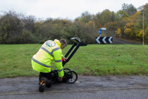
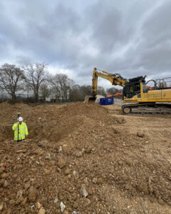
Our measured surveys are trusted by architects, engineers, planners, and developers across the UK. Whether you need plans for refurbishment, redevelopment, record-keeping or compliance, we capture every essential detail to scale using the latest 3D laser scanning and total station technology.
- Fast Response – Nationwide
- Scaled Drawings in 2D CAD or 3D BIM Formats
- Clear Fixed, & Competitive Pricing
- ISO 9001 Certified
- CICES Approved
Get a free quote
Request a free, no-obligation quote for your project today.
What customers say about Terrain Surveys
Reviews


- Accurate floor plans, elevations, and cross-sections
- Survey-grade 2D CAD drawings or fully modelled 3D BIM outputs
- Clear presentation and measurement of structural features and levels
- Customisable drawing packages – we deliver exactly what you need
- Engineer walk-through - so you understand your drawings
- Drawings accurate to the millimetre—delivered on time and ready to use.

What You'll Get
Here’s what you can expect:
Why you need a measured building survey
Measured building surveys are essential when accurate, up-to-date building information is needed to inform design, refurbishment, legal documentation or asset management. We regularly support a wide range of professionals and property types with tailored survey data.

Before Building Works or Renovations
To ensure accurate planning and design, architects and engineers need detailed floor plans, elevations, and sections of the existing structure. Measured surveys provide this essential base data.

Planning Applications
When submitting a planning application, particularly for extensions or changes to existing buildings, local authorities often require precise drawings showing existing and proposed conditions.

Restoration or Conservation Projects
For heritage buildings or listed properties, a measured survey helps document the existing condition in detail before any sensitive work is undertaken.

Selling or Leasing
Measured surveys provide a precise record of internal areas, which is especially useful for lease plans, marketing documentation, or resolving discrepancies with floor area calculations.

As-Built Record Keeping
Where no reliable plans exist or if previous drawings need to be verified against the actual build, a measured survey provides a trusted reference point for future works, facilities management or compliance.

Valuation or Disputes
For commercial leases, dilapidations, or rights-of-light assessments, precise internal area measurements help ensure transparency and reduce the risk of disputes.
Accreditations


6 key reasons to choose Terrain Surveys
Why us
Experienced
Established in 2004 by three founding directors determined to improve surveying standards, Terrain Surveys Ltd was created with a commitment to excellence.Highly rated
Terrain Surveys strives to be the survey company of choice through a wide scope of knowledge and a constant drive for excellence. We pride ourselves on the quality of service provided, including customer service, survey deliverables, training, education, and the systems we operate.Focus on sustainability
As a leading provider of measured survey services, Terrain Surveys understands the critical role our work plays in shaping the built environment. We are committed to integrating sustainable practices into every aspect of our operations.Qualified and accredited
Terrain Surveys Ltd holds the ISO 9001:2015 accreditation, reflecting our commitment to quality management systems and consistent service delivery. Additionally, our team includes professionals with various industry-specific qualifications and certifications, such as membership in the Royal Institution of Chartered Surveyors (RICS) and the Chartered Institution of Civil Engineering Surveyors (CICES).Diverse and growing team
Our strength lies in our team, whose experience and knowledge, coupled with investment in training and technology, enable efficient work and the production of high-quality, accurate measured surveys that meet clients' strict deadlines.Nationwide coverage
Terrain Surveys provides comprehensive national coverage across the UK, ensuring clients receive consistent, high-quality surveying services wherever they are. With strategically located offices, the company is well-positioned to deliver efficient and tailored solutions to meet a variety of client needs.
Measured Building Survey FAQ
FAQS
The cost of a Measured Building Survey in the UK typically starts from £1000, but it depending on several key factors such as the property size and what drawings you want. At Terrain Surveys, we tailor each quote to your requirements and property. Get in touch for a free, no obligation quote.
To carry out a Measured Building Survey, we typically need:
- Site address and access details
- Type of building (residential, commercial, etc.)
- Scope of survey (floor plans, elevations, sections, etc.)
- Purpose of the survey (e.g. planning, design, refurbishment)
- Level of detail required
- Preferred file formats (e.g. DWG, PDF, Revit)
- Any existing plans or photos (if available)
Most surveys take 1–3 days on site, depending on the building size and complexity.
The full turnaround, including drawings, is usually 3–10 working days, but urgent surveys can be prioritised on request.
We typically deliver drawings in AutoCAD (DWG) and PDF formats.
BIM projects can be supplied in Revit (RVT) format, and point cloud data is available in E57, RCP, or LAS on request.
Our drawings are typically accurate to within ±5mm, in line with RICS and TSA guidelines.
We use high-precision total stations and 3D laser scanners to ensure exceptional reliability for design, planning, or construction.

Other Surveys We Offer
 Explore
GPR Surveys
Ground Penetrating Radar (GPR) is a technique used in conjunction with Electromagnetic locators to carry out underground utility surveys
 Explore
PAS128 Surveys
A PAS128 Survey is an underground utility survey which detects, verifies, and locates all underground utilities.
 Explore
Utility Clearance Surveys
A utility clearance survey is an essential step in avoiding accidental strikes on buried service infrastructure when undertaking excavation or drilling works.


Popular Measured Building Survey Locations
We'd love to hear from you
Get a free quote ONLINE OR CALL
+44(0)143 884 1300Request a free, no-obligation quote for your project today.